Sunday 19th February '17
I have a vague way of mentally categorising walks which is too airy-fairy to detail now, but yesterday I had a gung-ho attitude to the dismal forecast and wanted one that would be medium distance, medium challenging, and with no emphasis on views which I knew would be restricted. So what about a bit of masochistic moorland yomping?
Some easy footpaths and then two kilometres of road brought me to Queen Victoria’s Jubilee Tower* from where I launched off onto the squelchy moorland, in the half light, and cloudy drizzle, supposedly following a path along a fence line.
All of this walk had visibility between a hundred and two hundred metres accompanied by on-and-off rain, and a long middle period of quite heavy stuff. I used the word yomping which I understand to mean walking over rough, footpathless terrain, probably carrying a heavy pack. The path (in name only) didn’t follow the fence line as indicated on the map and for much of the way it was so far off, that worryingly, I couldn’t see the fence through the gloom and kept using the compass and the GPS, and so I squelched on to reach a corner of fence and wall to turn north-west for Clougha Pike. The weather was pretty hostile now and most unwelcoming at the summit where I jibbed at taking photos, my priority being self preservation. Again the map indicated a path following a wall line but this strayed away and then petered out; a better navigator would have picked up the track to the east. The path by the wall was non existent. I was descending perilously on the worst deep heather, tussock grass ever. Every single step had to be tested for thigh depth holes. Going was literally, painfully slow. It became so steep, which wasn’t apparent on the map, that I had to take a long detour. Well, I was getting what I came for, and as so often, managed to turn a benign walk into a minor epic - always good fun to overcome such challenges?
The remaining trek along the road coincided with the walk I did with Pete last Thursday and I arrived back at the car with my top half totally dry thanks to my Paramo jacket, but the Paramo Cascada trousers were not so good. I think they let in water through the long side zips.
Carefully measured and timed: 8.12 miles and 5.33hrs = 1.51 mph reflecting the difficulty of much of the terrain.
I am still using Impressive Art setting
CLICK TO ENLARGE
 |
| The snowdrops were much more apparent than the green saturation indicates |
 |
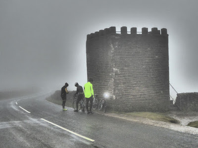
| Jubilee Tower where I peeled off left onto the moor |
 |
On map as "Shooters Cairn"
I lost interest in taking photos after this - the cynical may ponder that I turned back from here. Fancy doing Everest and forgetting to take a photo on the summit |
 |
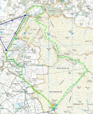
| Anti-clockwise. Start and finish at blue waymark, bottom of blue triangle - that was my walk with Pete last Thursday |


What on earth made you go up there in that weather - stick to the coast.
ReplyDeleteBC - As I said in the post I wanted a route where views were not too important, and I want to save the Cumbria Coastal for decent weather. You unlucky - I tied to phone you the evening before with an invitation but there was no reply - I know you would have enjoyed it (perhaps?)
ReplyDeleteSorry I was out, would have enjoyed your company. We'll fix up another date.
ReplyDelete