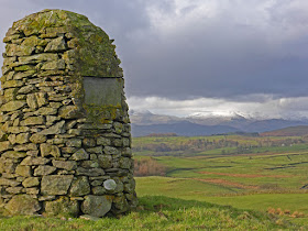
Sunday, 31 January 2016

Boulsworth Hill (Lad Law)

Saturday 30th January

Boulsworth Hill -  SD 930 356 (English Marilyn 145 out of 175 for me) 

I have a vague memory of visiting Widdop with our group of climbing friends in the sixties. Weather was foul, we took one look at the bleak crags then departed the scene. I have retained a memory of a large, intimidating crag throwing out an invitation for a potentially rewarding re-visit given better weather. But I never returned.

Closing in on the last few of the English Marilyns, and researching for todays foray I noticed Boulsworth Hill (Lad Law) was only a few kilometres north of Widdop.

The nearest habitation is Harle Syke a suburb of Nelson, four kilometres to the west of my starting point, Coldwell Reservoir. I tried to programme it into my Tom Tom sat nav. It was not recognised. My iPad mini has its own mapping with built in sat nav and there was no problem defining the hour and a half’s drive.

With our best in the world Ordnance Survey mapping with its related OS grid reference system, which can easily pinpoint locations to the nearest few yards, I often wonder why this is not more widely used, especially by businesses who need to inform customers of their whereabouts. It would be invaluable if Tom Tom incorporated this into their destinations system.

Temperature at the start was two degrees but with an icy gale and associated wind-chill the feeling was much colder.

My route followed a good track: The Pennine Bridleway. A wet and muddy minor path struck off up the hillside to the summit. I was battered by wind all the way and lashed by intermittent hailstorms. Approaching the summit I saw the trig point, but then what seemed to be higher ground a hundred yards to the south, so I went there first and found an overhanging rock for shelter, hot coffee, and a quality Topping's pork pie given to me the day before by daughter J.

I splashed back to the trig point then descended. I met a guy on his way up and queried his lack of gloves. He said his hands were not cold: I didn't believe him.

I drove south on one of the most spectacular roads I have experienced in the UK. The objective: a nostalgic look at Widdop crag. The weather had closed in alarmingly with high wind and swirling hailstorms. Driving with Widdop reservoir on my right I could hardly see anything across the other side, and at the nearest point I was just able to discern the crags, appearing disappointingly small in contrast to my sixties memory, and the weather was even worse than it was on that miserable visit

By now the roads had a significant covering of snow and hail. My drive on the one-track roads as far as Colne was a challenge. My return via Guisburn and Hellefield was enjoyably traffic free and more pleasurable than my outward journey via the M6/M61/M65.


This was a good day out, but Widdop seems to be one of those places with so much promise, but not for me.

On the Pennine Bridleway- Boulsworth Hill ahead

Marked on the map as a ford - I can't resist sparkling water

The marginal track to the summit which lies to the left and behind the pimple on the horizon

Near the summit

Splendid 360 degree views all round the huge expanse of the Trawden hills and moors


Thursday, 28 January 2016

Bigland Barrow (Outlying Fells)

Another impulsive departure for a three hour weather window. I'm becoming impressed with the accuracy of our forecasts,

Wainwright says:

"...this is only really a very miniature fell. How are the mighty fallen, that we should be nowadays content with such! Remember when we used to trot up Great Gable? However, old age can't be helped (damn it) so..."

Well! It was no pushover at five miles with 600ft. of ascent, with a gale blowing and paths gloopy-slip-slidy with mud, and tracts of hard going through trackless heather and dead bracken. However, the views were rewarding, and this was certainly a worthwhile outing.

The summit has the remains of a wartime look-out post constructed from slabs of concrete with a rusted iron step-ladder which I mounted with care in consideration of the howling wind. Wainwright's drawing indicates a full roof, but half has now disappeared, goodness knows where considering its weight and size. I researched on the Internet but could find no more about this structure. My father served at a Royal Observer Corps post on Otley Chevin during the war with comfortable live-in arrangements manned by several men on a rota basis; I guess this Bigland structure was a spartan version for the same organisation.

Photography was compromised by high wind - I couldn't hold the camera still, but here are a few shots.

Union Jack (upside down - broad white should be at top) on the temporarily closed Swan Hotel which was flooded by Desmond so maybe that's the reason?

Quirky private post box at bottom of someone's drive 

Gloopy paths

A tricky stile, twas the same on the other side

The look-out tower on Bigland Barrow

Unnamed tarn near the summit


Monday, 25 January 2016

Pragmatics

I have today phoned and cancelled my forthcoming second knee replacement operation.

Last summer I walked over 700 miles at 16ish miles per day.

Since, I have walked regular distances of 6 miles, often over hilly terrain. I do this without undue discomfort, but I am having fairly bad pain when driving, and in bed, and I know it is not going to get any better. My surgeon has viewed the Xrays, and although I am not criticising, he has advised that it is time for a replacement, BUT:

My walking ambitions are endless.

I am 76. Logic says that walking ability, each month thereafter, becomes decreasingly valuable as age progresses regardless of the existing knee problem.

If I have the operation now I will be laid up for at least 4 months. Looking at the above logic those 4 months are more valuable than the 4 notional months after a notional operation that may take place in nine months time.

In any case there is the worst case scenario where the operation may decrease or curtail potential walking drastically in which case, if taken now, would annul a possible summer's walking which at the moment I see as viable.

Wow! That took a bit of getting across concisely - no doubt brother RR could reduce it to a one-liner, but I wanted to write this as a means of clarifying and rationalising my decision.

---------------------

On a lighter note I have been seeing a tv commercial recently for pizzas where they generously, and seriously (not joking) make the following offer.

"If you don't like our pizza we'll send you another one free"

Friday, 22 January 2016

Three Marilyns and a silly one

Wednesday 20th January

I'm twixt Marilyns and W's Lakeland Outlying Fells.

With the former I want to complete the English Marilyns. There are 175. After this post, combining two trips I will have 31 remaining.

Of those, two are problematic, that is beyond a reasonable one day car journey, one being near Wendover and the other near Folkestone. Other isolated summits are  possible with day car trips: Mickle Fell and Kinder Scout. There are then a group of four south of Manchester accessible by day car trips and the rest are grouped south of Shrewsbury and north of Hereford which could be mopped up with a centrally placed caravan trip taking a week or so.

On my visit to Northumberland in July 2014 I left three easy Marilyns, and on Wednesday I set off from home at 6.19 am and arrived back at 6.19 pm having summited all three.

Shillhope Law -  NT 893 097

A hairy 10km drive down the undulating twisty single-track road following the River Croquet from Alwinton took me to a car park below this summit. Alighting from the car the surface was covered with frozen ice and snow. I started putting on my Khatoola spikes and then found a chain link had parted during the Dunnerdale Fells outing a few days ago. I tried with pliers to open the metal hook to fix it back on but it broke off - I managed to sort of fix it, but confidence and opinion was waning.

A steep pathless ascent through what turned out to be soft snow covered heather took me to the summit in an hour. Twenty minutes from the top I noticed one of my Khatoolas had vanished from my boot. On the return I  easily  followed my deep footprints in the snow and recovered the missing item -  confidence in the Ks now waned to zero. If used again I plan to secure the spikes to my boot lace with one of those mini carabiners to prevent potential loss.

Ros Castle - NU 081 253

A long drive took me to near the summit. The last few hundred yards were covered in snow and ice, but I was able to park where the footpath set off for a quick twenty minute ascent. Back at the car I did a gingerly executed three-point turn and although the Yeti has permanent four-wheel-drive it also has a special off-road facility. I pressed the button and set off down the steep hill in first gear on the icy covered road, and thankfully all went well.

Housedon Hill NT 904 331

More country lane driving to get to this one. Driving in Northumberland is pure pleasure - I hardly ever saw any other traffic and the roads undulate and sweep through exciting bends with open views ahead, all enhanced with magnificent scenery. My ascent was by the south west slopes from a cul-de-sac road ending at  Reedsford, up steep snow covered grass and heather.

Down at the bottom I hit the button for Home on the satnav. It took me back via the A7, a road I have not travelled before which was almost traffic free and passing through wonderful border country.

An accident had occurred just beyond the slip road for Penrith Jct. 41 on the M6. I exited the motorway and tried to go down the A6 to Shap but that was closed, so I came back and was able to get back onto the M6, so the accident, although unfortunate for those involved had happened at the most convenient location possible, just between the two slip roads. I called into the Shap Service farm shop and bought a couple of delicious pork pies and a fairly expensive bottle of red for a welcome chill-out and meal after a reviving hot bath. Not a bad day.

Looking back to the car from the starting slopes of Shillhope Law

Same from higher up

The icy road and Ros Castle

Plaque on summit trig point

Ros Castle summit

Looking up  on the ascent of Housedon Hill...

...and down from the same point

From Housedon Hill summit

Zoom from same point to mysterious looking distant uplands
**********************************************
Thursday 21st January

Bishop Wilton Wold SE 822 570

Some would say that Marilynitis has tipped me over the edge. A few posts back Mick and Gayle posted about visiting this Marilyn on their way to the Yorkshire east coast. I had a look at my list and saw it ticked off, but I had no recollection of the visit. It seems I must have ticked it by mistake.

I know there are even more futile Ms than this, but even so it is located only 100 yards from a lay-bye on the  A166 between York and Bridlington across a ploughed field, and nowhere near any other Marilyn.

Yesterday I drove with Pete over 200 miles for the round trip. Pete sat in the car while I splodged across the field, took a quick photo and returned.

Whilst researching about this formidable summit I found that David Hockney had painted a picture of Garrowby Hill which is the steep road climb that leads up onto this plateau. David was a contemporary of mine at Bradford Grammar School, and although he was in a different form and I didn't know him personally I was well aware of his presence, so with this double connection I bought a print, and putting it up will be my next task after finishing this post.


Bishop Wilton Wold


Tuesday, 19 January 2016

Hampsfell - SD 399 783 (Outlying Fells)

Another quickie about thirty minutes drive from home.

For nerds and the like:
(anti-list-tickers can skip)

Wainwright's book, and the Wikipedia list of his Outlying Fells are confusing because of repeat entries for summits with two names, and others which W calls "nameless" for want of a name on the map, and for which the lists include double entries. I have now found a definitive list on Harold Street:

CLICK HERE FOR WEBSITE

That website shows all defined hill lists in the UK - would you believe there are  over 80 recorded?  

You can join then tick off your ascents on your personal list. Those ascents will then automatically  record on other lists for which your entry qualifies, so, for instance when I started looking at Marilyns I had ticked off all the Munros on the Munro list, and then found that many qualified as Marilyns (and for other more obscure lists), so I had a head start.

There is a league table of members for each list - I feature around number 35 on the Marilyns list.

A similar site:  Hill Bagging, is more user friendly, but you have to enter  dates of ascents, and I didn't have them for many Munros, although you could just enter a notional date. Hill Bagging is useful for its forum for each hill where others record ascents - useful for finding suitable routes and access information etc.

The H.Street Outlying Fells list has 116 summits of which I have climbed 36. I have plotted the rest on Memory Map (Harold Street shows OS grid references -Wainwright doesn't), and I guess there will be wild and obscure visits to come. 

Today's hill has personality. Although only twenty minutes walk from the road it is topped with a unique building and a magnificent limestone pavement and wide cropped turf paths. The building is described by W:

"The Hospice, provided by a pastor of Cartmel in about 1830 for "the shelter and entertainment of travellers over the fell," is a well built structure of dressed limestone with an outer flight of steps and a flat roof on which is a view-indicator (added later and still in working order in 2010*). The open interior offers good shelter and free poetry readings on painted panels on all four walls..."
* One of Chris Jesty's updates in his revised version of W's book

Many superb photos and transcriptions of the poetry can be seen here :

CLICK HERE

I plodded through melting snow and gloomy light. There may be debate about the highest point - the limestone pavement seems higher than the hospice area, but atop the hospice I reckon you are as high as you can get.


I thought the limestone pavement may be the highest point but the top of the hospice seems unequivocal


Sunday, 17 January 2016

"Stickle Pike" and "Dunnerdale Fells" (Wainwright's Outlying Fells of Lakeland)

Saturday 16th January

Another foray into Lakeland's perimeter hills with Bowland Climber, and today with BC's friend B. This circuit was another of my favourite runs when I was more sprightly and perhaps my favourite all time part of our Lake District. It is a  concentrated region of craggy mini peaks and small tarns.

Wainwright says:

"The Dunnerdale Fells are low in stature, small in extent and insignificant on the map, yet they assert themselves on the local landscape in a bristly defiance of accepted mountain landscape. Of course they are not worthy of comparison with Scafell or Great Gable, but they  refuse to admit it."

My title heading here refers to the chapters in Wainwright's book which titles refer to the area location of the peaks he mentions, and as in this case there are often prominent peaks in these chapter areas that W does not include, presumably because he just describes the details of the walk that he did for his own satisfaction in that area, so it is often quite confusing to follow as W also uses alternative names for some hills, e.g. Dunnerdale "Tarn Hill" herewith, even more confusing here because there was also another Tarn Hill. On this walk we combined two chapters, the Dunnerdale Fells chapter only having one peak

W's Outlying Fells peaks visited were:

Great Stickle                               305m.         SD  211 915
Dunnerdale Fell (Tarn Hill)        280m          SD 207918
Tarn Hill                                      313m.         SD 209 921  
Stickle Pike                                 375m          SD 212 928
Raven's Crag                               361m          SD223 929
The Knott                                    284m          SD 224 919

On my last post I praised the accuracy of our weather forecasts. Today the predicted snowfall started four hours earlier than the forecast, halfway round our circuit, but we had, in any case been walking through hard frozen snow once up on the tops.

BC had some rudimentary spikes on his boots and I had the Kahtoola Micro Spikes I had given as a present about three years ago. Apart from wearing them briefly one winter on the roads around home this was their first test on mountain terrain. For the first half on the frozen snow and ice they were excellent, but coming back down the eastern ridge of our walk the snow was softer and I suffered severe balling up of snow which accumulated within two or thee steps of  having knocked off the snowball making the going quite difficult. The difference was demonstrated by B who unfortunately had no spikes and was definitely struggling (without complaint), and towards the end slipped and fell quite heavily on his shoulder.

I'm afraid I was a bit over the top about the virtues of my spikes which caused some ribbing. At one point I thought I was going to be manhandled and divested of my precious Kahtoolas, but I did have some comfort in knowing that I had the car keys.

This was a proper winter conditions mountain day with good friends and as good an outing as I have had for some time.

No snow low down, but we were soon in it higher up


Distant Howgills and a good sample of this terrain - click to enlarge and see little tarns

Zoom to Howgills - Carlin Gill behind long ridge descending from left centre

Stickle Pike, the best peak by far on the round. Ascent was by the obvious path up righthand side, but then an almost alpine ascent up very steep, pathless, hard snow covered, rocky hillside to the summit

Caw from the rocky summit of Stickle Pike

Route only approximate on western side - scale too small to identify detail

Thursday, 14 January 2016

High Knott, Hugill Fell, Reston Scar (Outlying Fells)

Thinking back a few years to my Munroing days (completed June 2009) I seem to remember weather forecasts being somewhat unreliable. These days things have changed and mostly they seem to be pretty accurate right down to predicting within an hour or so when rain or sunshine will prevail.

That enables one to plan excursions into the hills for maximum comfort and my recent outings with Bowland Climber in pursuit of Wainwright's Outlying Fells have benefited from these forecasts in present times of erratic and quickly changing weather.

Yesterday we capitalised on a weather window between 10:00 am and 2:00pm, getting back to the car just as ominous clouds and spits of rain were mounting.

We were up in the wilds of Kentmere and trespassing to gain our first summit. The Chris Jesty revision of W's book says:

"...to an unusual stile that has been obstructed by fencing. The agile walker will find a way through; others will do better to give the summit a miss."

Views to the snow covered Lakeland hills were Himalayan.

I'm not sure who was leading who on the subsequent wall clambering; I seem to remember an inconclusive vote being taken on whether to continue across country or return to the car and re-ascend from Staveley, but I was grateful for assistance with my creaking frame from BC, and we eventually completed the cross-country bogfest to take in the other two peaks in this title thus completing three chapters in the book with one walk.

A top tip for walkers: use churches for shelter and re-grouping. Staveley Church saw us munching a sandwich with a flask of hot coffee before taking the road back to our car.

Once again I see that BC has beaten me to  a report on this trip and you can see his version at:


These photos do benefit from click to enlarge

A great view up Kentmere 

Williamson's Monument - 1797 - he was a local farmer who went up to this summit every day before breakfast (why I do not know) - erected by his son

Langdale Pikes - zoom

Looking back to Williamson's monument


Maximum zoom to Rainsborrow Crag above Long Sleddale where BC has done some fearsome routes


A fine view of the Langdales and Pavey Ark - Jack's Rake prominent


Descending to Staveley


Tuesday, 12 January 2016

Cartmel Fell (Outlying Fells)

In view of Blogger typing problems I am writing this in “Mail” which has decent formatting facilities, and I will then copy and paste into Blogger and see what happens.

In my last post I doubted my own intentions regarding completion of Wainwright’s Outlying Fells after being drawn into this exercise by my friend Bowland Climber who is so committed. My prevarication was questioned in a comment by Afoot, and here is my reply:

 "Ok, I know. I'm just kidding myself. I know I'm hooked. The next post will show me doing the next-to-last catch-up on BC (for the moment), that is walking the ones he has done that I haven't. We are also booked for Wednesday to do some more. There are 56 chapters in the book, each containing one or more of these hills to make a reasonable walk in each case. I have so far done 19 chapters, that is about a third. Some chapters can be combined to create longer, but still comfortable walks. Like Marilyns these minor hills take you to fascinating places you would  unlikely visit otherwise, and in some cases places which have little to recommend them.”

Well, yesterday I finished reading Voss (Patrick White - Australian) at 1:30, that is a novel based very loosely on an Australian explorer in the mid 1800s which imagines his meeting with Laura prior to departing for the interior, and intertwines their imaginary metaphysical love affair as Voss toils on his expedition. The prose is rich in metaphor, allusion and symbolism, and is quite difficult and profound, but still rewarding. Patrick White was awarded the Nobel Prize for literature in 1973. Hoping I would not suffer similar privations to Voss ( my intended Outlying Fell covers only two miles with a modest 300ft. of ascent) I was off in the car up the Winster valley.

The ascent starts from St. Anthony’s Church at Cartmel Fell - Wainwright suggests:

"Ideal for filling in an hour while the rest of the family are inspecting the quaint church…

…excusing yourself from their company, go round the churchyard wall to the left of the lychgate…”

St Anthony's Church, Cartmel Fell - starting point


Cartmel Fell summit

Morecambe Bay


I continued from the summit to make a circular walk taking in this view of Sow How Tarn...
...and this mini Middle Tarn


******************


Sunday, 10 January 2016

Following in the steps of the master

NOTE: Blogger will only let me type in Full Screen Mode, otherwise the cursor is not evident.

Blogger will not let me attach captions to photos - when I try the photo just disappears, so I have had to add numbered notes below on the second post here.

In the Preview (at least) Blogger is chopping off the last letter of some lines of text.

Anybody else having these problems?

List ticking is taking over. A couple of years ago I discovered that the BBC sold the whole of Shakespeare in a box set made from their comprehensive productions with the best actors of the day back in the  Seventies and Eighties, but I had baulked at a cost in excess of £100.  A few weeks ago I came across this lot reduced to £50 and snapped it up - it is too late in life to miss such opportunities.

I have now watched Winter's Tale, The Two Gentlemen of Verona, and The Taming of the Shrew, and last night, halfway through King Henry 6, Part 1.

Although there are 34 plays in all I am reminded of reading the Arthur Ransome books, and later in life, O'Brian's Maturin novels, and Anthony Powell's saga, Dance to the Music of Time, and of course  Proust's A la Recherche du temps perdu - you just don't want them to end.

Back to the title of this post - I have been lured away recently from my only on-going hill walking tick list, being completion of the English Marilyns, of which I have 35 remaining. The luring has come from my friend Bowland Climber who has embarked on Wainwright's Outlying Fells, and I live geographically between him and their location, so it is turning into a sort of joint effort, but, I have not yet admitted to myself that I am ambitious to  complete the list, or just to tag along when invited.

However, there are signs!

BC has already climbed some of the OFs on his own, and as my post for Staveley Fell indicates I have been playing catch-up, and herewith is another one in that category I climbed yesterday (Saturday 9th Jan.):

I am currently reading Voss, a somewhat depressing, but richly written novel by the Australian novelist Patrick White, and yesterday I was getting towards the denouement anticipating all ending in tears, so I had a quick look at the Met Office forecast and identified a weather window between 12:00am and 3:00pm, and within ten minutes I was in the car and off to catch up on Bowland Climber's recent solo ascent of Newton Fell which is only about twenty minutes drive from home. "Newton Fell" covers a large plateau on the map - Wainwright identifies Dixon Heights to the south which I have done before, and the summits marked Saskills and  Whitestones to the north, the latter two being my targets on this trip.

CLICK TO ENLARGE

This engineered, satisfying balcony path leads up from the caravan site at the foot of Newton Fell

From the summit - My 1:25 OS shows a trig point but it was not there. Research mentions an obscure stud set into one of these summit rocks but I didn't see it, probably under the cairn?

South down the A590 from Saskills summit - communications tackle evident

A 590 from Whitestones summit. The crag is a minor rock-climbing
 venue


Main crag of Whitestones

*************************************************************************

Three days earlier:

 Wednesday 6th January - Woodland Fell etc.


Outlying Fells, Chapter 24 (Woodland Fell) and Chapter 25 (Blawith Knott). 


Doing a joint walk with a friend and fellow blogger presents the problem of producing two almost identical posts with the likelihood that readers will be common to both. Bowland Climber, my companion on this trip has already written a good account of the trip:

CLICK FOR BC's POST

The title of this post is a tribute to BC's walking achievements. He has walked more long distance paths in more countries than anybody else I have come across.

This was a nostalgic round for me because it was one of my favourite runs when I was a little more sprightly. Wainwright is eloquent:

"...a connoisseur's piece, every step an uninhibited joy, every corner a delight. No footmarks, no litter - this is a miniature wilderness where every explorer treads virgin ground, none too easily when the heather is thick or the bracken high."

And:

Referring to  "present-day man":

"Perhaps it is asking too much of him to tarry here while yet he is strong and energetic but he would do well to bear Woodland Fell in mind for the time when he is neither. That time will come".

W's book has been revised by Chris Jesty keeping all the original text etc, but just making corrections and highlighting, thankfully, the routes on the maps in red, and also adding an alphabetical list to improve navigation around the book which in W's eccentric format was never easy.


This route includes one of my favourite Lakeland hills, Beacon Fell, and Jesty includes it in his own list of seven favourites in Outlying Fells .


1. Log pile
2. Our first summit - Yew Bank - obvious footpath to col
3. Duddon estuary from Yew Bank
4. Dow Crag and The Old Man of Coniston
5.         ..            ..           ..         ..         ..
6. Coniston Lake and Beacon Fell summit  - see BC's account re lady sat on cairn

***************************************
Back to my Shakespeare:

why did they all want to be king of England, or any other country?

It was almost guaranteed that they would come to an unpleasant demise. 

************************