Thursday, 16 September 2021

Trigs 103 continued - Mellor plus 2

 Wednesday 15th September 2021

Mellor Moor        SD 657 312     223m

Knightfield Gate   SD 629 326     73m

Hoolster Hill         SD 627 294    124m

Mellor like most of our towns was not designed to accommodate private cars. Many of the streets are lined on both sides reducing them to one way traffic with constant jams with vehicles coming in both directions. It is such a shame because this is a valuable example of that Lancashire village yellowy sandstone building. I spent ages trying to find somewhere to park ending up in a modest residential estate. Even here most people have more than one car and often park on the road outside their houses. I tried not to be blatantly outside somebody's view from their front window but even that ended up with a compromise. Before that I had found a spot on an updated council estate. A resident emerged in friendly manner and told me that it was wheelie-bin day and several vehicles had been hit by the refuse trucks coming round that corner. I then saw a shell suit clad youth across the road climbing up his fencing to get on top of the open and full wheelie-bin where he proceeded to jump up snd down to compress the contents - that didn't look like a good omen, I had visions of the rest of the gang break-dancing over my car. I moved off.

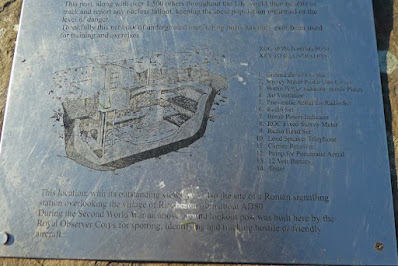
A short walk out of town took me up to Mellor Moor trig with panoramic views all round. The huge expanse of the BAE* complex dominating  to the west. There is a redundant Observer Corps post and also a topograph. An informative plaque enlightened me. My father was in the Observer Corps during the last war but this post, one of 1500 dotted around the country is from the later period of the Cold War. Here personnel would be underground in a claustrophobic bunker to report on radiation levels etc. in the event of a nuclear attack - mmm!

A  mixture of lanes paths and quiet roads lead me to the second trig. During the whole of this walk I experienced a more than usual ambience of silence and peace.

After leaving the road at Balderstone a complex of paths radiated from a private house. As I was trying to sort this the owner emerged and tried to direct me. I had a feeling he had sent me on the wrong path but I couldn't face going back and loosing face so I decided to improvise. I descended to a stream in woods. I climbed the steep bank after crossing using tree roots but the way was blocked by barbed wire. I dropped back to the stream and found a footpath  which eventually brought me to another barbed wire fence. I used my length of  15mm. rubber  pipe insulation slit down its side to cover the wire and managed to climb over to get me back onto my route - good job I had been in the Scouts and learnt to "be prepared."

At the A59 my 2015 1:25 OS map showed no road through the BAE complex from north to south but my  2020 1:50 map showed a yellow public B road going right through to emerge just to the east of Salmesbury Hall. Only two or three vehicles used this mile of road as I walked its accompanying cycle track.

Trig number three was on private farm land and twenty yards the other side of yet another barbed wire fence. This had obviously been breached before, the wire being a bit floppy. I covered the barbed wire again with my rubber sleeve then extended my walking poles and wedged them under the wire at a width of four feet pushing the wire upwards enabling me to climb through between the barbed wire and the fencing wire below.

After all that I descended to my legal path erected my chair and took lunch. The rest of the walk back to Mellor on quiet roads and paths was uneventful. This had been a particularly pleasing day where I had used some ingenuity to overcome obstacles and experienced an overwhelming sense of peace.


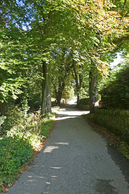
Leaving the road to climb to the trig above Mellor

Mellor trig. Observer Corps bunker and topograph in background

Informative plaque (and below) but difficult to read here - summarised above


Much of the morning had this inversion lingering

Zoom to BAE


St. Leonard's Church, Balderstone


I had emerged from the black gap in the wall in the background to cross the A59. The foreground road runs right through the BAE complex.

Trig number three and its unofficial access


On the way back (egress)

This is actually a posh marquee erected by the adjacent hotel to provide for large functions. The windows are glazed, not open.
---------------------------------------------------------------
* BAE - BAE Systems plc is a British multinational arms, security, and aerospace company having much to do with construction of fighter aircraft amongst many other pursuits.

Thursday, 9 September 2021

Trigs 103 - Laneshaw Bridge, Gib, Knarrs Hill, Sheep Hill

 PLEASE NOTE THE "READ MORE" SIGN AT THE BOTTOM OF THE POST TO SEE ALL THE REST  - A NEW IRRITATING BLOGGER FEATURE

Tuesday 7th September 2021

Gib                          275m              SD 986 459

Lane Head,

Laneshaw Bridge   240m (239m)  SD 914 410

Knarrs Hill             334m               SD 936 424

Sheep Hill              359m              SD 916 436

I spent a long time looking for parking on Google Earth for Gib finding only vague possibilities. On arrival there was an open entrance to an apparently unused scruffy builder's yard directly opposite the public footpath leading to Manor House (farm.) The car was telling me it was only fifteen degrees, but within minutes the sweat was rolling down my brow. The rest of the day was  around twenty-nine degrees. The posh sounding name of Manor House belied its appearance.

Whilst the house itself had character the surroundings were a shambles of disused farm equipment and domestic rubbish and general squalor. My path passed though a gloopy farmyard to the rear. A track then lead for a couple of hundred yards onto the outtake land. This track was piled up on both sides with  perhaps thirty or forty rusting, broken down tractors, Land Rovers and the odd mangled and unidentifiable chunks of farm machinery. I have never seen anything  like this before and couldn't resist  lots of photos and even being re-motivated as I returned from the trig. The track took me onto a field which I skirted, uphill on two sides to avoid cattle in the middle. They looked on  quizzically as I took my obligatory photo of the trig. I am sure they were thinking sympathetically that I was a slightly deranged and harmless old geezer not worth the effort of intimidating in this hot debilitating weather.

A drive down to Laneshaw Bridge followed and I found a shady spot to park in a residential road. Lane Head trig was a short walk from the town centre up a lane and through a few spring loaded gates to find my trig unexcitingly in the middle of a field. I returned part-way then branched off on the Pendle Way and/or Pennine Bridleway footpath. As I left the road onto a private tarmac path I noticed a sign pointing to **** House which I immediately recognised as the address of an old friend, Mike Dickson, from my formative years in Bradford over fifty years ago. That old bunch of friends have dwindled and we have not kept much in touch and sadly Mike passed away at a tragically younger age a few years ago but I wondered if Mavis was still resident. I called in and we had an unexpected and enjoyable reunion and Mavis accompanied me for about half a mile across the fields before turning back. Some readers here will will remember those old Bradford times.

A steady climb over good grassy fields took me past Knarr's Farm and onto the nearby trig situated on a pointy pimple at the end of an elevated ridge with splendid views all round of this attractive and individual Pennine landscape.

On Warley Wise Lane I recognised features from my Google Earth trawling and realised how limited that is to identify potential parking spots unless they are particularly obvious.

At The Back Lane End pub the path passed though their rear car park to gain access land for Sheep Hill. Lunch was obviously under way in the kitchens detected by mouthwatering aromas and I was looking forward to erecting my chair at the trig and having my sandwich break. A good but narrow path not marked on the map took me to the trig through blooming purple heather. A local chap out for a walk obligingly offered to take my photo. I did  use my chair and munched my ploughman's sandwich and a Bakewell tart accompanied by my flask of coffee all enhanced by this peaceful location. 

I retraced some way from the trig to pick up return footpaths downhill to Laneshaw Bridge and a for the first part a tiresome drive to and through Colne before getting onto the splendid deserted A 682 to Gisburn and Long Preston - I purposely avoided returning by the M65 and M6 after recent bad experiences of awful tail-backs. But that was not avoided to start with when driving through Colne. It seems that cars have now reached saturation point in many places with grid-lock after grid-lock, and cars restricting passage parked on both sides of urban roads.

All the trigs on 103- Blackburn and Burnley. The red buoys are unvisited and the persons are visited. Ignore al the other marks. I have concentrated on visiting all the ones furthest south and east (i.e. furthest from home) and the remaining ones will not involve as much driving.
\
Start/finish at Laneshaw Bridge, bottom centre


Wednesday, 1 September 2021

Trigs 103 - Delf Hill plus 3 - shocking!

Tuesday 31st August 2021 

Butter Haw (Mickleber Hill)     SD 930 529     178m

Pinhaw Beacon (Robert Wilson's grave)                          SD 944 471     388m

Delf Hill (Stanbury Moor)        SD 977 357     445m

Wolf Stones                               SD 971 394     443m

I was proud of my careful study of the map showing a route straying slightly from the pubic footpath but avoiding field boundaries. Pride comes before a shock.

Mickleber hill was enclosed in a 100 yard diameter circle by a fence and TWO electric fences. The trig was about thirty yards away. Experience tells me that such fences are often not switched on. There was no barbed wire on the fence proper and I reckoned with a bit of stretching I could get under the first electric wire then straddle the fence and the second wire. I was well embarked on this manoeuvre and involved with both electric wires when I started receiving shocks from both of them. One had become caught round my boot and I had to extract it with bare hands thus adding more shocks until I managed to get clear, still of course on the the outside. As I reflected I reckoned I had been insulated until well into my involvement before  I grounded myself with my walking poles  -well that's my theory anyway.

It looks like this campaign is being redefined as unspecifically "visiting" these trigs and photographing them, but not necessarily touching.

A short drive took me to the car park marked on the OS map for the ascent of Pinhaw Beacon. This trig stands exactly on the Pennine Way long distance path and I must have bagged it when I did that walk in 1987 but I was rewarded by this visit. There is a superbly constructed toposcope beautifully engraved next to the trig - it was  done by one Douglas Goode, I'm not sure who he is - more persistent Internet searching may discover. The toposcope is dedicated to those who have died of Covid and to all the National Health workers who have been, and are involved.  Goode has included a sonnet and information about Robert Wilson's grave located nearby and marked on the OS map.There is some information in a Craven Herald article:

CLICK HERE

It seems Robert Wilson was a keeper of the beacon in 1805. Running short of food in his hut he set off in a snowstorm to re-provision and perished. Details can be read (I think) on the photo below. 

I spent some time trying to find Wilson's grave but after tiresome struggling about in deep heather gave it up as bad job.

When I had parked at the car park there was just me and one other car. Three quarters of an hour later when I returned the car park was full, a party of ramblers were just setting off.

I was able to park at the  dam wall of Ponden reservoir. I seem to be cherry-picking parts of the Pennine Way recently and I followed it again up to High Withins of Brontë fame, see photos below. I have passed through this ruin several times  but today diverted to the trig on Delf Hill above. Here there were  carpets of purple heather in bloom in all directions, a sight that always uplifts my spirit. I descended by a slightly different route before rejoining the PW and then, having carried my food and flask all the way there and back lunched in the car.

Ascent to Wolf Stones, after a short drive was from a tiny lay-by within thirty yards of the footpath leaving the road. Further up this narrow road with limited chance to park was another small lay-by which I used with Bowland Climber when we were walking the Brontë Way.

I met A couple on the way to Cowling embarked on the Pennine Way and then a chap on his own. All my recent encounters on the PW have underlined my view of what a truly classic walk this .

Because this day was split into a few shortish sections I had thought I would not be walking far but when I checked back home I found I had done about ten miles in all and I was well tired and am still stiff next morning as I sit and write this up.


SUGGEST CLICK PHOTOS TO ENLARGE, ESPECIALLY THE TOPOSCOPE ONES