Wednesday, 27 July 2022

Grisedale, north west of Garsdale

Tuesday 26th July 2022 - circular of Grisedale
 6 miles, 905 ft. ascent


Following a comment from Gimmer on my last post I was motivated to explore his "kidney bowl" shaped valley north west of Garsdale station. That also set me wondering about that term. I couldn't help conjuring up a ghoulish mental image of such a bowl containing a morbidly bloody kidney. Of coourse the term, I suppose, derives from its similar shape to that organ, but for what practical purpose?

No matter. After parking just before the station I tramped off down the road in the rain, but with a more optimistic forecast. As I was passing a cottage on the left the owner was making signs at me through the window which I couldn't interpret until she emerged from the door to tell me she had been indicating a red squirrel  on the feeder she had established on the other side of the rad, but too late, Red Squirrel had moved on.

Part of my objective for the day was to trial new boots upped to size 11 from my normal 10 to 10.5. I have developed an extremely painful bunion (I think) at the base of my little toe which hurts on and off. At its worst it  is excruciating. I have consulted the nurse practitioner at my GPs but it seems there is little that can be done. The new boots came from Mountain Warehouse at a modest £79.

I crossed the road to ascend the path climbing over and then down into the kidney bowl. I was walking mostly through tall wet grass and reeds but with a well defined path but my feet were soon soaked which no waterproof boot can prevent in those conditions, The leather of the new boots is supple and perhaps reasonably stretchy and I had no pain from the affliction during the whole walk so I have high hopes. 

Once over the brow I was on an airy balcony path with views steeply down to Grisedale beck, a most attractive stream which my route followed  on and off until I reached my furthest north-west before turning to complete my circle. I was still hunkered down with my  hooded waterproof but only sorts on the bottom half; in summer I prefer this to the faff of donning and removing cumbersome overtrousers, and the shorts dry off very quickly once the rain has stopped.

I descended into the bowl and then climbed a short stretch of  minor cul-de-sac road before branching off into more tall reeds and long grass but with a decent path alongside the cheery Grisedale beck. Now the rain stopped and the sun shone, but I was being attacked by midges, something I have mot experienced for a long time.

At my furthest north-west I saw the ruined cottage marked on the map and then turned east to arrive at the cul-de-sac end of the aforementioned tarmac. Here I met a horsey type on her way to call in her two cob horses at the end of the road - the horses obviously knew she was coming and we all assembled in a group and chatted as she fed the horses apples. Each horse was offered an apple which was bitten in half from her hand and the second half passed to the other horse. They were fine looking animals well built and strong enough even to take me for a ride if I was so inclined.

A long descent over more access land took me down to cross the railway and follow good tracks to view Ure Force waterfall and a return to Garsdale station.

I took more photos than usual because of Gimmer's curiosity and hoping to give hm a good perception of the terrain for his virtual visit.

I  recommend this as a satisfying circular for any potential followers. 

Worth clicking photos to enlarge


Where I might have seen Red Squirrel

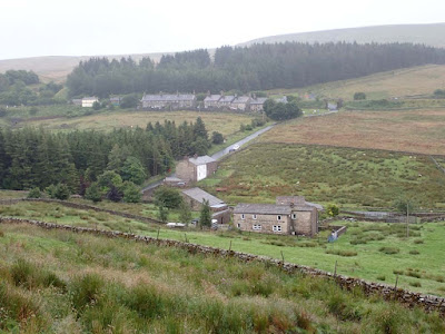
Looking back to Garsdale station. You can see my white car halfway up the road

Just to show typical terrain 

Down into Grisedale beck from the balcony path

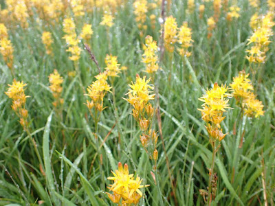
Not sure what flower this is but they were impressive in their abundance, see below


Back to Grisedale beck. My furthest north-west was just round the far bend in the valley beyond the clump of trees


Back down Grisedale from whence I had come

The ruin at my furthest point west


Pano shot showing most of the kidney bowl that Gimmer remarked on

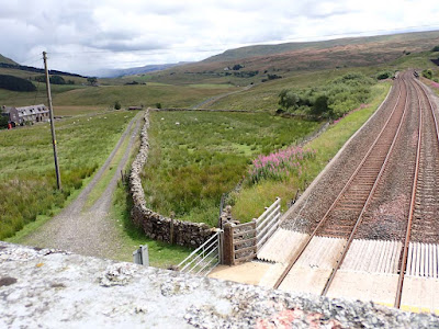
South down the main line


Ure Force above the bridge, and the other side below. It is only named on the 1:25 map, not on the 1:50 shown below but is to the west of Yore House where the foot path crosses 


Start/finish Garsdale station - clockwise

******************************************************
 
From the car at the start, My route climbed over the righthand brow to then drop down into the bowl of Grisedale


Thursday, 14 July 2022

Deepdale (off Demtdale)

Wednesday 13th July 2022  - Deepdale (Dentdale)

6.5 miles. Ascent 1291ft.

The start could be approached from the north over Barbon and through Dent, or from the south via Ingleton and Kingsdale. I chose the latter. I don't think I have driven up Kingsdale before and I was awed. Kingsdale is a major go-to environ for potholders which one can imagine from this broad dale with ranges of exposed craggy limestone lining the steep valley sides, it is like something from another planet. I should have taken photos but there is only a single track road with drop-off tarmac edges that would prevent pulling off onto the grass and there are only a few passing places, so my awe was mixed with tension and apprehension that I would meet a vehicle coming the other way. Fortunately I was lucky and after opening and closing two gates I arrived at White Shaw Moss and was pleased to find decent parking  at the end of the track where I would finish my circular walk.

The views far down into Deepdale and Dentdale were stunning illuminated with patches of early morning sun - it was only 8:30am. In the far distance a pointy hill was seen and although I don't find it easy identifying such  I am pretty sure that was Kidsty Pike at the end of the High Street range in the Lakes twenty seven miles away in a straight line.There was a rudimentary path steeply descending into Deepdale and then more level walking through sheep fields on green turf and limestone ambience, and views of  the best of Yorkshire Dales* hill country in all directions. Walking down Deepdale to almost where it joins Dentdale was Yorkshire Dales walking at its best. I then had to regain a thousand feet or so of height to climb the bridleway to high on the other side of Deepdale after which the track levelled out to contour, more or less, back to my starting point. That bridleway was not easy going bering paved with uneven stone, some loose and some embedded, and there were frequent waterlogged stretches of puddle forcing one to dodge from side to side using the grass verges for short spells, then balancing on and off the grass patches in the centre of the track all preventing any rhythm of walking. Compensation came from the views back down to the two dales with Whernside dominating across and then Pen-y-Ghent poking out above the skyline, and further to the south immense extents of wild country as far as one could see. 

That was one of the best walks I have done for some time.

******************************************************

* I use the term Yorkshire Dales loosely being aware that there are other counties involved in the overall area of what I think of as "the limestone country."


************************************************************

  If you have similar feelings for the Yorkshire Dales as I do it is worth clicking photos to enlarge for a slideshow

My car at the end of the bridleway

The road descends steeply to Dentdale. I peeled off right on a footpath about a hundred yards further down

The distant pointy hill could be Kidsty Pike?


Governor's Lathe. A very isolated working farm.
Internet didn't find anything about this unusual name

Gin clear water

Typical limestone country walking

Much of the path down Deepdale was marked with yellow splashes of paint. The colour was much brighter and deeper than the photo shows. This one even informed us that his was a footpath! That kind of marking would be more expected on our better known long distance paths and seemed a bit out of place in this remote dale.

Mire Garth - now a holiday let


Halfway up the bridleway on the other side of Deepdale looking back up the dale I had descended into  from top right 


A good indication of the hard going on the bridleway after the climb as it levelled  out and contoured back to my car. Note the huge expanse of wilderness in the distance


Start/finish, White Shaw Moss, bottom right. anti-clockwise


Friday, 8 July 2022

Thursday walk with Pete - Borwick, Lancaster Canal

 Thursday 7th July 2022 - Lancaster Canal, Borwick

My regular Thursday walks with Pete were interrupted during Lockdown but have been resumed since, although I have not usually posted about them.

Back in the late 50s and early 60s a group of us from the Bradford area made our way to the Lake District most weekends to climb and Pete was amongst that crowd. He and I both had a walking trip in Norway in 1960 crossing various glaciers and climbing Galdhopiggen by its backdoor. As with most of those bonds of friendship developed in one's youth that you think are going to last forever, one by one we married and had families and drifted apart. The last time I saw Pete was around 1973 when he was  married and visited me and my family at our home in Bradford.

After I lost my wife to Motor Neurone Disease on Boxing Day 1997 I moved to Arnside in 1999. In 2002 I was going to the gym at Holgates leisure complex in Silverdale to get fit for my GR10 Pyrenean traverse in 2003. As I worked on a rowing machine I chatted with a chap sat on the next one. I discovered he was from Bradford, then I asked him if he was in the Yorkshire Mountaineering Club, then he said,

"What's your name?"

 "Conrad" I replied.

"Stop rowing! Put your hand there! It's Pete!"

We had met up again after 30 years and at first had not recognised each other, It turned out Pete and Liz (Elizabeth) had a superb static caravan on the site and visited from their home in Bradford for long weekends. Pete had retired and Liz had extended weekends having reduced her primary-school headship hours by job sharing. Subsequently Pete and Liz bought a house in Arnside and we have socialised and I have walked regularly with Pete ever since, even to the extent of Pete accompanying me on thirty or so of my Munros.

Pete is now 88 compared with my spritely 82 and a few years ago he was afflicted with rheumatoid arthritis but miracle drugs corrected that over a twelve month period and for the last couple of years Pete has been able to walk a modest two miles or so with me every Thursday (more or less.) In consideration of Pete we stick to fairly level ground with tarmac or benign footpaths. The walking is of course incidental to the value of continuing a long held friendship and a regular get together. Our walks end up with tea and cake at Café Ambio attached to the prestigious newly built livestock auction mart just off Jct. 30 of the M6.

I have recently acquired an Olympus TG6 camera. It is waterproof and designated "tough" and after some faffing I have now got the correct colour and picture quality settings sorted and with s bright sunny day I was keen to put it to the test.

We walked a mile there and a mile back down the canal gossiping of current happenings and some reminiscing. 

Approaching Capernwray we encountered drama across the canal. The static caravan people there had a problem bringing a caravan onto site with a tractor and the caravan was almost on the point of falling into the canal. On our return leg we saw them eventually manage to manoeuvre back on track.

Suggest click photos to enlarge
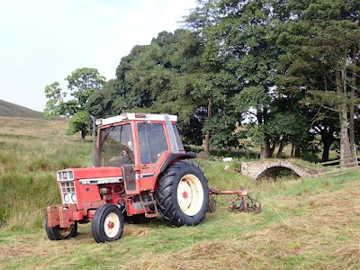


See comment from Bowland cCimber below. This is his photo at the same location from February 2018