For newcomers

At the bottom of each post there is the word "comments". If you click on it you will see comments made by followers, and if you follow the instructions you may also comment and I always welcome that. I have found many people overlook this part of the blog which is often more interesting than the original post!

My blog nick-name is SIR HUGH. I'm not from the aristocracy - my middle name is Hugh which relates to the list of 282 hills in Scotland compiled by Sir Hugh Munro in 1891. I climbed my last one (Sgurr Mor) on 28th June 2009

****************************

Thursday, 12 May 2022

Bowderdale, Howgills, and The Calf

 Wednesday 11th May 2022

Bowderdale and The Calf, Howgills.

Walk 4 from: The Lune Valley and Howgills, Dennis and Jan Kelsall, Cicerone Press.

The authors say in their introduction  "If you only do one walk in the Howgills, this should be it."

My Met Office forecast app shows a row of shining suns for the day so off I go.

Over recent years these forecasts have been highly accurate. So when I park up at the cul-de-sac road end in Bowderdale I am not concerned at the  heavy rolling cloud cover varying from light greys to brooding darkness. Through the car window I watch swallows darting as I sup coffee from my flask confidently believing that a clearance would be forced by the strong wind. But, perhaps a shred of doubt sets in as I find myself employing delay tactics for my departure.

On the stroke of 8:00 am I am away. The last bit of tarmac leads onto a good farm track but littered with puddles from the heavy overnight rain. 

At a wall-end I branch left leaving the track to continue its way up the ridge that I will be returning by. 

I am now on a narrow but  well defined walker's footpath which has been skilfully engineered to  follow a contour with hardly any loss or gain in height for around five kilometres to the head of the valley. The rounded but impressive peak of Yarlside dominates at the end of the valley. The Calf is hidden round the corner to the right.

The cloud cover of variegated greys has not cleared and halfway up the valley rain arrives and the wind increases and this continues for the rest of the walk

At the head of the valley the path demonstrates again the skill of its designer by taking a slanting climb across the fellside. The angle chosen allows (me at least) to walk at a steady plod without the need for frequent stops to catch breath, a remarkable achievement for a path that needs to gain  height in a short distance. As I swing to the south-west I get views down to the A683 with a rare patch of sunlight illuminating the starting point for the normal ascent of The Calf via Cautley Spout.

As the path pulls out onto the plateau there is a tiny tarn. The wind is now ferocious driving intermittent spells of rain. I am battling into that and meet two guys walking The Dales High Way and we have a brief chat. They warn me to be careful in view of the high wind. I must look like a vulnerable old codger who should know better than to be up here in these conditions. So much for the Met Office  forecast. At the Calf trig I take a quick snap with no consideration for composition. I then remove my rucksack and delve to get a pair of gloves out of the pocket of the hollowfill jacket therein. With the wind tearing at everything this is a more onerous task than one might imagine - the wind catches a handkerchief which I must retrieve but I am stood there with the jacket being torn about by the wind as I stuff it back and then scamper to reclaim the handkerchief. I depart the summit in haste.

I now have that wind behind me and trot along with more ease. The Dales high Way ridge from here back down to Bowderdale must be one of the best ridges in England - I backpacked this LDP in 2016.  Even in today's conditions it is a delight with enticing views into the steep sided  valleys and distant vistas in all directions. I am pleased to remember to branch off at the little tarn from the well defined path by which I ascended.  The Dales High Way path is not obvious where it leads off from the tarn and it would be easy to blindly follow the more well defined path that leads back down into Bowderdale, but I reckon you would soon realise the mistake. 

At eleven miles ( including 2069 feet of ascent) that is the longest I have walked for a long time and I'm pleased to note that I am in no way fatigued as I devour my packed lunch back at the car - there had been nowhere whatever to stop for that on the route especially in those conditions.

_________________________

Interesting stats: Memory Map gives me 2069ft. of ascent and then 2070ft. of descent; what happened to the other foot?

The Bowderdale road ends a sort distance beyond this. 8:00 am and I'm off


The farm track littered with puddles. 


First views looking up upper Bowderdale. My path swings to the left a bit further on to pick up the contouring path.


Note the well defined path, the clouds, and Yarlside dominating at the head of the valley

The path clinging obediently to its contour


Looking back down Bowderdale

A glimpse back down to the Sedbergh road and the more conventional starting point for the ascent of The Calf

The Calf - (676m. - 2217ft.)

The Dales High Way path from The Calf summit. It soon becomes more of a  boggy trek but nowhere enough to be a real nuisance. Note the ridge extending forever in the distance.

The route on the right is that of my Blease Fell walk posted here a few days ago


Sunday, 8 May 2022

Randygill Top and Green Bell (Howgills)

Saturday 7th May 2022 

Walk No. 1 from: The Lune Valley and Howgills, Dennis and Jan Kelsall. Cicerone Press.

A tough little walk for me, eight miles and 1695ft. of ascent, but it was oh so good to get back on some hills again.

"Twas easy walking as far as Weasedale but then out onto the uncultivated grassy upland and a relentless five kilometre climb much of it on steep ground. I say relentless but from the spot height at 586m, just as one thinks Randygill Top is only now a short distance away one drops very steeply about 100m. to Leathgill Bridge (actually a natural land feature) followed by its corresponding climb out on the other side to gain Randygill summit. If I had looked carefully at the map contours I would have been prepared for this sting in the tail.

From that spot height I thought I could see figures on Randygill summit and I took a zoom shot. When I arrived there was a small orange tent, a radio aerial and a guy with a large, even for its breed, Alsatian dog. The dog saw me and started to bark with savagery but happily for me the guy had hold. However that dog was obviously very strong and its owner was struggling to retain it and I could see a  possibility of him loosing control. If that had happened I believe seriously that I would now be dead. I couldn't go to the summit cairn snd turned to pick up the track to Green Bell taking a quick zoom shot back to the summit, the dog, and its owner.

Further down the path a runner came up behind. I had noticed little blue flags marking the path. I was informed that I was on the route used by the SAS as a selection tool for applicants to weed out wanna-bees that would not be up to the mark. 

I gleaned more from the marshal on Green Bell. The course is a strenuous fifteen mile trek over these Howgills with a full Bergen rucksack. The guy on Randygill was marshalling a checkpoint. TToday was the annual event open to all,  some training to do the selection course for real, and any members of the public who want to have a go either running or walking unencumbered with the rucksack.   Today there were fifty entries and they kept passing me from time to time until I veered from their route well down the other side of Green Bell.

A bonus for the walk described in the book was a short diversion to view the source of the River Lune. I have previously been disappointed on similar searches finding nothing much to pinpoint the exact location amongst a mush of peaty ground, but this one didn't disappoint with its well defined spring and a half decent trickle of water and a well defined streamlet leading off to turn west alongside the A 685 and now named River Lune.The first section is named on the map as Dale Gill and this leads into Greenside Beck, but it is quite obvious the these two form the proper origination for the River Lune. I gained a sort of smug satisfaction from this little visit. 

That was a good round and would provide an excellent introduction for anybody to the Howgills


Randygill in the clouds on the right and the summit well back. Green Bell to the left. The clouds cleared and I had good sunny weather for most of the walk


Yet another old farmhouse in the process of renovation. Why do they make such a mess or is it me that is just OCPD?

On the way to Randygill

Red dots - looking back to my route all the way to the A685

Zoom to strangers on Randygill summit

Just a taste of Howgills scenery

The loss of height and the required climb out from Leathgill Bridge. It was MUCH steeper on descent and ascent than the photo indicates.

The savage Alsatian on Randygill summit. This was a zoom back I took after putting some distance between me and them

On the way to Green Bell

A  more friendly marshal on Green Bell who told me all bout the SAS selection course and today's event

Source of the River Lune and...

...off it goes to join the Lune gaining its proper name as it swings west to follow the A685. One would expect this river to flow out north to the Solway but after travelling west to Tebay it swings sharp left and goes south to eventually reach the sea beyond Lancaster.

Anti-clockwise from Wath on the A685


Thursday, 28 April 2022

Blease Fell - Tebay

 Wednesday 27th April 2022 - Blease Fell from Tebay

It is 8:15 a.m. I have just arrived in Tebay wearing shorts motivated by a balmy, warm spring day yesterday signalling time for me to put long trousers into hibernation  but  I have been sandbagged. My car gadgetry tells me it is only 2 degrees outside. There is no hurry and I remain cocooned in the comfy warm car and steal a cup of coffee from my flask at the risk of depriving myself later.

I am here to break new ground on a venture into the northern edge of the Howgills and see what I can see. The Old School is opposite my car and I wonder about its history because of a blocked up arch in the gable end.

Back home I have just Googled hoping for some academic treatise on that architecture. I find that this is now a guest house and it has more first page entries from every accommodation website anybody has ever heard  of, and after five pages I gave up - no mention of its potentially interesting erstwhile life.

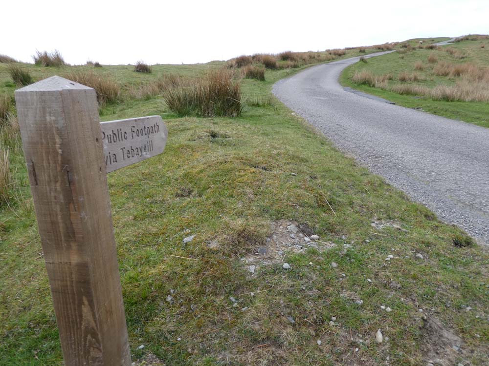
Off I plod up a tarmac lane climbing steadily. At  the farm of Tebaygill there is a significant example of corrugated iron architecture in the shape of a barn with a curved roof. Skilful use of that material can produce characterful buildings - this one is only hinting at that possibility, but enough to catch my attention. They are obviously much prone to rust which I guess is a problem for their owners, but something I find attractive with that vibrant colouration.

The tarmac gives way to a rough rocky old lane and the surrounding terrain is that of tussocky pale green and fading yellow grass. No heather on this upland, and as I branch off on a quad bike track to follow the high ground walking is easy. The gradient is steady allowing for non-stop ascent so that when I eventually stop to look behind the view is surprisingly dramatic. I am looking down the long undulating slope back to Tebay, and off to my left I can see the M6 threading through the Lune gorge. The cars are like ants and I wonder if their journeys are more purposeful than those of the industrious insects.

Further on I get a  new elevated view looking up the whole length of Borrowdale (not the Lake District one) and I can even see through to the  old A6 Shap road. Borrowdale is one of my favourite locations. I discovered it years ago by chance rather than recommendation from elsewhere. One's own discovery from exploration is  part of the raison d'être for for this business of walking and absorbing the landscape.

My furthest south finds a jolly little cairn of white stones on Blease Fell, located to obtain the best view of the Lune gorge with it eponymous river, the railway and the M6 all fighting for space. Further to the left I am looking into the heart of the Howgills with Carlin Gill prominent and the deep cleft of Black Force. That was the scene of an exciting day with Bowland climber in September 2019 CLICK HERE 

I spend a while looking at the contrast of timeless hill country against modern intervention thrusting and intruding. I move to slightly higher ground following my GPS eventually having its cursor  over the Ordnance Survey spot height on the map ( 474m.)

Quad bike track has to be vacated for a cross country trek over mildly tussocky terrain to soon join another track leading to Hare Shaw (472m.) Once one has gained height in the Howgills many subsequent summits can be visited by gentle ascents.

From Hare Shaw it is downhill all the way back to Tebay, but I stop halfway for a sandwich, coffee and nibbles. Up until then my hands have been cold even with a pair of modest gloves but at last the sun has made some impression, so much so that I find I have extended my lunch stop by nodding off for a while. There has been nobody about all the way - all is peace, and the only sound comes from the odd skylark.

Well that's some more new and worthwhile ground explored and my early start has left  time to make a long promised visit further north to my friend Gimmer, who comments here, we have known each other from schooldays, I shy at saying exactly how many years ago!


The Old School (guesthouse now) with the record number of accommodation first page entries in Google I have ever come across, I gave up after five pages.


Corrugated iron splendour.
 Blogger is havng one of its tantrums and will not let me dispense with the underlining despite using "clear formatting" which when I tried deleted the photo as well. I have better things to do than spend the rest of the day trying to sort it.

Ty[ical of much of hill country scenery. Perhaps the advent of quad bikes has reduced the need for storage facilities and the like in the more remote parts of these sheep rearing hill farms

Extensive tree planting in Tebay Gill

The quad bike track now left for a less well defined version

Walking was on an easy gradient and I was feeling fit and it was longer than usual before I stopped to look back at my outward route surprising me by its extent


Borrowdale. The light was dingy. This could be a better photo on a day of more amenable weather

This unsightly stuff carried on over a few hundred yards. If it had been effective for the quad bikes I suppose it might have some justification but it was apparent that such was not the case.


This and next - the  Lune Gorge and the M6, Blease Fell cairn in the foreground, and next but one looking to the left...


...into the heart of the Howgills - Csrlin Gill and Black Force. This one for BC

On the way back. That must be the Solway in the distance


Friday, 22 April 2022

Smardale from Ravenstonedale

 Thursday 21st April 2022 - Ravenstonedale Smardale circular - 7 miles.

Smardale Bridge features on Wainwright's Coast to Coast  which I walked in April 1990 (32 years ago!)

In 2003 I had a mountain bike ride that passed by. 

This packhorse bridge from the 1700s has an attraction way beyond its modest construction. It is the way it nestles  comfortably into its surroundings like an aged gent settled into his old armchair, and it is then enhanced by the special cropped greenery of the limestone country with dashes of white and grey here and there where that rock protrudes. Whichever direction you approach from it reveals itself unexpectedly a long way down in its hollow.  When you arrive, which you will, because this is also a crossing point of several routes, adding again to its significance, you will note the old cobbled humpback surface and wonder at those old drovers taking their livestock miles and miles to sell down the country.

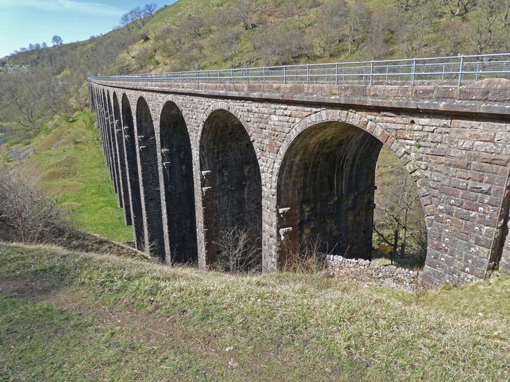
Scandal Beck runs below, now a decent sized river after  a short journey from its source on the northern slopes of the Howgills. That beck carves an ever steepening sided gorge necessitating construction of a splendid viaduct for the railway in 1861.

It was built in 1861 by the Cumbrian engineer Sir Thomas Bouch as part of the South Durham & Lancashire Union Railway, which crossed the Pennines to carry coke to the iron and steel furnaces in the Barrow area and West Cumberland. The line was closed in 1962 after steelmaking finished.   Thanks to Visit Cumbria

I have a strange concept about Scandal Beck:  it seems (to me) in parts to be flowing the wrong way in relation to its surrounding landscape.

The bridge, gorge, and the viaduct have provided for a variety of footpaths and walks which have become classics and "must dos" for many a walker, but it was only when I perused a recently purchased Cicerone guide that I realised that possibilities extended north to Smardale and return could be made by traversing the viaduct which is not marked as s public right of way on the OS map, but its length from Smardale south to Smardale Bridge has been incorporated into an accessible nature reserve.

My circular walk was all quiet and peaceful and as good a seven mile circular as you could have anywhere in the country. I expected this to be a popular trek but I only met two other couples the whole way so what has happened to those many many people that walk the Coast to Coast? I am not complaining of or welcoming the dearth of fellow walkers, just informing.


WORTH CLICKING ON PHOTOS TO ENLARGE

    8:30 a.m. start in Ravenstonedale


Ravenstonedale church. I tried to visit on the way back but it was closed


Smardale Bridge comes into view far down below after topping the distant horizon


Note the cobbled pathway


Distant Smardalegill viaduct which I would cross on the return leg

Zoom to same

Smardale Hall
Smardale Hall is a hall house built in the 15th and 16th centuries. The hall has a tower at each corner, very medieval in appearance. There was originally a 14th century tower house on the site, but much of this was demolished to enable the building of the present hall. Some of the original fortified dwelling is built into the current structure. There are earthwork remains of another medieval house in the grounds of the hall, as well as the earthwork remains of a probably medieval motte.Thanks again to Visit Cumbria
 

This is the more modern main line Smardale Viaduct just north west of Smardale village not to be confused with the walkable Smardalegilll viaduct - see next photos.

On the dismantled railway on the way to Smardalegill  Viaduct

Smardalegill viaduct


Lime kiln. NB quarry adjacent

Having left the railway track Smardale Bridge comes back in view. Yellow dots my inward journey and red my return

Scandal beck on my way back into Ravenstonedale village.