For newcomers

At the bottom of each post there is the word "comments". If you click on it you will see comments made by followers, and if you follow the instructions you may also comment and I always welcome that. I have found many people overlook this part of the blog which is often more interesting than the original post!

My blog nick-name is SIR HUGH. I'm not from the aristocracy - my middle name is Hugh which relates to the list of 282 hills in Scotland compiled by Sir Hugh Munro in 1891. I climbed my last one (Sgurr Mor) on 28th June 2009

****************************

Wednesday 27 June 2012

Doing what I do best

On Sunday I walked locally, and even though this was only a few miles from home it was new territory for me, so my only information was from public footpaths shown on the OS map. After the first one hundred yards on an unsurfaced, but sound track there was a branch left through a gate. This lead into a lane overgrown with nettles and long grass and other mixed flora. After much recent rain this was all sopping wet. I thrashed my way through for about three hundred yards until I emerged into a field.

Further on I crossed the river Bela which was a fine sight in full flow between lusciously green fields.

I met one other walker along the way and also stopped to chat to a friendly farmer as I tracked through his farmyard.

At 2.8 miles this was my longest venture so far, and the knee seemed to hold up well. The main thing is that I just couldn't have done that walk before the operation.

Modest as this short trip was, I was elated to be walking in our  rewarding countryside again exploring new locations, and having surprise encounters.

oooooooooooooooooooooooooooooooooooooooooo

Sunday - one day later.


Uplifted by yesterday's jaunt I was off again. I parked the car at Dallam Bridge (yes, I am driving again). I walked over Dallam deer park to Beetham.

Dallam Bridge


At Beetham I stopped at The Old Post Office Tea Rooms for soup, tea and a chocolate brownie. The tea shop owner is a young girl and a keen outdoor type providing a friendly welcome, with good food, and proclaiming "dogs welcome". I chatted here with the girl and her mum and heard about a backpacking trip round the Isle of Man - sounds interesting - must look it up.

The tea rooms at Beetham - always worth a visit.
I crossed the A6 where one often sees cyclists and walkers tackling Land's End to John 'o Groats (or t'other way round). Branching off the A6 after a few hundred yards took me up Paradise Lane, and then onto another new footpath for me across fields to Milnthorpe, over the cricket field and back to Dallam Bridge.

This trip was just 4 miles which is a half decent afternoon's walk, so things are progressing. Watch out, I may be following Mick and Gayle on The Pacific Coast Trail before long.

Monday 25 June 2012

A stylish wedding


Arnside Knott seems to have featured often here recently.
Last Saturday I was there again. For several years after moving here in 1999 I took my Springer, Barney up the Knott every morning, and have ascended many times since - I must have clocked up several hundred ascents, not to count  wanderings on the multitude of surrounding footpaths, and even now I can discover new paths that I have not walked before.
On Saturday good friends of mine, Paula and Mark who live just down the road decided to tie the knot on The Knott. A large number of friends and family gathered in the National Trust car park and climbed up to the viewing station where a civil ceremony was conducted (Paula and Mark having visited the registry office the day before).
Back down at the car park bubbly was consumed, and then in the evening we had a good old knees-up in the Women’s Institute hall in Arnside


The bridesmaids dresses were intentionally jokey

Saturday 23 June 2012

National Trust fatuity

In case anybody thought I was exaggerating  in  a thread on Afoot in the Hills -"That's fine say the RSPB and SNH" - 22nd June - http://afootinthehills.blogspot.co.uk  , here is a copy of a letter I sent to the local paper after receiving the reply from the National Trust about local tree felling.


14th March 2009
Letters and Opinions
The Westmorland Gazette
1 Wainwright’s Yard
Kendal
Westmorland LA9 4DP
Dear Sir
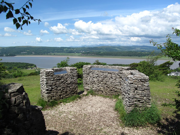
As a resident of Arnside I recently sent an email to the National Trust enquiring about the reasons for tree felling on the approach road to Arnside Knott car park and received the following reply.
Dear Mr Robinson

Thank you for your email of last Friday, which has been passed on to me, as I am the Property Manager responsible for Arnside Knott.

I am sorry you do not like the result of the clearance work up the road. The aesthetics are a matter of taste, I think, as other people have said to us they think it is a great improvement.

However, the clearance work was not done for aesthetic reasons, but to ensure that Fire and Rescue could get access up to the car park on the Knott. I hope it is unlikely that we ever have a serious problem there, but if we do they will need to get there as easily as possible. The Fire and Rescue team and the wardens did do a recce before the tree felling was commissioned, to check how much clearance there was above the fire engine, with the wardens on top of the fire engine. The conclusion they all came to was that there was not enough clearance, to get up easily or without doing expensive damage to the fire engine. Even a flashing light would cost about £2000 to replace, I am told, so Fire and Rescue are understandably reluctant to risk losing them. Given that the trees needed to be cleared, it made sense to cut them back down to ground level rather than 'pollarding' them higher up, which would have looked strange, is more difficult and would have meant re-cutting them again sooner.

I should perhaps warn you, while writing this, that the warden-in-charge is planning to do a similar exercise with the next section of the track, above the cattle grid. 

The trees will grow again, of course, though historically there have not been trees on either side of the track for all that long. In previous times, the track was open on both sides, with no fences so, as the whole area was grazed, there were no trees to speak of.

Another practical, though incidental, advantage of clearing the trees down to ground level,at least for a while, is that it will enable the tenant to repair the fences. They are in badly in need of repair and renewal in places, and cattle keep getting out on to the road, which is an inconvenience all round.

I hope this answers your query and will persuade you that there was indeed a good reason for the felling work. 

Yours sincerely

Rowena Lord
Morecambe Bay Properties Manager
The National Trust Property Office
Bank House Farm
Silverdale
I read this with some incredulity. All the people I have spoken to are dismayed at the wilful destruction of natural and scenic habitat.
I find it difficult to believe that if a fire engine could pass through the cattle grid, which is narrower than the road, that it could not pass along the road, where perhaps there may be some need for only marginal trimming of the trees.
I have never heard of anybody travelling on top of a fire engine – this is absurd, and, I would have thought quite dangerous.
This all seems to be the start of a wildly misconceived plan to provide access for fire engines in ever more obscure locations - why not build a nice concrete road right up to the top of Arnside Knott?
As for repairing fences I am sure the value of saving the trees would have been outweighed by the slight inconvenience in the repair of fences.
What are The National Trust up to? I am sure the expenditure could have been put to more logical and beneficial use. 
In these times of supposed environmental awareness I believe we should be thinking positively about ways for not having to chop down trees, rather than conjuring up peculiar and very debatable reasons for destroying them.
Conrad Robinson

Monday 18 June 2012

The Tour of Arnside Knott

Having walked the tours of The Ecrins, The Vanoise, The Quyeras and The French Gorges the best I can do at the moment is give you some pics of my local "Tour" taken today - a round trip of about three kilometres. I don't think this one will get published by Cicerone.
The starting line

Turn right into wood where road goes to shadow

Into the woods


Starting the steep ascent


Railway viaduct -Arnside/Grange-over-Sands.
High Street and Kentmere fells at skyline

Across the Kent estuary, Dow Crag and The Old Man of Coniston centre
Zoom to  Skiddaw - 33 miles distant

Welcome seat at summit of A. Knott - trig is a little higher up and behind, but this is best for the view
Well-known local landmark - Lake District hills in background. Legend says two lovers ostracised by their families planted two trees and linked them together
Heysham Power Station across Morecambe Bay - about 11 miles away
View indicator - looking across Kent Estuary to Grange-over-Sands - skyline shows Caw (the pointy one at left end) then further right the Coniston fells

Hunphrey Head - an attractive peninsula sticking out into Morecambe Bay - makes a pleasant walk - there is a trig point at the end
Spring at bottom of very steep slope of The Knott - nearly always has water and unfailingly remembered and visited by our late dogs Barney and Jake.

Zoom to Ingleborough - twenty miles away
***********************************************************************************
KATIE UPDATE:

Photo as received by me from Jill


I never ordered this!

Friday 8 June 2012

Backpacking the easier way

Following JP's comment on the last post here is the pic.

I was on my walk of the French Gorges in 2007. The Llamas are quite big out there; the one carrying my kit was following on behind.


Thursday 7 June 2012

Photoshop - layers


I have bought Photoshop’s Layers by Matt Kloskowski. This is the easiest to understand computer manual I have so far come across.
For the uninitiated, Photoshop is complex software enabling photograph manipulation, painting, and graphic design etc. In contrast to Matt’s manual it is devilishly unintuitive, but rewarding when one  masters some of its attributes relevant to your requirements.
Photoshop’s cornerstone  is a many faceted feature called layers, which seems to demand three dimensional lateral thinking to make it perform the task you require. Photoshop, like most software has its own vocabulary which often has no hint of the outcome for a named operation, or if there is a hint you nearly always have to set up some other parameter before you get what you want.
I have dabbled with Photoshop for a number of years, but my present restriction after a replacement knee operation five weeks ago has provided  the opportunity to explore further.

Matt’s manual  teaches you to do things the right way. I have already discovered quicker methods for some operations compared with my own laborious procedures.
The results below are hardly sophisticated, and were achieved in a fairly cavalier fashion - detail could easily be tidied, but I am not aiming for the front cover of a graphic design magazine at the moment. These efforts have been constructed using only photographs. In previous posts I have shown examples of free painting using Photoshop, which is a much more creative format.
Creative possibilities are only limited by one’s own imagination, and of course skill in operating the software.

"The bloke in the pub said there were dinosaurs in these woods"

"I think that chap in the tent has a Cornish pasty - I'm off over there"


Tuesday 5 June 2012

The emergent mountaineer


At 8:30pm last night I set off to climb my first hill since the knee op.
The objectives were Arnside Knott (159m), and the lighting of our jubilee beacon.
Within a hundred yards of home I stopped to chat to my neighbour with his VW Beetle which he has spent £30,000 restoring; he was just getting into his stride showering me with enthusiastic details, which although interesting threatened to delay my ascent of The Knott. Fortunately another neighbour couple arrived on their way to beacon ignition, and I was saved. These two set a good pace, but I was able to keep up and we arrived at The Knott summit in good time.
A large crowd took in the splendid view of the sun dropping behind The Old Man of Coniston, and then the chairman of the parish council, assisted by National Trust bods set our beacon alight.
All in all this was a good effort by Arnside PC and The National Trust. I chatted with a number of people I knew from the village, and eventually set off back with a full moon providing enough light at eleven thirty to follow the path, but as I entered the trees I made full use of my torch - it is a steep, rugged path, and in my present state of instability I had to take care.
I managed to get an eerie shot of the moon through the trees, and arrived home about eleven thirty well pleased with this, my most ambitious outing since I walked a thousand miles round the Welsh boundary last summer.
Stats.
3.1km
136m. of ascent - wow !