For newcomers

At the bottom of each post there is the word "comments". If you click on it you will see comments made by followers, and if you follow the instructions you may also comment and I always welcome that. I have found many people overlook this part of the blog which is often more interesting than the original post!

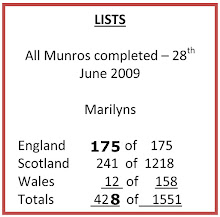
My blog nick-name is SIR HUGH. I'm not from the aristocracy - my middle name is Hugh which relates to the list of 282 hills in Scotland compiled by Sir Hugh Munro in 1891. I climbed my last one (Sgurr Mor) on 28th June 2009

****************************

Friday 24 March 2017

Gaisgill, Tebay, and National Trust reply

Thursday 23rd March walk with Pete

Every walk has its own character or one might say each walk generates its own ambience. Today we drove from Arnside in warm sunshine and blue skies. Arriving at Tebay broody clouds prevailed and when we stepped out of the car there was a wicked cold wind blowing from the east. Even though the sun eventually won the battle with the clouds that chilling wind persisted, half behind us on the outward journey and full in the face on the return. We both agreed that the characteristic of this walk was "unfriendly." I had come ill-prepared with just a base layer, shirt and a lightweight shell jacket and no gloves. Pete has trouble with cold wind making his eyes water. Although it was not wholly unpleasant with views accross to Orton Scar and the Howgills we were glad to get back into the car and re-group at Café Ambio.


CLICK TO ENLARGE


If you look at the map below this the end of the Tarmac. That track could continue as an interesting walk but not today.

This looked a bit unfamiliar. I only do tractor photos for Alan if I, as a non expert, think they are  unusual

I bet they don't know the whereabouts of this little baby

Tebay always looks a bit neglected as does this, their monument, to what there was no clue. Notice the trouble taken with the trough to carve its end circular to fit the plinth

Zoom to Orton Scar

A there and back route starting art Gaisgill and taking in the little spur road as far as Tarmac end

An arty one. It just took my fancy. I considered Photoshopping the sky window out, but what the heck...


---------------
I had a rant about the mini concrete damming of a spring by the National Trust in my recent post: "National (dis)Trust":
CLICK
and I emailed them. Here is their reply which to some extent vindicates their action. I don't have a degree in conservation or land management so I'm not really qualified to comment further with authority, except to say that all this "meddling" with nature does irritate me - it seems to me that if you improve habitat for a certain species you are likely destroying habitat for others.

Hi Conrad

I’m Ross, one of the NT rangers responsible for managing Arnside Knott.  The mini dam you’ve spotted we constructed last August when the spring was virtually dry in order to create a small reservoir of water.  We’ve then managed to put a 20mm alkathene pipe at the base of the dam and dig that in under the path and away down the slope.  If you’ve spotted the mini dam then I’m guessing you’ve certainly spotted the new water trough just up the slope from the vehicle gate on the bridle path.  The natural spring now feeds this trough.  

Before the installation of this trough grazing was restricted to the far side of the site (i.e. the cattle didn’t want to stray too far from the water supply) but now they can explore this end.  You’ve probably noticed we’ve thinned out some sycamores on the scree slope and beyond had some contractors in thinning out the trees near where it becomes grassier.  This does a few things: it enables the sun to shine on the stone warming it for a variety of invertebrates including the southern wood ant, it exposes bare soil to the warmth allowing pioneer species such as wild strawberry and violets to establish and it links the grassy areas to the water supply, which will hopefully encourage the cattle to roam at this end of the site.

There are some Shetland cattle on as we speak and they’ll be there for a couple of weeks before being moved onto Heathwaite.  They’re a conservation species with the ability to survive on poor forage and, as I’m sure you know, are an essential tool in managing the site for the rare grasses, wildflowers, orchids and associated species that make the Knott so special.

Any other questions feel free to email directly rather than using the Morecambe Bay email as we only check that every week or so.

Kind regards

Ross

____________________________


Thursday 16 March 2017

Cumbria Coastal Way - Bootle (Stn.) to Drigg

Wednesday 15th March, '17

I haven't worked out the logistics of the next section, but coordinating train times is becoming stretched. A new approach may be needed. Anyway, it was the 6:00 am train again, and a 7:35am walking start from  Bootle station.  It is becoming quite a long train journey now.

Once I had backtracked onto the CCW proper there was a narrow path, broken by erosion on the seaward side, and at a welcoming metal gate through the barbed wire fence I was tempted into a network of farmer's squelchy fields until I was able to get onto the beach for a stretch of reasonable shingle, then pristine firm sand to arrive at the road diversion round the MOD Eskmeals Firing Range. Here they have a magisterial mast come look-out post. I wondered about the effort of gaining the observation room at the top, which I supposed would be inhabited by officers, and of course, in consideration of the high and mighty a lift had been installed.

At Hall Wabberthwaite my gpx file of the route, dowloaded from the Long Distance Walkers Association, showed a ford crossing the River Esk, but research had told me that this was not viable, and a three mile detour is now specified.

From here the rest of this walk became one of the most long drawn out, squelchy mudfests I can ever remember. First of all the unsurfaced farm tracks were abundant with large puddles requiring a zig zag course and constant vigilance. I was then into cow trodden, marshland and mud fields with no sign of the footpath on the ground. I tried for a long time to keep feet dry, but in the end I gave it up as a bad job and just sploshed, gurgled and sucked my way through the mud and water. Fortunately I was not going in deeper than my ankles. Further on, after reverting to tracks, because my feet were soaked through, I had a feeling of liberation and just sploshed in a straight line thorough all the puddles.

Walking down the north side of the Esk on a good forest track with the river on the left and Muncaster Castle high up above, I fortunately met a lady with dogs and she told me the section further on round the shore to Ravenglass would be impassable due to exceptionally high, high-tide, and she pointed out the alternative inland track; but for that I could have been in a lot of trouble.

From Ravenglass the River Mite, a tributary of the Esk is crossed by a pedestrian way on the railway crossing, and then some road and a bit more footpath brought me to Drigg, and decision time.

My intention had been to walk to Seascale. I had missed the 13:42 train from Drigg by five minutes, but there was a direct train at 14:27 and there is a quaint coffee shop at the station, so a comfortable three-quarter hour wait would by pleasantly acceptable: plan A.

The alternative: Plan B, was to take another hour or so walking the remaining three miles to Seascale, but having arrived there I would have to wait for more than two hours to catch the 16:51 which wouldn't get me back to Arnside until 18:43. There was little hesitation in adopting Plan A.

The coffee shop was run by an elderly lady. I entered and found myself in a much cluttered gift shop, so crammed with an eclectic mix of stock that walking through to the coffee shop room at the back risked knocking things over. I asked for tea, but the lady said she only served coffee, so I settled for that, along with a man-sized wedge of date and treacle flapjack putting in serious doubt my ability to cope with a proper meal back at home.

Undaunted by the mud, even revelling in the abandon of heedlessly splashing along I thoroughly enjoyed this walk. There was much variation in scenery, and good weather - I walked in shorts for the first time this year, and had no need for gloves.


Shingle to start with - better sand further on.
The Look-out tower at Eskmeals  MOD visible left of centre on horizon

Perfect walking on firm sand - click to enlarge.


The look-out tower complete with lift

Reception at MOD Eskmeals. I heard several one-off almighty explosions at various times during the day making the whole ground shake even when several miles away


I managed to tip-toe through and keep my feet dry, but later on in the marshy fields I gave it up as a bad job

Tractor graveyard


My route crossed this marsh to arrive at the road - the faint sandy coloured line below the hills

Muncaster Castle

Walking down the north side of the Esk. It was here I met the lady who told me of high tides and ther alternative route to Ravenglass

Roman bath house - I was looking forward to the modern version back at home

Crossing the River Mite at Ravenglass

Looking back to Ravenglass


Ravenglass again

On the way to Drigg

The strictly COFFEE ONLY shop at Drigg station

Pink dashes - diversion from LDWA gpx file.
Blue dashes - high tide diversion to Ravenglass


Friday 10 March 2017

Glasson Canal

Thursday, 9th March '17 - Thursday walk with Pete

Pete's wife Liz had an appointment at Lancaster hospital so I drove them both there for 8:30 am.  dropped Liz off, and continued the day with Pete, returning to collect Liz at 4:30pm.

At that time in the morning our first priority was for a bacon butty. Booth's supermarket café at Garstang provided.

Back at Galgate we walked up the road leading to Glasson Dock, but only as far as Conder Green. You would guess from the road's minor classification, and wiggly appearance on the OS map that it would be quiet,  but it was in fact busy, being the only practical link between the A6 and Glasson Dock. So we were dodging traffic, and at one point we were overtaken by a guy on a bike pulling a camping trailer.

Further on we came across the cyclist again repairing a puncture; he was French and had cycled from Plymouth so far. His plan was to see our Lake District, then Scotland, then, hopefully, to take a boat to Iceland. I showed off a bit speaking French, but his English was better than my French. This was the first puncture with his Kevlar enhanced tyres.

Our return route via the Glasson Canal was muddy in patches, but the sun was shining and Spring was in the air.

At the junction with the Lancaster Canal we turned north again and headed back to Galgate.

It was still far too early to pick up  Liz - our normal Friday routine is to drop Pete off at Liz's art class in Storth around 3:45pm. So we headed up to Williamson's Monument whose splendid green copper dome can be seen high above Lancaster from much of the surroundings. Unfortunately we were unable to ascend the monument due to ongoing repairs, but the views back down into Lancaster and across Morecambe Bay were impressive. The famous Pendle witches passed trough here in 1612 on their way to trial and for most, execution at Lancaster Castle.

We retreated to the café for tea and a cake.

The French cyclist

Glasson dock in the distance, and Heysham Power Station

Fortunately this holly-prickly stile was not on our route

On the road to Glasson

Some of the canal path was muddy

Glasson Canal and the Bowland hills

Two old codgers at the Glasson, Lancaster canals junction

Galgate Marina

The view down to Lancaster from Williamson's Monument


Cumbria Coastal Way 6 - slideshow

The last post for Cumbria Coastal Way 6, (Millom to Bootle Station) had strange photos because of an unintended, erroneous setting on my camera.

For those interested I have converted all the photos, some of which were not shown on the post, into black and white, with what I think are rather pleasing results.

Click on the link CLICK HERE and when Dropbox opens click on the first thumbnail, then "full screen" at the bottom to see the slideshow to full advantage. Each black and white photo is preceded by the green cast original.

Wednesday 8 March 2017

Cumbria Coastal Way 6 - Millom to Bootle Station

7th March '17

Logistics are becoming difficult.

Yesterday I had to catch the earlier 06:02 train from Arnside so I could catch the 14:36 back from Bootle Station. As I go further north the time for the return train becomes earlier. All this is to allow for my penchant for arriving home in time for a hot bath, a meal and a relaxing evening. The hot bath is now enhanced by the new boiler - I just turn the tap to full and get the bath rapidly filled at a temperature that now necessitates addition of cold water! How did I put up with that old incompetent boiler for all those years?

I was walking by 7:30, the first half  mile through Millom's streets to get back on the CCW.  I persisted with what I thought was the Impressive Art setting on the camera, but I think I must have had it set on something else - all todays photos except the odd one where I overruled have a ghastly green tint.

All the walking was on pristine, perfect walking surface beach until SD 096 847 where a jink in the route indicates transfer to the cliff tops. Huge vistas of sand with not even a footprint, and huge skies provided wonderful walking, and I reckon the best so far on this LDP (long distance path). I saw one or two people, but all away in the distance.

The river Annas is quite strange. You don't expect to see a fully fledged river running along a cliff top. It is well supplied in its short seven kilometres from four or five sources near the summit of Black Coombe. At one point there is a somewhat over engineered bridge which the CCW crosses, and a bit further on a decidedly less professional companion consisting of just two beams - plenty of scope for a mini disaster.

All in all a grand walk arriving at Bootle Station for 2:00pm with thirty-six minutes to spare.

Take your pick. Not far out of Millom.
 The orginal on the funny setting was weird. This was an odd one where I reverted to standard setting, even so, despite some Photshop still badly overexposed at the top, but that was looking into the sun

Most of the beach was pure sand, but this bit was slightly more rocky

The cloud trying to move off Black Coombe - it never did

Maximum zoom - tufted duck

Near Haverigg

Haverigg Holiday Village

Max. zoom. Cormorants

Pristine sand as far as you can see. It was brighter than this awful green cast indicates

The over-engineered bridge over R. Annas, and...

...its less welcoming companion. I put one foot on each side and waddled across

The R. Annas - it drops off into the sea just beyond where you can see.
 The CCW path is  hardly visible along this awkward hillside.


*********************************************************

Katie update


Sunday - 5th March '17


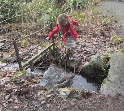
A few photos from a visit to Grizedale Visitor Centre with High Horse and Katie. We followed the Gruffalo Trail. We went a bit late in the day, so there is plenty left to do there on a another visit.

Note the muddy knees

Is that The Gruffalo lurking?


I could be a rival for Mark at Beating the Bounds?
The most obliging bird in the book to get photograph.


I think K, as a potential teacher is teaching mother High Horse (teacher) the best way to do something