For newcomers

At the bottom of each post there is the word "comments". If you click on it you will see comments made by followers, and if you follow the instructions you may also comment and I always welcome that. I have found many people overlook this part of the blog which is often more interesting than the original post!

My blog nick-name is SIR HUGH. I'm not from the aristocracy - my middle name is Hugh which relates to the list of 282 hills in Scotland compiled by Sir Hugh Munro in 1891. I climbed my last one (Sgurr Mor) on 28th June 2009

****************************

Thursday 28 October 2021

Katie update and Salts Mill


Wednesday 27th October 2021

Granddaughter Katie is 10!

We had a trip to Salts Mill - a famous "destination" which includes exhibition of many David Hockney paintings. My third visit. Nostalgia for me.  Hockney was a contemporary of mine at Bradford Grammar School albeit a year ahead of me. Later he was a familiar sight pushing an old baby's pram round Bradford full of paintings and easels. It was rumoured that on receiving his "O" Level maths paper he scrawled across it "I can't do maths but I can draw" and so he did.

Our reason for the visit is that Katie is showing some talent for art. Even at her age she has had discussions about further education in that direction with her teachers.

We lunched in Salts Diner. The paper napkins had a logo of a dog printed, our waitress had no knowledge of the derivation. Our ever present mobile phones were asked to search. 'Tis Stanley, David H's pet dachshund doodled by him on a napkin during a visit to Salts.

Katie is constantly inventive and finds endless ways of entertaining herself. Stanley was seized upon, in what one may think macabre fashion, but not so,  with tenderness Katie knifed into Stanley's middle and informed us he was having an operation. The story continued with various stages of stitching up, recuperation, convalescence and tender care. I think all this emanated from a recent wound sustained by Aunty Kate's Springer Spaniel with a similar backstory which Katie has been involved with.

The Stanley saga continued even on the car journey home when Stanley was passed to Mum for careful care when Katie anticipated nodding off.

I was once again massively impressed with the Hockney paintings and in particularly those painted fairly recently using the iPad. I have created my own modest efforts using Photoshop Elements on my iMac.

What a super day out with Katie and Mum. Katie was a pleasure to be with the whole day and I think absorbed some of  the significance and importance of the art.


Katie views a chair constructed from a sort of anti-perspective Hockney painting


Bar a few crusts and one small portion finished off by me Katie scoffed the lot.

Stanley


Katie operating

Katie and David

Watching an illuminated show of some of the iPad paintings. Stunning.

Just part of the exhibition of iPad paintings depicting the coming of Spring.

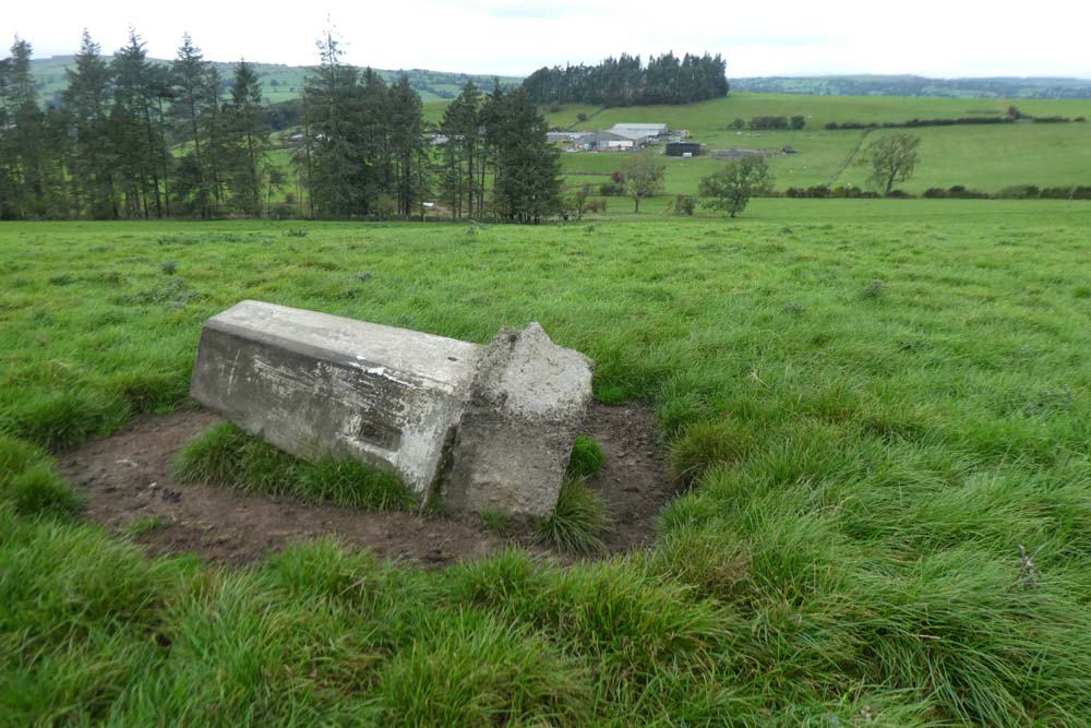
For BC - this one reminded me of the ex-WW2 ammunition dumps we found north of Dolphinholme:
http://conradwalks.blogspot.com/2021/04/east-from-galgate.html


Monday 18 October 2021

Tribute to Murray

Murray Walker has given me inspiration. No, not as an F1 commentator, although that may well be so. When Murray died much was published and his image for me was enhanced further. Murray did his bit during WW2 volunteering in 1942 at the age of 18 for officer training to become a tank commander with the Royal Scots Greys. Murray landed in France the day after D Day and took his Sherman  tank  through the final push into Germany. He was later promoted to admin jobs and left the army in 1947 as a captain. 

I have made several plastic kit models since I  posted in August but my skills seemed to deteriorate after that and I would not want to show those efforts in detail. but I am reasonably satisfied with my latest effort, inspired by Murray and his Sherman Easy Eight tank. These came from USA when the Americans entered the war and supplied us under the Lend Lease scheme and they were the mainstay tank for the Allied forces from then onwards.

WORTH CLICKING PHOTOS TO ENLARGE (I THINK)

Invasion of Arnside


Murray with a Sherman at Bovington Tank Museum courtesy of Wikipedia


From the On Line Tank Museum  - CLICK TO VIEW

The M4 Sherman (named after the famous American Civil War general William T. Sherman) is one of the few really iconic fighting vehicles of the Allies during World War Two, and one of the most famous tanks in history. But while this historic status was gained partly thanks to its intrinsic qualities, but also due to the sheer numbers in which they were provided, only surpassed by the Soviet Union’s T-34, with a staggering 50,000 total delivered. It remains by far the most widely used tank on the Allied side during the war. It was derived into countless derivatives and had a very long postwar career which lasted well into the Cold War. It has been largely compared to the T-34, and had the occasion to confront some during the Korean War.

Thursday 14 October 2021

OS footpaths

I mistakenly identified the "path" on my last walk as a path but it turns out to be a parish boundary. No wonder I had a hard time over that rough moorland.

Thanks to Bowland Climber for putting me right. I was aware of the similarity but perhaps had a bout of wishful thinking.

From OS 1:25 legend:


Wednesday 13 October 2021

Trigs OS Sheet 103 - Waddington Fell plus 3

 Tuesday 12th October 2021

Dockber               SD 789 467   152m

Mason House        SD 692 436   139m

Spire                     SD 579 466   476m

Waddington Fell   SD 714 474   395 (396)m 

These four trigs seemed to emphasise and bring into focus the huge width of the Ribble Valley along with the great expanses of wild moorland to the north-west and south-east of Clitheroe. This is not so apparent when you drive through the more urbanised road routes in the valley.

The first two trigs lay only a few minutes walk from the car. The final two I had intended as a linear there and back but that plan changed.

For Dockber I parked in an unpleasant lay-by, apparently part of the old road with access at both ends but sheltered by trees from the busy A59. I reckoned it was just the sort of place you might find a body. The trig was only about two hundred yards from the road but access barred by a substantial hedge. A few perilous hundred yards down the verge as cars whizzed past in excess of 80mph road lead to  a public footpath. As I approached, watched with much curiosity by a large herd of sheep, I thought I should be able to see the trig. It was only when I was within ten yards with GPS telling me I was all but on the spot I saw the trig lying unhappily on its side. I wonder why? As I walked back I could see the expanse of the Ribble valley below.

Mason House was reached through a gate on the minor road near Bashall Eaves. I'm not sure if the little field was private but it seemed to be tended as spot to sit on a remembrance bench and muse. The trig was within two feet on the other side of a barbed wire fence but I was able to make human contact. The backdrop  was provided by one of BC's oft mentioned hills.

A short drive took me to Spire and my intended linear there and back to Waddington Fell. Spire trig was visible at thirty yards from the car. A few hundred yards further on a curious house named Spire on the map nestles in trees. It has an unusual sort of triple chimney construction. I have done an Internet search but found nothing.

The map shows a path all the way to Waddington Fell but not designated as a public footpath. The going was horrendous. Reeds, tussock grass, bogs, and at one point I took about twenty minutes to get through fifty yards of chest high dead bracken downhill.  To start with I was following a walled field boundary but then off into wild moorland with only the occasional faint trace of a trod. The going was heavy. A barbed wire fence was straddled after twisting the barbs back under the plain wire. A wall, part tumbled down was surmounted with difficulty and ingenuity by using my extended walking pole to push the barbed wire away from the wall so I could get down in between. I then realised I had left my other pole behind. I spent another five minutes enticing it at arms length with the wire stretching pole until I could hook its loop and recover. I think if I'd had  to get back over that wall I would still be there. This was was one of those days when distance was irrelevant, the overriding factor being the hard going. I watched Sully the other night (landing of the air liner on the Hudson River) and was constantly reminded of the warning issued by the flight simulator saying "terrain,terrain!"

When I arrived at Waddington Fell trig I knew there was no way I was going back the same way.

I had identified a return route to the south involving road walking and footpaths but it was nearly six miles more. I looked good and hard at the map and realised I could return by a shorter route on more amenable tracks and roads to the north, but even that involved a further half hour downhill trek over more pathless moorland before getting onto the easier part. 

The final walk out by the road ended with a dispiriting steep ascent to get back to my starting point. I was well tired. According to Memory Map I had covered only 7.74 miles in 6.4 hours with only a stop of about ten minutes for sandwich and coffee. 'Twas an average speed of 1.16 mph, but with ascent of 1358feet. As I said it's the going that matters, not the distance.

Dockber. I think he'd been on a bender the night before.

Looking down the Ribble valley with extensive moorland hills skirting beyond

On the way to Mason House. For my fellow blogger* and nature photographer extraordinaire "eat your heart out."

Manson House trig situated on the edge of this pleasantly cultivated arbour.

For Bowland Climber - see the arrow. The End is nigh!

Spire trig from the car, and the reverse below


This and Waddington Fell had these Red Rose emblems adorning. Who? Why?

Attempts to remove the mounting bracket. They are more secure in that cast concrete than one would think. Ordnance Survey did it right

The strangely chimneyed Spire House, and below


My route soon left this track and skirted round the left end of the trees with much hard going


That is not a path to the right, just a water course

Walking pole extended and deployed to increase gap between wall and wire

Waddington Fell


Miles of wild moorland in every direction

Ten out of ten for this versus the convoluted and intricate metal constructions that abound and don't work

The final stretch - hard to bear after a tough day

*Beating the Bounds - have a look:   Click to see his blog. 


Saturday 2 October 2021

Trigs 103 x 4 (Wilpshire)

 Doe Hill                               44m       SD 676 381

Parsonage Reservoir S          236m     SD 704 310

Parsonage Reservoir N         236m     SD 701 325

Eden Holme                          83m       SD 661 340


Weather windows have to be seized.

Way back one would not have set off looking at the lashing rain early this morning but our modern forecasts are pretty accurate and clearance was promised followed only by occasional showers. It was still almost dark when I set off at 7:00am to drive south in driving rain. I generally don't much like going south from Arnside but this project to visit all 76  trigs on OS Sheet103 is proving to be interesting and worth the trauma of driving in industrial Lancashire to find the many areas still providing open country and acceptable walking. A shell waterproof had been replaced by my heavier and warmer Paramo jacket awoken from hibernation. 

The very minor road accessing Doe Hill serendipitously provided a large enough gateway for parking within fifty metres of the lane leading to Doe Hill. The rain stopped at exactly the time I switched off the motor.

I met a dog walker with a friendly Labrador who jumped all over me in friendliness and we exchanged a few words . The path leading off the lane was not signed and also hidden by shrubbery. Without the knowledge from its showing on the map it would be easy to miss.

There was an eerie early morning feeling at the trig with the sun trying to break through the lingering  billowing rain clouds, and the hint of the earlier darkness still prevailing.

After my half mile there and back I was able to drive the five miles to start the remaining three trigs on their 10 mile circular walk starting from the car park at Tiggi's restaurant on the A59. The River Ribble causes difficult logistics for travelling north to south in this area but thankfully Ribchester Bridge, one of the few crossing places, was well positioned for me today.

So far this project has provided pleasant walking terrain, interesting features and incidents, and on a couple of occasions good company. Today's walk was more mundane and incident free and although I had an enjoyable day it would go to bottom place if I was giving all on this project a rating.

Parsonage Reservoir South provided the best view of the day. Not far from Tiggis, at Harwood Fold, my way was barred by two farm gates, one padlocked and within a few yards the second comprehensively tied up with, guess what, hairy farmer's string. I had to climb them both.

After leaving the trig my way was again blocked by cows with calves and their minder bull and they were showing some signs of irritation. I dodged over a gate and then had trouble in gateless fields trying to get back on path. I headed for a walled corner.  It looked like a dicey climb but then I spotted a short ladder on the other side which I was able to entice with my walking pole and pull back over. Even then it was with some difficulty I managed to overcome and get back to my route.

I had already had more than an acceptable amount of road walking and now I had a busy section with no walkway to get me back down to Parsonage Reservoir and the ascent to the second trig on this circuit. The trig was inexplicably bounded by a twenty foot square barbed wire fence with a proud notice attached informing me of its renovation by Wilpshire Parish Council. I wonder how much that cost and how many more deserving causes it ranked above in the spending of what I am sure would be limited resources. I doffed the rucksack and squirmed underneath the barbed wire to have the satisfaction of touching.

Now downhill and at the entrance to Wilpshire golf course a bench was well placed and sheltered (again provided by the wealthy Wilpshire Parish Council) where I lunched in great comfort  musing at the Council's success in usurping the use of my portable chair.

More convoluted route finding followed including some crop fields ploughed out to the edges leaving no alternative but gloopy plodding - that is the kind of walking that I just don't enjoy. I at last arrived at the anticlimax of Eden Holme, very low in the league table of all trigs I have visited. I was at the corner of yet another ploughed out crop field, the trig hidden and disheveled in a hedge with no views. My visit only lasted long enough to take the photo. A few more fields and tracks had me back to Tiggis and my car. At just short of ten miles and a bit more than a thousand feet of ascent I was pretty tired - that is about as much as I want to do these days.

"Morning has broken..."

Should be no problem to a retired climber but not so easy these days


Looks like this will soon be a tunnel