For newcomers

At the bottom of each post there is the word "comments". If you click on it you will see comments made by followers, and if you follow the instructions you may also comment and I always welcome that. I have found many people overlook this part of the blog which is often more interesting than the original post!

My blog nick-name is SIR HUGH. I'm not from the aristocracy - my middle name is Hugh which relates to the list of 282 hills in Scotland compiled by Sir Hugh Munro in 1891. I climbed my last one (Sgurr Mor) on 28th June 2009

****************************

Showing posts with label Geocaching. Show all posts

Monday, 1 December 2014

It's who you are with that matters


"I reckon it's getting dark."

My words after finding our sixth geocache of the day at the edge of a secret tarn in the middle of an oh, so remote primeval swamp-forest  unknown to the rest of humanity. I was jesting a little in consideration of it being well into the afternoon and it having taken us five hours to cover only four and a half miles.

My explorer companion was Bowland Climber, a regular commenter here. After we scratched, scraped and squelched our way back through the swamp-forest to more familiar territory, frequently consulting compass and GPS, we did find ourselves, yes in the dark, marching steeply down a Tarmac road overlooking Windermere, but with just enough light for a glorious flame-red sunset high up above the distant hills on the other side of the valley.

BC had not  geocached before, although he is a veteran of more long distance walks here and abroad than most trekking enthusiasts have even heard of. A lot of the terrain was challenging with tussocky swamps, dead bracken, gorse, dense fir forest and difficult route finding, enough to discourage most self proclaimed adherents of the outdoors, but not BC.

I am in my element with such challenges, but if I am with someone who is not game for it my day is ruined. Successive immersions of boots, and desperate fights through forest were greeted by BC with more and more laughter and amusement at our self inflicted discomfort, and a constant stream of interesting and largely amusing conversation was maintained throughout. BC also entered into the spirit of geocaching and I think he found four out of our tally of six.

Much of my walking has been solo, but being with someone of like mind and constant good cheer is a great pleasure.


PLEASE PLEASE CLICK TO ENLARGE

Please also see: BowlandClimber

Windermere below, and distant Old Man of Coniston and Dow Crag

Zoom to Dow Crag


Simpson Ground tarn

Location of one geocache. This was in the middle of a thick forest with no paths within several hundred yards in any direction. We reckon it was built before the trees were planted - it involved a hard fight to get there

Close to the above shelter and what geocachers refer to as "ground zero" for a cache

Science fiction mossy stuff on boulder shown in previous photo


Simpson Ground tarn looking back to location for taking earlier panorama photo

This is the final primeval tarn which, but for its geocache, may never have been previously visited by humans. Note, the reflected tree is growing in the middle of the tarn

Friday, 29 August 2014

Black panthers in Cumbria?

Halfway round my Thursday walk with Pete we are on a roll finding geocaches - I have just found my 300th, but pride comes before...

... I have only been doing this stuff for 60 years and once again I have navigated us onto the wrong footpath.

We are in rocky, wooded limestone country in  Latterbarrow Nature Reserve which is all sheer delight. My shaky interpretation of the OS map tells me there is a  public footpath that will shortcut us back onto our correct route.

We climb steeply on an identifiable path, Pete being thirty yards behind me. As I crest the climb the path ceases abruptly. I am looking ahead and fifty yards away I get a rear view of a large black animal, perhaps a bit bigger than a Great Dane slinking and weaving through the trees - it disappears within about seven seconds (not long enough to deploy the camera of course). The animal is totally deep black and seems to have a sheen more than you would expect on a woolly black sheep.

I tell Pete and we retrace our steps speculating about telling the Westmorland Gazette who regularly publish black cat stories but that is just a joke and the subject is dropped, but a nagging continues in my mind.

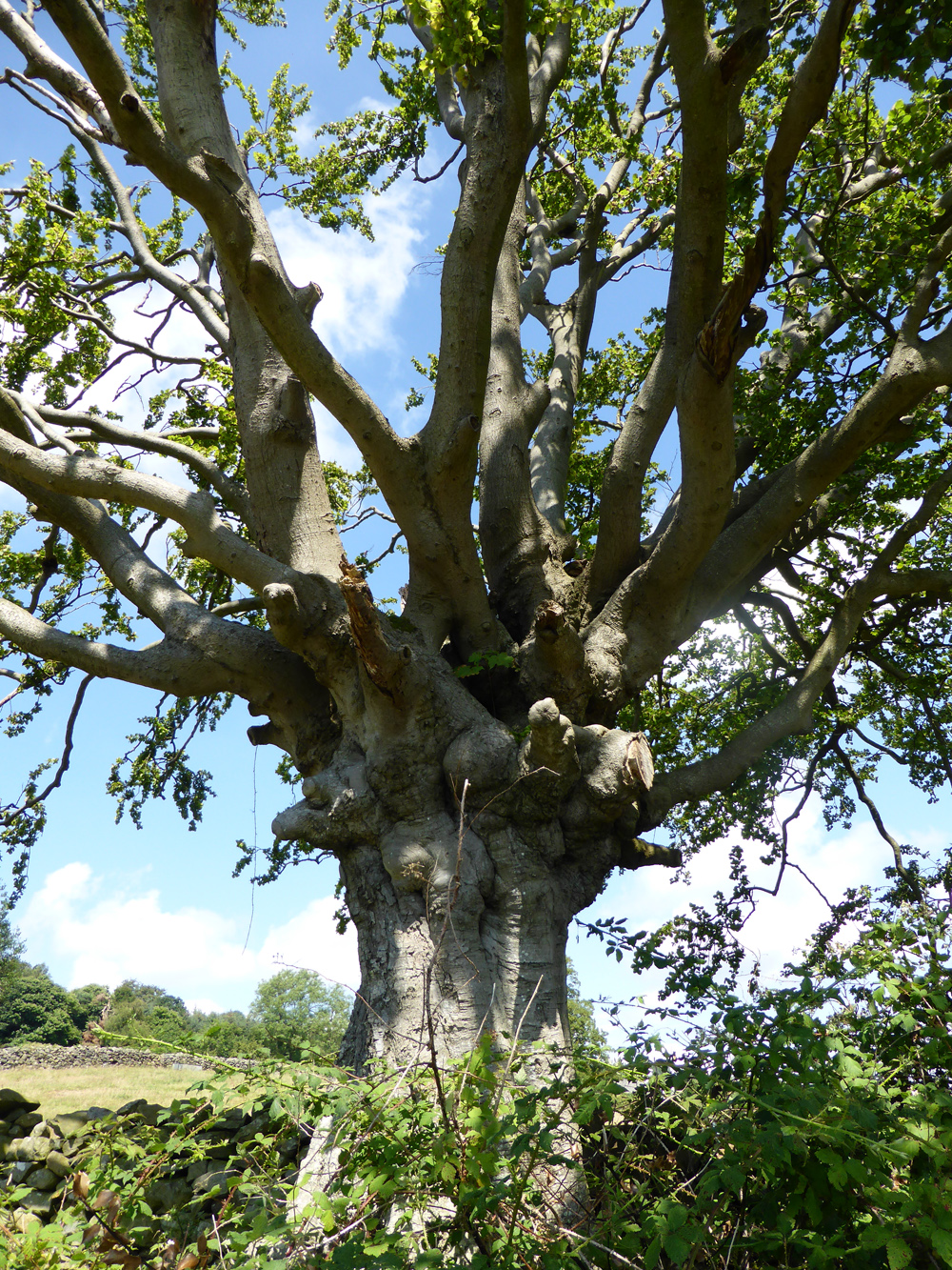
The next geocache is dramatic and soon  grabs our attention when I ascend a magnificent oak tree thinking of England, Bucklers Hard, Trafalgar, and Victory.

The precision of weather forecasting is well demonstrated as rain starts at 1:30 precisely, just as predicted the evening before on North West Tonight

We find another couple of geocaches, have a chat with a farmer, and snap some unusual fungus. In the field of our last geocache the existence of black panthers in Cumbria is now undoubted.

My apprentice returns our first find of the day


Heart of Oak are our ships,
Jolly Tars are our men,
We always are ready: Steady, boys, Steady!
We'll fight and we'll conquer again and again.

Must download a fungus app

A black panther heavily disguised as a rare breed sheep

Saturday, 9 August 2014

Another HAT story

THE HAT has featured here before, see:  THE HAT. The history of that cherished item was interwoven with tales of Pete.

Earlier this year I left THE HAT in a pub at Bentham and it was eventually returned by post. That is another long story, see: THE HAT LOST . The day after losing THE HAT I bought a replacement in Settle.

When I collected Pete for our Thursday walk this week, to add to his rheumatic problems, I found he had brought the car boot lid down on his head and virtually scalped himself, yes, we've all done it haven't we?

Considering the hot sunny day Pete's head needed some protection, and by chance I had the Settle replacement hat in the car so it has now been donated to Pete and I think it suits him well.

THE HAT continues to do good service, but it is getting a bit ragged and daylight can be seen at intervals through the stitching attaching the circular top panel to the body, so I'm not sure how much longer it's going to last.

We had a pleasant geocaching trip around the lanes of Borwick finding only four out of seven but I have long since quelled anxiety about not finding caches, especially when the originators use "left" and "right" instead of compass points in their clues as well as other unsatisfactory or undecipherable hints. It is like doing a bad crossword puzzle - not worth wasting time on.


For my overseas readers.
 A bit of classic dry stone walling. Comes in many variations all over the UK depending on the local stone; that's given me an idea, I may start a collection of pics?

We are now more fortunate in how we draw our domestic water

Pete with the newly acquired hat - ever the optimist

How many times have I snapped Ingleborough? But I can never resist

Hedge bindweed, I think?

Saturday, 19 July 2014

Walking photos

Thursday here again. Pete is ok for modest distance so we had a steady 4.5 mile geocaching trip from Cartmel finding six out of nine.

Following last week's dearth of photos I clicked more often. The weather was hot and sunny, not always the best for photography, but looking at the results was interesting. I know little about the finer points, but I do take all my photos through Photoshop and crop many and also use the enhancement features on most which allow:

1. Darken/lighten highlights (nearly always darken)
2. Lighten/darken shadows
3. Contrast (only used occasionally)

This day I took 13 pics and discarded two and created one new one to compare with the original. I felt no need to make any adjustments under the three above categories, and only cropped the one of the sunlight in the woods slightly, and the final one of Cartmel Priory to illustrate a point. I suppose the camera was having an easy time with default settings working well in perfect light conditions obviating my need to intervene afterwards.

This Panasonic DMC TZ40 is proving to be a good buy rendering realistic colour and impressively detailed and sharp zoom shots, even at 21 x, and with the neat advantage of fitting into an easily accessible, horizontal, velcro fastened pouch attached to my rucksack waist belt. That encourages  opportunistic snapping which is missed when the camera is stowed less conveniently.

CLICK FIRST PIC TO ENLARGE

Route started at the priory going clockwise

In Cartmel Priory grounds - location of our first geocache

Cartmel Priory

In the village - very touristy - lots of people about

Home of the original ubiquitous "sticky toffee pudding" now seen on nearly every pub menu in the country 


The interior of this construction was totally overgrown so no clues to its purpose - anybody any ideas? See the next pic. which details the cement rendered curved wall tops.


Howbarrow, 170m.
 It has a trig point which you can just see.
 The people were a family from Oregon in The States seeing more of our super country than many other visitors from abroad.

Pity about the electric transmission lines across the pic.

I seem to remember visiting here with Gimmer to stock up with veg. at the start of some expedition into the wilds. I think it has now closed down. Too remote even for the more ardent organicists?

This view of Cartmel Priory with Hampsfell in the background has been trashed with the modern building, the hideous portacabin thing and the car park, but below shows what can be achieved with a bit of cropping - what you see in the cropped photo is pleasing, but the real life view can't be avoided


----------------------------------------

UPDATE - The unidentified shrub photo in my last post was Lavatera.
From Wikipedia:
Many Lavatera species have now been transferred to the related genus MalvaLavatera species are known as tree mallows, or rather ambiguously as rose mallowsroyal mallows or annual mallows.

Saturday, 12 July 2014

Is geocaching single minded?

Thursday walks with Pete, who had his 80th on 4th July, are being threatened, but after this week I am more optimistic.

For three months Pete has had pain in hand, knee and foot joints. The g.p. ran tests, and administered an ineffective course of pills, then referred Pete to a consultant - he had to wait six weeks for that appointment. Rheumatoid arthritis was diagnosed. Pete was given a cortisone injection which has given partial relief, and he will see the specialist nurse again in six weeks for further treatment.

So, on Thursday we had a triumphal time finding nine out of ten geocaches. The first batch were around Levens only about seven kms. from home, and then we drove north to find more around the almost too-pretty-to-be-true village of Brigsteer.

Once again we found ourselves on previously untrodden footpaths. At Levens the track at SD 486 872 would be an unlikely place to visit because it doesn’t lead anywhere, but the views to the west towards Whitbarrow and The Lakes are worth a visit.

Pete was surprisingly active, and I think he actually found more of the geocaches than I did, but two of them involved climbing huge old larch trees, although the first one was only a few feet off the ground.

Searching for the second tree cache I left Pete and thrashed off through a landscape of sparse old trees, and brambles underfoot following the g.p.s. The cache was hanging from a branch  over twenty feet up in a cylindrical six inch container and I found my body threaded in an S shape, feet on one branch, body threaded through another at waist height with another branch over my shoulders.


Back on the ground I had lost all sense of direction, and I had been a long time. At first I couldn’t raise Pete by shouting and thought he may have gone off back to the car in a huff, but after taking a compass bearing, and more shouting contact was established and a pleasant walk on good paths took us back to the car and a drive to Café Ambio for tea chocolate brownie and almond tart.

----------------------

I seem to find it impractical to combine geocaching  with a walk that has its own objective - something to do with time constraints, and the male inability to multi-task I think. Despite superior scenery and other possible items of interest, photography, and to some extent conversation are inhibited, so on a day that lent itself to pictures there are only a few. In the words of the old school report "...must try harder."


Levens Church - the location of our first cache is within this photo


Across to Whitbarrow from the cache on the cul-de-sac path mentioned above


All the gardens in Levens and Brigsteer were in "bright array" and their owners out in force snipping, dead heading, and toiling. Pete knows all the latin names and rattled this one off but I can't remember.


Tuesday, 13 May 2014

An objective demoted


"Ospreys seen at new site as pair move in”. (8th May).

So says The Westmorland Gazette.

The location, Foulshaw Moss across the bay from Arnside where I live.

A sighting is a long shot - birds will likely be sitting on eggs, not flying back and forth, but off I go having plotted four geocaches on a ten mile tour including part of The Cumbria Way footpath.

Of course there was no sighting, but the first geocache is a good example of geocaching finding mystery locations. A fifty yard diversion from The Cumbria Way leads to a secret, indented grassy terrace on the edge of the bay neatly by-passed by the official footpath. This mini bay is backed by limestone crags and blooming gorse, a delightful haven. The cache involves climbing moves up the rock adding spice to the adventure.

Another diversion takes me into an old magic wood with no public way beyond making exploration otherwise unlikely. Sunlight dapples through on my left with intermittent glimpses across the bright sands and water of the bay. I find the cache and return rejoining The Cumbria Way.

Caches have finding clues. The next one says "San Andreas". I am on the old road replaced by the A 590. Grass grows and the Tarmac has split into longitudinal fissures. The "cache" is a folded A4 plastic sheet inserted into one of the cracks - you were advised to bring a permanent marker, but no clue why. I find a stick to prize out the plastic feeling like a chimp demonstrating use of tools.

Near the car I search for the final cache. GPS pinpoints rear of the ARMCO barrier where the defunct road joins the A590. I get a shock. There is a huge, malevolent looking adder coiled, ready to strike - it starts to rain - I'm off back to the car at speed - that was a resounding DNF (did not find).

Across the bay to Arnside where I live.
 Arnside Knott, a Marilyn, dominates

The old wood, location of second cache. Water and sand of bay on left

There was a gate behind the mound bringing you round to the right hand end of the crag.
Cumbria Way walkers would most likely file past without finding this attractive spot - good place for a picnic


Time to be off before I become another headline in The Westmorland Gazette

Friday, 24 January 2014

Where to next?

Daughter, High Horse (teacher) keeps suggesting I should incorporate geocaches with my longer walks which sounds ok in theory, but, a week ago I found thirteen out of fourteen on one geocache-dedicated six mile round. That walk would normally take two and half to three hours, but it took five.

So, to find say half a dozen on a long walk day could extend time by a couple of hours. Companion walkers can be another factor if they are not fellow enthusiasts for the game, so one can feel uncomfortable spending a lot of time searching when your companion’s main objective is to get on with the walk.

My strategy for regular Thursday walks with Pete is to plan a route first (that is always down to me), then see if it coincides with any caches, and that is unlikely to amount to more than one or two.

For the last year since we completed the Lancaster Canal we have walked circular, approximately six mile routes almost every Thursday within half an hour’s drive of home without repetition, but it is now becoming increasingly difficult to find fresh ground , especially in this uncommonly wet winter when we try to keep mostly to quiet roads and lanes.

Our walk yesterday managed to find yet another new circle, and one geocache pleasingly situated at the point with best views.


Memory Map on my computer showing Thursday walking routes plotted. Previuosly I deleted them, but recently they are retained to help avoiding repetition


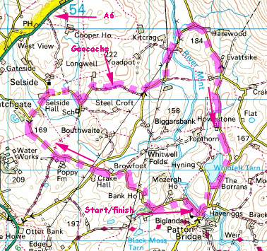
This Thursday's walk, north east of Kendal

River Mint near Patton Bridge


A de-luxe stile (not on our route)


Whinfell Tarn