For newcomers

At the bottom of each post there is the word "comments". If you click on it you will see comments made by followers, and if you follow the instructions you may also comment and I always welcome that. I have found many people overlook this part of the blog which is often more interesting than the original post!

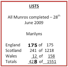
My blog nick-name is SIR HUGH. I'm not from the aristocracy - my middle name is Hugh which relates to the list of 282 hills in Scotland compiled by Sir Hugh Munro in 1891. I climbed my last one (Sgurr Mor) on 28th June 2009

****************************

Tuesday 29 January 2013

Singing in the rain, I'm happy again


Monday. Another Marilyn.

Guess what? Heavy rain is forecast. But I don’t care.

Sun shines as I breakfast, but cloud blanket draws over before I leave at 10:00. I know I will be wet at some stage.

Ten minutes before the summit of the steep ancient lane from High Nibthwaite over to Low Parkamoor I notice the first specks of dark grey on the lighter grey of the Lake District stone under my feet before I start feeling the onset of rain. I branch off the medieval track, where I have pondered on its usage in olden times with donkeys or mules, and climb steeply towards the summit of Top ‘o Selside through heather and snow patches on a faint path. It is only ten minutes to the summit. Wind and rain have now become a gale, and once, partly because I am unbalanced anyway, I am nearly blown over.

As a seasoned summit bagger, wishing to avoid the disaster of missing the true summit ( which once happened on a Munro, necessitating re-climbing later) I notice there are two summits, the first being cairned.

I am enjoying the drama of wild weather because of good clothing, and knowing this is a short walk with the luxury of a car awaiting, rather than erecting a wet tent and enduring prolonged adversity. I battle to the second summit (just in case), and am rewarded by  an agreeable, partly frozen, mini-tarn just below the col, positioned as only nature can manage, and too small to appear on the map. I head down through pathless heather and more snow to the old lane, now an open track, continuing in the original direction, and down to the road where I route march back alongside Lake Coniston, still in penetrating rain, but less wind. I feel fitter and more invigorated than for many a month.

Half a mile from the car, my supposedly waterproof trousers permit ingress down my right thigh, eerily chilly and uncomfortable compared with the warm snugness provided by the rest of my apparel.

There are two contour circles of equal height on the summit, but the spot height of 335m is shown on the the one to the east, whereas the cairn is on the western one

On the ancient track, just before the rain started

Coniston Lake. Dow Crag and The Old Man of Coniston and Weatherlam etc. in the background

The cairned summit - conditions were more dramatic than the picture shows

The perfect tarn just below the two summits

Low Parkamoor here and the next pic. My route descended the valley before it. The old farmhouse is joint privately owned with the National Trust and they hire it as a holiday cottage... if you want.
Here, an extract from their advertising:

"It is eco living all the way with no mains services. The house is served by a traditional Lakeland composting toilet, pure fell water straight from the well, with cooking and hot water provided by the restored Georgian wood-burning range. Living at Parkamoor is a unique experience. It takes care and consideration but the rewards of the simple pleasure of sitting by the fire or cooking on the range make it a treasured experience."
Looking as I tramped by in the wet and the wind I'm not convinced?


Friday 25 January 2013

A BOGOF - Claife Heights plus Lancaster Canal


For some time I have only occasionally walked in the Lake District, having objections to overcrowding, and parking difficulties. Perhaps that’s all a bit of overreaction. 

Having a fresh look, motivated by the Marilyns list, I find there are 55 of these hills in Area 34 which covers The Lakes and a few hills further afield.

On “discovering” the Ms I found I had climbed 32, and have now done two more (Lambrigg Fell, subject of my last post), and on Monday, dare I say it, I ticked off Claife Heights?

Contrary to my petty Lake District prejudices, the village hall car park (£2 voluntary contribution) at Sawrey was empty, and my walk to Claife Heights and back may well have been located in the Antarctic for its dearth of humans.

Well, that now leaves 21 in this area. Scrutiny reveals interesting prospects and mini peaks that would not likely be visited otherwise. I wonder if fellow Marilyn baggers will become ubiquitous? There was one line of footprints in the snow going up to Claife Heights which looked fresh enough to have been made that day.
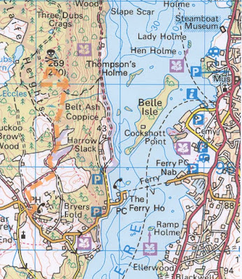

The skull and crossbones is the Memory Map marker I have used to denote Marilyns.I drove up on the minor roads on the western side of Windermere, and returned across the ferry. My last crossing a few years ago cost around £1- On Sunday- £4.30

The views from the ascent of Claife Heights are generally poor

This was the best I could achieve on the summit

______________________________________

Thursday - 24th January


Lancaster Canal - Cabus Nook to Garstang


My journey south down the Lancaster Canal with Pete is now entering more familiar territory for me. I lived in Preston until 1999 and we are now only about 16 miles away. Because of our commitment to undertake walks of around six miles each Thursday we are only making good three miles or so each time south on the canal as we have to return, usually via minor roads and tracks to our car and starting point.

The most notable feature on this section was the great increase in numbers of boats moored canal-side, and also in several large marinas. Connection to the Leeds Liverpool Canal is now possible since the opening of The Ribble Link connecting the canal to the River Ribble, which then has to be crossed to Tarleton, and thereby connecting to the Leeds Liverpool. Researching some of this stuff I gleaned that: 
"...crossing of the River Ribble is not for the faint hearted and a pilot is available at Tarleton". I can well believe that especially in a flat bottomed narrow boat. I was also amused to find that narrow boat owners refer to any other kind of boat on the canal as a "noddy boat".

A bit of noisy trudging through Garstang on our return leg dodging the traffic, until quieter country lanes were reached
This and pic below show a large static caravan park with moorings - there is still ice on the water.


Despite extensive searching on the Internet I couldn't learn anything about this unique bridge near Garstang. The inscription in the centre of the arch reads "FWB - 1927". I would have thought it was a listed or scheduled construction of some note

Another large marina across the canal

More radical architecture!

Aqueduct over the River Wyre


This was a zoom shot right across the canal, and has not been enhanced or enlarged in any way

Looking south-west down the Wyre from the aqueduct
The marina at Garstang - quite an elaborate development here
Taken from where our return route on the road crossed the canal again at Snape Wood. The snow plastered Fair Snape Fell in the Bowland Hills can be seen on the distant horizon


Monday 21 January 2013

Are lists bad?


As I confess to becoming, for the moment, a Marilyns* addict, apprehension looms at the likelihood of repeated accusations of being a single minded, list ticking statistics nerd. 

Browsing found this Internet site: CLICK HERE , and I decided to see how many Marilyns I had climbed. Out of 2016 my tally was 274.

Using a list is a means of  getting me to places I have not previously visited, and these hills, by definition are most likely to be pointy, therefore more likely to offer panoramic views, giving a better than odds-on chance of a worthwhile outing.

I am never going to climb even half of these hills, so I reckon that dispels any accusation of list ticking for its own sake. As far as I know nobody has done them all - private land, Ministry of Defence territory, and remote Scottish islands including difficult, or maybe impossible sea stacs are all obstacles. Anybody who wants to know more may consult Alan Dawson’s excellent book The Relative Hills of Britain.

So, on Sunday by midday, despite potential snow, I put off some very important tasks and headed for my nearest unclimbed Marilyn; coincidentally the lowest  in height is Arnside Knott which is only fifteen minutes walk from my home, and I must have climbed it hundreds of times in the last twelve years. The next nearest is Lambrigg Fell (338m - SD 586 941) very close to the Grayrigg train disaster site of February 2007.

A sparse covering of snow dramatised this short walk, and a small tarn was a bonus. The views from the summit especially to the Howgills were good for the soul, all supporting my Marilyns betting theory. 


*The Marilyns (the 2016 hills in Great Britain with a minimum of 150 metres drop on all sides)


Click to enlarge - the train disaster was on the railway shown of Grayrigg


A few yards from the road at the start


The Howgills from Lambrigg summit


My line of ascent. The road is this side of the trees. The path follows the wall one third distance from righthand end of trees. The railway is in the valley on the far side of the trees. Whinfell Common is the prominent peak at left horizon which overlooks Borrowdale on its far side (see my post Three Miles Too Far? - 19th Dec 2012) 

Zoom to the Howgills -The Calf. The hidden gully/ravine to the left is Carlin Gill which I have climbed in winter. The central one I climbed in summer and had a "bad moment" on some rock near the top whilst my companion, who had taken an easier route looked down and laughed.

The tarn seen from above on the way down


Friday 18 January 2013

Lancaster Canal-Potters Brook to Cabus Nook


The ubiquitous mud was semi frozen - not unpleasant to walk on, and there were long stretches of smooth turf. This section was mostly through open fields providing pleasant enough walking, but not much of note to record, and only about three dog walkers were met with brief greetings exchanged.
I tried to Google the strange name of our finishing point, Cabus Nook, but could find nothing of interest except for a link to a website recording canal walks by a Wigan father and son duo recording their various canal walks:  CLICK HERE.

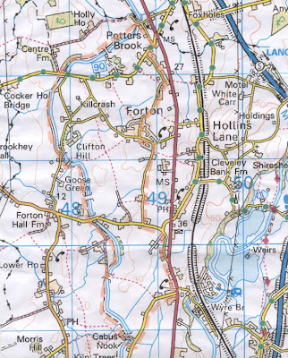
This map looks almost 3D - it was scanned from the somewhat crumpled printout I took on the walk

One for my "Relics" folder - even if it was restorable I reckon the quality of the original construction wouldn't be worth the effort

We had a chat with the skipper - unfortunately it was on the other side, otherwise we might have cadged a brew. He had done all the restoration himself, said it was a dog when he bought it - very proud

Most of the canal was frozen, and quite thick with it - on the last picture a channel can be seen where a boat had ploughed through - the owner of the boat in that picture told us it was against canal rules to motor through ice

A large and attractive canal side house - it was much bigger than the photo shows

An abnormally  acute left hand bend here reminded me of a James Stewart (and other notables) film I saw when I reckon I was about fourteen - the film's date was 1952. My memory recalls the title "Where the River Bends", and I found it under that via Google, but other info, and this poster say otherwise.
I have no doubt my film buff brother (RR), who has a phenomenal memory will be able to comment. We very likely saw the film together - he will probably remember  which of the thirty or so suburban cinemas  around Bradford  at that time we viewed it in


The distant Bowland hills. The walk in my last post toured at the base of those hills

Tuesday 15 January 2013

Tech comes to Bowland


Abbeystead, starting point for this walk, was the scene of a dreadful explosion in an underground building at the waterworks in 1984 killing 16 of a visiting party of 44.

Although I lived only a few miles away in Preston, and then in Arnside, I have always had an irrational feeling I would somehow be intruding if I went there - the same applies to Lockerbie. However, now browsing the map after the passing of time, I noticed The Wyre Way, a long distance footpath which circumnavigates a bowl of land to the east nestling up to the foot of the Bowland Hills, and I decided to explore on a trip with Tom on Saturday.

The walk is all situated within the Abbeystead Estate which includes Abbeystead House described as a “shooting lodge” when built for the Duke of Sefton in 1886. The estate is now owned by the Duke of Westminster.
Some shooting lodge!
Another notable feature, for nerds only: a few kilometres north-east of our walk, is grid reference SD 6418 5654 close to Whitendale Hanging Stones, and appropriately remote. Somebody with a double degree in goodness-knows-what has calculated this to be the centre of the UK... including the islands!  (Click here), but be warned; this not as simple as you might think.

I have walked over all the summits of these hills in the past, but this valley route gave excellent views from a new perspective, with varied walking, on squelchy fields, Land Rover tracks and Tarmac roads. It would be an idyllic route on a summer’s evening.

-----------------------------------------------------------------------------

                      iPhone and iPad mimi - (FOR TECHIES ONLY).

My iPad mini and iPhone are now loaded with Memory Map OS GB 1:50,000 Complete. 

My only requirements from a gps are to pinpoint myself on the map, and to refer to it as required when navigation is in doubt, so in the interests of battery life I only switch on when needed rather than having it continually recording the route and its attendant statistics.

IPad mini 

In-car use. I navigated (Tom was driving).

GPS signal boots up quickly and remained constant throughout the journey in the car.
Although a conventional sat nav is great when driving alone, navigating with the 1:50,000 OS map as a passenger is a dream: easy to see with instant enlargement or reduction to see greater or magnified areas at the touch of a fingertip, and moving position all the time clear to see.

Backpacking? On this walk it stayed in my rucksack. It's a bit heavy, weighing in at 458g including protective case and charging plug - that is half the weight of my tent!

The camera gives good results, but holding it still is not easy. I still prefer to use a proper camera, and in the past have occasionally remembered to take photos with the iPhone to post on the blog, which can’t be done from the camera in the field (as far as I know). You could decide to use the iPad only and not take a camera thereby saving weight.

Picture viewing is excellent. In the Apple shop I had a demo looking at the same photos on an iPad with Retina Display versus the iPad mini where that facility is not available - I could hardly tell the difference.

You would have the benefit of a backup for your mapping in the event of mobile phone failure. Battery life on the iPad is better than the iPhone. The iPad mapping is much better for forward planning with the ability to see a greater area.

I am not sure how you would carry the iPad on a backpacking trip so that you would have quick and easy access, and after this trip I found the iPhone totally adequate for my needs whilst walking. All in all I think the iPad would be luxury to help with strategic route planning, and valued, as a personal choice for all its other attributes not specifically relevant to walking and navigation.

iPhone

The iPhone is brilliant in the field. The screen is easy to see, even in bright light, and scrolling is perfection compared with the MM 3500, and I reckon the latter will be redundant from now on. The GPS signal picks up quickly and continues even when in a pocket. 

-----------------------------------------------------------------------------------------------------


Centre of UK just visible -small  red spot to north east of the route


The vertical red line is part of the boundary of OS Sheet 102 I have marked on my Memory Map
Clougha Pike and Wards Stone behind foreground hill on right

There are numerous similar markers for the Wyre Way, all with different symbols - we wondered about the significance of the hat on this one - any ideas?

Descending to Tarnbrook - Wards Stone 0n horizon

Tarnbrook Fell - we walked about a hundred metres up this track before we both, simultaneously realised we were off route.

Tarnbrook - an earily isolated hamlet - it seemed like a film set for Tom Jones or The Herries Chronicle

Tarnbrook again

Wolfhole Crag, I think 

Another elaborate Wyre Way marker

Clougha Pike and Wards Stone looking back at the valley bottom we had traversed

Friday 11 January 2013

Memory Map 3500 and the Lancaster Canal


An iPad mini has entered my life.
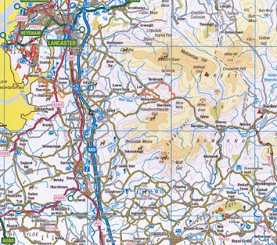
Buying the Memory Map 3500 gps with Great Britain OS 1:50000 maps complete gave me the right to download to three other devices, so GB OS complete is now on the the iPhone and the new iPad mini, including gps tracking and route transfers from the pc. 

The MM 3500 has been back once for replacement, and even now the screen is erratic whenever you touch it, and in your pocket it is so sensitive it jumps from screen to screen with an irritating electronic sound. Although scrolling has improved from the 2500 it is still clunky crying out for WD40. The iPs are hugely superior in scrolling, screen brightness and definition, and they also have an efficient place name finder taking you instantly to anywhere in the country. Comparing the now, almost certainly redundant, MM 3500 to the iPhone is like  comparing Captain Cook’s telescope with the Hubble.

Armed with all this tech it was back to the canal again yesterday with Pete. It was a bit of a mud fest, but as always there was interest and pleasing photo opportunities.

We returned by minor roads and squelchy field paths. At one point Pete had an epiphanic moment as it dawned on him we were arriving at the Bay Horse Inn where he has lunched frequently with Liz over the last couple of years - such can be the novelty of approaching somewhere on foot that you normally approach on wheels.


We omitted the loop from Potters Bar - 'twill be done next time

The River Conder flowing under the canal


Galgate Marina

A path for Jesus across the canal - another for the Signs collection

Glasson Canal meets the Lancaster Canal

Ellel Bridge -  unusually fancy on a private road leading to the big house on the next photo


Ellel Grange - HQ of a Christian based evangelical organisation. I reckon they must be well endowed - 

From their website:
Purchased in 1986, Ellel Grange was the first Ellel Ministries centre to be established and it still remains the International Headquarters of the work. As well as holding Healing Retreats, Training Courses and Ellel's 9-Week Flagship Training Programme. 

Ellel Grange is an Italianate Villa, finished in 1859, in the same style as Queen Victoria's Osbourne House. It is surrounded by large grounds and pleasant wooded areas, with one of the finest collections of trees in the North of England. The Lancaster Canal runs through the estate with lovely walks along its towpath. 

Hay Carr - as far as I could ascertain still a private house, and was on the market in recent times for £4m.

Potters Brook - our furthest south

The Bay Horse Inn - a superior eating place often frequented by Pete and Liz