For newcomers

At the bottom of each post there is the word "comments". If you click on it you will see comments made by followers, and if you follow the instructions you may also comment and I always welcome that. I have found many people overlook this part of the blog which is often more interesting than the original post!

My blog nick-name is SIR HUGH. I'm not from the aristocracy - my middle name is Hugh which relates to the list of 282 hills in Scotland compiled by Sir Hugh Munro in 1891. I climbed my last one (Sgurr Mor) on 28th June 2009

****************************

Sunday 31 March 2019

Back o' t' Fell Road - Lindale

Thursday walk with Pete -   28th March 2019 - Back o' t' Fell Road - Lindale

A brief post mainly for my own record on this pleasant little used road out of Lindale.


CLICK FIRST PHOTO TO SEE OTHERS AS SLIDESHOW


Zoom to Whitbarrow


This area has been constructed as a series of lakes/ponds and not shown on my present OS map - purpose unknown


Curious growth on tree branch. Original photo against light was just silhouette, now lightened in Photoshop. Any identificstion or info welcome.


Every year some particular plant, shrub or tree seems to be favoured - this year it seems to be the blackthorn.


Tuesday 26 March 2019

Three more trig points (OS Sheet 91)

Monday 25th March 2019

Westerhope
Moor                        676 m. NY 923 325
Black Hill.              559m.  NY 913 356
Fendrith Hill.        696m. NY 877 333

Construction of trig points in the 1935 re-triangulation of the UK was a mammoth task never mind the mathematical snd organisational efforts involved in the whole survey. For an excellent history CLICK HERE

My imagination is fired picturing Ordnance Survey guys carting huge loads of heavy materials to 6,500 of the most remote locations in our landscape. Trigs would  usually be on high, often weather was foul and clothing inferior. Mechanical assistance was minimal.

Thanks to those guys I now have an abundance of target venues which are guaranteed by their purpose to give me the optimum view from anywhere in the UK whilst providing a satisfying bonus objective. 

Today's walk had added nostalgia. Wherever I go these days I seem to coincide with previous  escapades. In August 2017 I resumed my Berwick-upon-Tweed to Castle Cary walk from Westgate where I had finished with a broken arm the previous April. From my parking today at Swinhope Head I drove for home down the steep five kilometre one track road to Westgate and found it difficult to remember the toil I must have had on that hot August day twenty months ago. Today it was similarly sunny, but only four degrees with a biting wind.

Rough terrain with only intermittent sheep trod paths made for hard going, and at  nine miles plus, with lots of ascent and descent, this was a demanding day for me, but rewards of all-round expanses of wild country, much previously trodden, and the more localised memories made for a good day out.

Just off the road from Swinhope Head. The first summit is a long way beyond the horizon here, and the visible track soon petered out

I would return to this point from my first summit to set off on the diversion to Black Hill 

Looking back on my route from the previous photo. My eventual summit number three can be seen on the horizon just beyond the end of the fence line

First sight of Westerhope Moor (number one). There was ice on the pond
Westerhope Moor trig (number one)
Black Hill trig (number two)
A stop at the car for a snack and coffee before ascending Fendrith Hill (number three). Again the summit is a long way back from that seen in the photo.


Fendrith Hill trig. Cow Green reservoir in the distance

The green line is my Berwick/Castle Cary route. The red line is my approximate Land's End John 'o Groats route. My Memory Map on the computer is scattered with many previous walks and some day-dreams. Thr purple is a national park boundary I think.

Friday 22 March 2019

Endmoor and Gatebeck

Thursday walk with Pete - 21st. March 2019 - Endmoor and Gatebeck

After my relatively productive two mile walk the other day I have again found material for an interesting post from  a short walk. 

In the mid nineties I built two boats.  I'd enjoyed the building more than the sailing and they were both later sold. I would have taken on another project if my move to Arnside in 2000 had given me the space.  I did post (with photos) about those activities a while ago:

http://conradwalks.blogspot.com/search?q=boat+building

Shortly after starting this walk with Pete I saw a sign at Gatebeck for Fyne Boat Kits, and was surprised that I had not come across this place before. Fyne supply a big range of kits for small boats ranging from canoes and kayaks to larger sailing boats. For anybody interested HERE is a link to their website.

After Gatebeck the road climbed quite steeply in places all the way to our terminus at the Kirkby Lonsdale/Sedbergh road. Daffodils were everywhere in varying states of bloom.

Pete needs flatter terrain than this but he has been going well recently and he was fine with this steady climb and the welcome downhill all the way back.

There are thousands of properties dating back to the 17th Century and further in this area and they probably outnumber more modern dwellings and we tend to walk past and take them for granted.  There is often a date plaque above the door and I took a photo of one proclaiming 1744. That had me wondering what was happening that year and Wikipedia had many tidbits, the more interesting ones for me are shown below -  my Reader's Digest version of Wiki:


-----------------------------------------------------------------------

So 1744 was almost unbelievably as newsworthy as 2019 (so far), after all it isn't often that someone has declared war against us. 

Shortly after the M6 underpass we were on the tops with fine views all round.

I spied a tractor related machine for our enthusiast Alan R. It may be too far removed from his specific subject of agricultural tractors, but I have hopes. It was a weird contraption designed with no eye for beauty, more as though it had been cobbled together from bits of various other machines for some unidentifiable multi-function purpose, which, judging by the look of it had failed - we will see.

Further on another ancient farm building had a plaque for 1736, but we will save perusal of happenings that year for the moment.

Back at Café Ambio I think Pete was more than usual ready for his refreshing cuppa and an Ambio sized portion of carrot cake - I usually have their own flapjack which is like something from Shackleton's survival rations, but none the worse for that.


See plaque below


An unusual manipulation of this stream presumably for the farmer's benefit, most likely preventing an area of bog in the field?

Looking back to the M6 which we had passed under further back. We were now out on the tops getting fine views to the Shap fells and the Lake District.

My prize for the ugliest tractor. The inscription reads 646C

30 x zoom

The plaque below was on the adjoining building but I reckon it is relevant to this one


Our destination reached. The Kirkby Lonsdale/Sedbergh road - well done Pete


Wednesday 20 March 2019

"You hurry to a spot that's just a dot on the map..."

Tuesday 19th March 2019 - north of Ings

I read maps like some people read books (I do read books as well).

This morning, after looking at the news on my computer, then catching up with blogs I  turned to Memory Map. With Pete I have walked in the area shown on the map below and noticed a little hill with rocky outcrops above the highest point on the road, but being restricted to tarmac with Pete I didn't have a chance to explore further and have always intended to go back. When I studied the map this morning I noticed a large unnamed tarn, actually a reservoir. It lay in a bowl on the other side of my little hill and there was no public footpath for a large area surrounding it and I reckoned it must be hidden from view from any public right of way.

Interesting.

A secret.

Must "hurry to the spot..."

From the hectic A 591 the contrast was sudden as I drove up the narrow gated road from Ings to find a parking spot. That is not easy with my Kia which is the best car I have ever had in all respects, except for its tendency to get stuck on anything other than metalled road - I have already had Green Flag out when Kia sank to halfway up its wheels on relatively benign grass only three feet off the road.

An easy-walking cropped turf path lead after a few hundred yards into a friendly wood with shafts of light slicing between the trees illuminating abundant bright green moss.  I guess this is going to be bluebell heaven come the season.

At Yews farm I came upon a travelling farrier (sounds like an English folk song) who was shoeing a majestic shire horse in the farmyard. There were billows of smoke rising from this operation, but the horse seemed so relaxed and patient.  I am wary of horses and have always thought it would be unfair on a horse for me to ride carrying my weight, but this big fella looked as though he could carry a whole rugby team without much effort.

Pleasant road walking took me past a smaller pretty tarn with two distant swans with several cygnets decorating the scene, and then I was at the high point on the road below the craggy hill. I was concerned when I saw a car parked with its occupant moving things from the boot. My little hill is not on access land and I feared I may have a problem. I saw this chap was equipped for fishing and we had a good chat. He was off to my secret reservoir, but skirting round my hill rather than going over the top, and my intentions for trespass were of no consequence to him. The reservoir is stocked with rainbow trout and rights are leased by Windermere and District Angling Club. This guy was as immersed in his passion for angling as I am for mine with walking. He told me his new year's resolution had been to go fishing at least twice a week for the year, and I asked if he was on target and he replied in the affirmative, so off we both went on our different ways chasing our differing aspirations.

I enjoyed the exercise from the steep climb onto my summit from where I had a grand view of my reservoir and the surrounding unique edge-of-the-Lake District countryside including the smaller tarn I had seen on the way.

A short downhill stretch on the road brought me  back to the car. This modest 1.9 mile circuit, albeit with a lot of steep uphill, gave me more pleasure than many longer and more significant outings.

Will have to go back here when the bluebells are out

My kind of horse

The first tarn with swans and cygnets

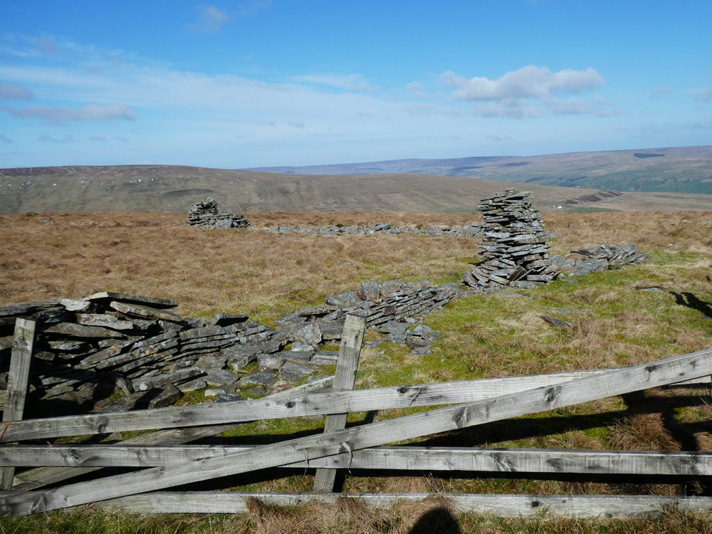
My little hill from where I met the angler. The summit is further back

My secret reservoir from the top of the little hill - I was slightly disappointed when I realised it was not a natural tarn (but only very slightly)

Looking back at the first tarn and up towards The Lakes proper

Looking back at my hill after I had descended


Monday 18 March 2019

Knott and Maulds Meaburn Moor

Sunday 17th March 2019
Knott (Gt. Asby)               NY 647 092 - 412m
Meals Meaburn Moor     NY 639 152 - 292m

Over the years I have dallied with Ordnance Survey triangulation points. For readers from abroad these are concrete pillars used by our mapping quango to mount surveying equipment enabling mapping of the whole of the UK - there are 6,500 of them, so for me this is a good list because the number means I have no likelihood of completing them all and can just cherry pick and avoid the stress of compulsive list ticking.

OS maps are divided into numbered sheets. In the past I have visited all the trigs on Sheet 97 (Kendal and Morecambe) and Sheet 98 (Wensleydale and Upper Wharfedale) - there are usually forty or fifty on each map sheet.

Some years ago I had made a start on Sheet 91 (Appleby-in-Westmorland) and visited 16 of the 48. I have for the moment resumed this campaign and visited two more yesterday bringing my total to 18.

Trigs have to be in a prominent position to enable a view of two more trigs to measure the angles of elevation and horizontal plane for completion of each triangle. The majority are therefore situated on high points but there are also many on  low lying terrain, often only a short distance from a road, so it can be feasible to visit several trigs in one outing.

If you want to know more THIS SITE is worth s visit.

This resumption was conceived on a whim as I breakfasted and looked out at a tempting weather window. I had other things to do but I reckoned I could be there and back in time for at least some of my chores.

This was all glorious limestone hill country as good as it gets and it was invigorating to get back amongst some hills after much recent rural country walking. Knott was only a short climb and I decided to  put off my chores and drive the few miles north of Orton to bag the second one which was only a short walk from the road. That gave me a little bonus.  Ordnance Survey, having finished using trig points offered members of the public the opportunity to "adopt a trig" - that has since been discontinued, and I have only seen one or two of these, but Maulds Meaburn was one such. The adopter was one William Dodds - "On the occasion of his retirement - May 1994." Despite time Internet searching I could glean nothing about William.  If anybody knows more I would be interested to hear.

After allowing my  Panasonic TZ100 to ingest mud I made an insurance claim and then bought a new TZ80 which only has the smaller sensor but with the advantages of a 30 x zoom and a proper viewfinder. Today was my first chance to give this a try so I took many photos.


WORTH CLICKING FIRST PHOTO TO SEE SLIDESHOW FULL SCREEN


Just off from the road - we have had much rain recently. Knott is the obvious hill - the trig is quite a long way back from a cairn that can be seen from this location


Lime kiln. There are many in these limestone dales

Typical limestone escarpment
This and below - zooms into the northern end of The Howgills


Knott summit and trig

Just a few yards from  Knott trig - perfection


================================================


On the way to Maulds Meaburn trig, only a couple of hundred yards from the road


East from Maulds Meaburn trig - northern pennines in the distance

"This trig pillar was adopted by William Dodds on the occasion of his retirement - May 1994"