For newcomers

At the bottom of each post there is the word "comments". If you click on it you will see comments made by followers, and if you follow the instructions you may also comment and I always welcome that. I have found many people overlook this part of the blog which is often more interesting than the original post!

My blog nick-name is SIR HUGH. I'm not from the aristocracy - my middle name is Hugh which relates to the list of 282 hills in Scotland compiled by Sir Hugh Munro in 1891. I climbed my last one (Sgurr Mor) on 28th June 2009

****************************

Wednesday 29 January 2020

Following the coast (2)


Monday 27th January 2020 - Heysham to Potts Corner (SD 413 572)

Family commitment had me driving son W to work in Morecambe for 8:30 am then calling in Carnforth to have new tyres fitted, and then to Milnthorpe for two shopping chores, and so back home for 11:00 am. I decided to fill in more of my un-walked sections of England's coast. That meant driving back to Morecambe and then further south to Heysham to start walking at 11:45 am.

Double yellow lines prevail in Heysham; they compensate by having a carpark the size of two football fields where I parked (ten hours for £1.40.) That is reasonable compared with parking in the Lake District where you could pay up to £16 or more if you were using the two car method for a linear walk. I was the only car parked on that huge space.

St. Peter's Church stands well above the sea with  extensive views from the large graveyard across Morecambe Bay to Warton Crag, Arnside Knott and Humphrey Head. Wikipedia tells me there has been a church there from the 7th or 8th century, and the proud, isolated, windswept location gave me a palpable impression, more than usual, of antiquity and mediaeval doings.

Higher above the church on another promontory the remains of St. Patrick's Chapel also look out over the bay. Here there are stone coffins cut into the rock . The adjacent notice ponders on their use as archaeologists are wont to do. It amuses me when they unearth a minute piece of pottery and inform us that this was part of a huge fancy shaped vessel, and then go on to hypothesise that it belonged to someone of "high status" followed by even more speculation that a bakery existed on the site based on the finding of single seed of wheat. They then unequivocally date a piece of pot because it has a ziz-zag pattern "...that wasn't used until the 8th century..." Well who's to say that some rebel potter couldn't have applied such a pattern before that date?

As I trudged back I started slipping on the muddy downhill path in that fashion where to avoid falling one has to keep going, but faster, until firmer ground is reached - thereby this walk might have ended. Onlookers approaching showed concern - I know I am aged but I don't feel it, but encounters like this make me realise how others see me, presumably as another of the increasing number of pensioners trying to relive their youth.

I was now looking at Heysham Power Station. There is no way forward anywhere near the coast.  A long inland diversion by road and Middleton village is unavoidable. Don't be fooled by Money Close Lane marked on the OS 1:25 map - there is no way through. See Ruth Coastal Walker post from October 2016:

CLICK HERE

Ruth is well known to me and her intermittent trek round the coast has now got her into north west Scotland.

As I am not intending to complete or claim a total pure navigation of England's coast I am quite content to include stretches where I have diverged somewhat from that objective on previous walks.

Dreary road walking which has to be done followed - it didn't even have the attraction of new territory because although I have not actually walked this section before I have passed through by car and it is all uninterestingly familiar.

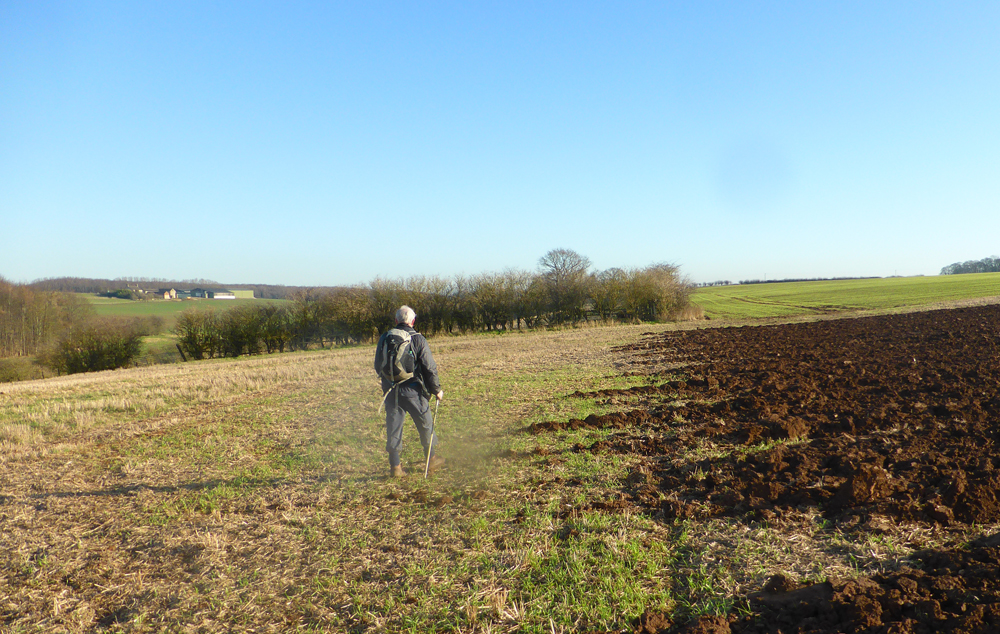
After skirting Middleton a quieter lane leads to the sea and road's end at Potts' Corner as marked on the map. I surveyed the way ahead for when I resume, hopefully on paths more akin to country walking.

I set off back  and was shortly passed by a service bus heading to the road end. I deduced it would have to return soon. I kept a look out. Sure enough it trundled towards me along a straight stretch of road but deigned to stop as I tried to flag it down.

Back at the two football field carpark my sole occupancy had been increased by one - another car had parked close alongside me. Fortunately it was not quite stopping me opening my car door fully. I wonder what goes on in other people's heads? I suppose others may wonder the same about me - ah well, this had been a good eight mile exercise, but not much remarkable as a walk.

As an afterthought I think my post demonstrates that there are at least some things going on inside my head and that makes it difficult to comprehend that there are people out there who have absolutely nothing going on.


St. Peter's Church, Heysham

From the graveyard across Morecambe Bay

St. Patrick's Chapel just above the church


Heysham Power Station blocking the way

Potts' End - more amenable walking when I resume


Monday 20 January 2020

Following the coast (1)

Monday 20th January 2020

I know I will never walk round the whole coast of England (I have already done all of Wales.)

Browsing the map I wondered how much of the England coast I had walked and I plotted the information very approximately onto a map:


That gave me the idea of filling in the blanks, but not as a serious campaign, just as and when, and with the knowledge it will not be completed. There are bits from Carnforth down to the northern Welsh border that I have walked but they are too small to show on the map but there is much I haven't and all that is more or less within driving distance for day walks.

The nearest home is a short bit from Bolton-le-Sands north up to Carnforth so off I went this morning.

The start is on the shore just south of the Bay View café/garden centre which I have often visited with Pete but walked from there in the opposite direction. A stretch of tarmac leads to the shoreline "footpath" marked on the map as The Lancashire Coastal Way. Much of this area is covered by sea when the highest tides prevail and it is a lacework of deep and shallow puddles interspersed with marsh. With great care I was able to keep my feet dry just wearing Gortex trainers until near the end.

As usual I noticed discarded Lucozade bottles every now and then. They seem to be the most frequently repeating litter item. So does that mean Lucozade drinkers are more prone to littering than other humans? Or are they sold in higher numbers than Mac Donald's burgers thus statistically increasing their mathematical chance of higher frequency? With this worrying puzzle I plodded on  wondering where I stood as an ofttimes purchaser of Lucozade and what does that mean when defining my character?

I returned by lanes and then footpaths across more marshland. A new occupation has been growing for a year or two in our area, that is looking after pet dogs while owners are at work. Bordering my lane was a field where a chap was so engaged with about twenty dogs. They all came tearing across the field towards me barking and leaping at the disturbingly low fence and kept up with me for about two hundred yards until I was past the far end of the field. I am sure those dogs could have jumped the fence and presumably as fairly tame pets they were not of the ilk to be totally ferocious but I reckon I wasn't all that far from being torn limb from limb.

 Drama wasn't over yet.

In the next open field there were four horses and a group of six or seven sizeable ponies. As I walked the ponies set off on a parallel course from me but thankfully about fifty yards away. They geared up into a full gallup and when they were about two hundred yards ahead of me they turned and reversed their course again at full gallup and they continued to do this during the whole ten minutes or so it took me to walk across this large field.

I was looking forward to visiting Bay View Café. I drove up there to find new tarmac road leading past a whole newly developed café with three massive glass windows in line and visible inside perhaps more than fifty tables all occupied. The road lead to a massive car park with around a hundred cars parked and no vacancies that I could see, not that I had any intention of stopping after witnessing this monster development from what used to be a cosy little café with friendly staff and home made cakes. I was off back home to a bowl of my own home made soup and malted bloomer toasted and buttered..

Initial tarmac leads to marine marsh shoreline.
My own Arnside Knott is one of those distant hills

The marshlands

The only operative part was the bit of thin green string

It was here that I realised I had previously walked part of this route with BC during our straightline Longridge to Arnside campaign. That time we went over, today I went straight on

Some of the dogs still chasing even though I had now turned at right angles and was walking away from the fence.

Some of the ponies and horses now resting after their galloping alongside me. I was only ten yards from the stile here and at last felt safe to take a photo.

The green route disappearing south-east was our Longridge/Arnside straighline route


Thursday 16 January 2020

OS Grid squares


In my last post I erroneously used the OS grid square TD which was pointed out by BC who I am walking the OS Grid line 38 (SD to TA) with and some exchanges were made on our two posts.

In fact the square TD does not exist. Partly for refreshing my own memory and for others who may have had theirs similarly dimmed here is chart of all the OS squares. It will be seen that our walk goes through SD,SE and TA as I have indicated in red. At least it's less complicated than the Periodic Table. Somebody may make a fortune inventing a new board game based on this? Endless variations including endless combinations of squares to visit may be used for inventing new long walks - oh! don't get me started.


Tuesday 14 January 2020

OS Grid 38 (northing) SD 305 380 to TA 269 379 - Day 12

Sunday 12th January 2020 - Skipwith Common to Froggathorpe (SE 755 373)

Although it was raining when we set off our walk through Skipwith Common was perhaps the best part of this three day trek. Surprisingly this area was the site of a WW2 airfield but it is now scattered with mature birch and Scots pine carpeted with golden bracken and heather  - it is all reminiscent of wonderful Cannock Chase and according to the information board home to a wide variety of wildlife including nightjars.

To the south we could see trails of emission from Drax power station  drifting horizontally in puff ball clouds blown by the strong wind.

North Duffield had a pretty duck pond and a chap with a shed making bespoke woodcraft items to what appeared to be a high standard and we chatted a while.

If Skipwith Common had been the best part so far our next two and a half kilometres of road walking on the A 163 to Bubwith was the worst. There was only a narrow grass verge and a fair amount of traffic but thankfully it was not as intimidating as we had been anticipating.

From Bubwith we were able to follow the disused railway track which was much more attractive than many I have walked on. North West tonight a few evenings ago had an item announcing the improvement to the planned round England coastal path. I have walked on most of the section they described from Morecambe up to Arnside and beyond and apart from one or two short missing  links I see no need to spend lots of money unnecessarily "improving" existing ancient tracks which seemed to be implied. Much better to seek out sections of our country where at the moment there is no alternative but to walk long distances on busy roads and so provide alternatives. This adoption of the railway track is a good example to follow along with negotiating permissive paths with landowners and the like.

We left the railway path at Froggathorpe to pick up our parked car and head back home after a thoroughly enjoyable three days.

Click first photo to see slideshow
This landscape across Skipwith Common gives me a lift. What a transformation from a WW2 airfield

Drax power station - eleven kilometres to the south

North Dufield

Interesting man in his man-shed. Everything was immaculate and in place

Derwent Bridge - Bubwith


Bubwith church - we lunched on a stone bench by the photo below in the grounds of the church

River Derwent

Looking back to our route over Derwent bridge as seen in photo above

Old platforms on what would have been Bubwith station

Pleasant walking, good underfoot on this disused railway


OS Grid 38 (northing) SD 305 380 to TA 269 379 - Day 11

Saturday 11th January 2020 - Church Fenton to Skipwith Common (SE 642 373)


We walked on roads out of Church Fenton to the south of the old RAF airfield - there was no apparent activity although it is still used I think on a civilian basis.

We crossed the main east coast railway by a metal bridge in the middle of nowhere. For the first of two trains we were on top of the bridge and the whole structure shuddered and we thought that we, bridge and all, may have been taken for a ride on top of the train. I managed to get a couple of shots when another train approached from the opposite direction as we descended the steps.

In Cawood we searched for the castle but there was no trace on the patch of common land with its ditches and  long marshy grass. Partly because the crested newt has made its home here this patch of tranquility in the centre of the village has been saved for the community. I reckon we have a lot to thank the newts for in many parts of our country. The River Ouse was crossed by an elaborate swing bridge. Just to the north of here the River Wharfe joins the Ouse. We followed the Ouse eastwards on its northern embankment looking back across to Cawood church with Union Jack flying; was there some special occasion?

We lunched in a bus shelter at Riccall, our last village of the day then crossed the busy A19 to walk down the lane to the start of Skipwith Common and our parked car.

Back at the Owl Hotel we had our second excellent evening meal, this time in the restaurant. The previous evening had been busy with us having to eat in the bar where a thirteen year old  guest singer was performing - her backing track was deafening but her voice was up to it and although not all that much to my taste her performance was impressive.

Click first photo to enlarge all
Church Fenton airfield, and below...


Approaching our crossing of the east coast main line and...

...train one, this and below


And train two, this and below


We found this original gatehouse to the castle after our abortive search for the rest of it on the newt land behind. BC gives more history about this on his post.

The swing bridge over the R. Ouse at Cawood - the R. Wharfe joins the Ouse just to the north in the distance upstream in the photo

Looking back across the Ouse to Cawood church

Just checking to make sure it is right-way up

Walking into Riccall - this pub like many was closed down

I guess this conversion would handle about as well as a dodgy supermarket trolley

My favourite photo of the trip - it is now being used as my desktop background

Riccall church

OS Grid 38 (northing) SD 305 380 to TA 269 379 - Day 10


Friday 10th January 2020 - Barwick-in-Elmet to Church Fenton

Last year  Bowland Climber and I  set out to walk the Ordnance survey northing grid line SD 38 running from Blackpool on the west coast to East Newton (TA 268 379) on the east coast.

After nine day walks using two cars and public transport we finished at Barwick-in-Elmet on 2nd April 2019. Part of our motivation was to ensure we kept walking-fit during the winter months.

We have now resumed with three consecutive days walking and two nights bed and breakfast in the excellent Owl Hotel at Hambleton:    https://www.owlhotelpub.co.uk

The first two days have been very well described by BC and I am sure Day 3 will follow. 


Setting off from home at 6:00am I had a good drive until I hit the Leeds ring road. There must be twenty roundabouts and every one had a quarter mile tailback.  I rendezvoused with BC in Church Fenton about 9:15 later than planned and after driving back to Barwick-in-Elmet I think we were walking by about 9:45.

We were soon following Stone Age dykes but the footpath veered away and we could see on the map we could still follow the dyke for another quarter of a mile. Just before we rejoined the public footpath we were accosted by a young gamekeeper complaining that we had ruined their planned shoot for the next day - well, we had put up one pheasant and we speculated about the possibility of the whole shoot being cancelled on our behalf. There was intermittent gunfire during most of this three day's walk and quite close at times.

We had several sightings of buzzards in the clear blue sky and at one point red kites.

The highlight of the day was the tiny St. Mary's Church  isolated in the middle of a field near the village of Saxton. There had been a medieval village surrounding the church which is now long gone.

The Ramblers' Church

Since being rescued by a group of walkers in 1931, St Mary's has been known as the Ramblers’ Church. The repairs made then are recorded on the back of the church door. The church stands alone in the middle of a field filled with the bumps and furrows of earthworks that indicate the site of a Medieval manor house, for which St Mary’s was probably originally the chapel.

Nearby is Towton, the site of the War of the Roses battle, believed to be bloodiest in English history which brought the Wars of the Roses to an end in 1461. Ten thousand men are said to have been killed, and Cock Beck, the little stream which you cross to get to St Mary’s, is said to have run red with blood. You can find monuments to crusading knights in this tiny 14th-century church.

Despite its awesome history, St Mary’s is a peaceful place. The tiny rectangular building is very simple. It was probably built by the Tyas family, whose massive grave slabs are set into the floor. Carved with heraldic symbols and inscriptions, and dating from the 13th-century, they are an important and interesting collection.
Later additions were made to the church in the 18th-century, with a rustic pulpit, clerk’s pew, reading desk and painted texts.
Thanks for the above from the website of The Crooked Billet pub which we walked past not far from the church - my highlighting.

The church had an unusual three tier pulpit which reminded me of the Monty Python sketch identifying the grades in our class system - perhaps the top one was reserved for the visiting archbishop and the lower ones for his subordinates?

We had much lively conversation wondering about the Battle of Trowton which must have been on a par with battles of WW1 and unbelievably more bloody. Why did anybody want to be king in those days? Nearly all of them came to a violent end after spending the whole of their lives in conflict. Perhaps that comment reflects my twenty six years of retirement and the stresses of daily working life now a distant memory?

More debate surrounded the meaning of the word billet - we were both correct, me with my piece of wood and BC with his soldier's accommodation, but have a look at a good dictionary - there is much more.

What a splendid day's walking after only one decent walk for me from well before Christmas.

WORTH CLICKING FIRST PHOTO TO SEE REST AS SLIDESHOW 


Barwick-in-Elmet Church

Becca Hall - 1783 - many owners - quite interesting history on Wikipedia. Currently owned by Lara Grylls, sister of Bear Grylls.

In Aberford

Aberford Bridge - Grade 2 listed. Late C18.

For my Relics collection


This was a dodgy bridge. The path alongside went uphill whilst the river was flowing downhill!

This and below - red kites


St, Mary's Church close to Saxton and the site of the Battle of Towton


The three tiered pulpit


Church Fenton church, and below


***********************************************************

Granddaughter Katie update.

I gave her watercolour paints for Christmas and this was her first attempt.