For newcomers

At the bottom of each post there is the word "comments". If you click on it you will see comments made by followers, and if you follow the instructions you may also comment and I always welcome that. I have found many people overlook this part of the blog which is often more interesting than the original post!

My blog nick-name is SIR HUGH. I'm not from the aristocracy - my middle name is Hugh which relates to the list of 282 hills in Scotland compiled by Sir Hugh Munro in 1891. I climbed my last one (Sgurr Mor) on 28th June 2009

****************************

Thursday 31 March 2022

Katie's Pencil Case and other stories


Thursday 31st March 2022 - Walk with Pete - Hilderstone (nr. Burton-in-Kendal)

Through Lockdown etc. Thursday walks with Pete were suspended although we did keep in touch by phone. Walks were resumed  a while ago. I have not recorded those walks here because they are mainly short tarmac excursions of up to two miles often on  previously walked routes with no particular noteworthy items or occurrences, the main aim being a get together for two old friends, but today I thought I would update and include a couple of other items.


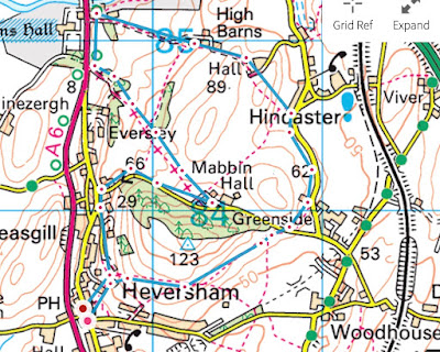
We parked at Cinderbarrow car park where there is a miniature railway with a mock station and a picnic site - I think it only operates at weekends for children's rides. My son W was amused to hear of us using this venue which he says has a reputation for goodness knows what after dark.

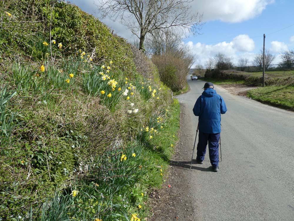
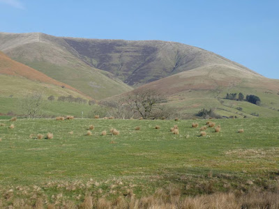
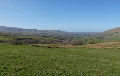
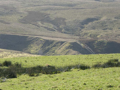
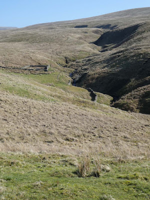
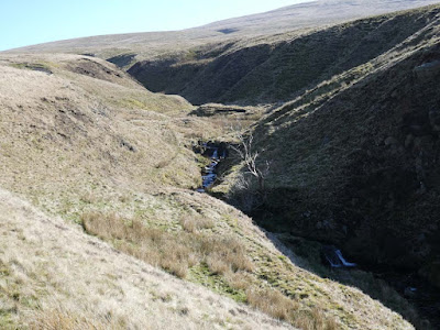
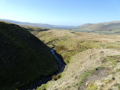
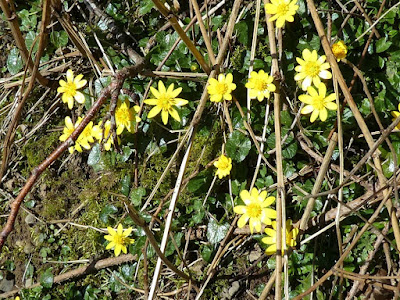
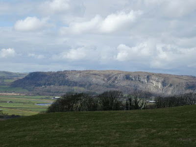
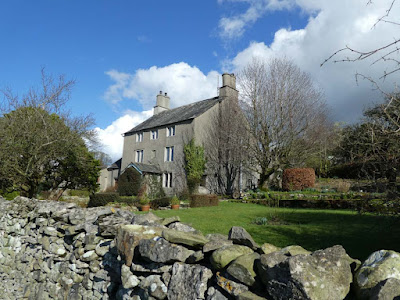
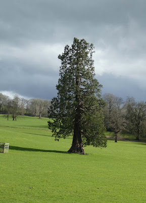
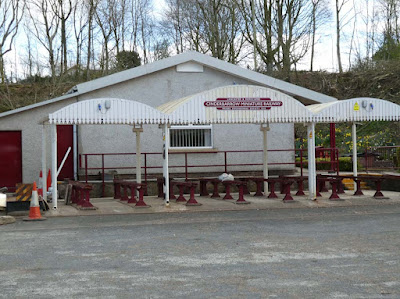
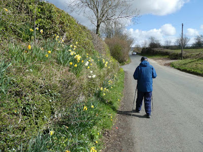
We walked up the adjacent lane in biting cold wind but with a better clarity of air than I have seen for sometime. The roadside spring flower colours were accentuated in the bright sunshine. We had been on this lane years ago but today we had splendid views of Farleton Fell, a limestone hill of note that I have only visited a few times in my twenty odd years living in Arnside - why so I cannot explain.

We passed a simple slate sign (at odds with the surrounding limestone) fronting a small wood informing us that this is the site of a Quaker burial ground - 1670 to 1820. I have seen some of these elsewhere on my travels and today I was motivated to do a bit of Internet browsing - there was nothing about this particular site but the following was gleaned from somebody's post-graduate thesis.  If you want to read more of this academia click on the link. 


"The Book of Discipline is, and was, a ‘definitive statement of beliefs and procedures’ (p. 11). The central tenet of Quaker life is ‘simplicity’. In funereal practices, this meant there was to be no set service and no distinction between rich and poor in grave furniture. Moreover, as all ground was God’s, there was no need to be buried on consecrated ground."

At age 87 Pete gets troublesome watering of the eyes from persistent wind, but fortunately he had is sunglasses today, but after three quarters of an hour we turned to retrace, glad now to have that wind at our back. 

As always we finish up for an hour at Café Ambio at the prestigious newly built livestock market and auction house at Junction 36 on the M6. Today it was quiet with no farmer's auction and we missed the hubbub of their company which for them is as much a social occasion as `a means of buying and selling their stock.

Cinderbarrow miniature railway with its adjacent car park. Recently Blogger refuses to enlarge the first photo when you click but the others do appear enlarged.

Left turn ahead. Spring colours accentuated in the bright sunlight and clear atmosphere


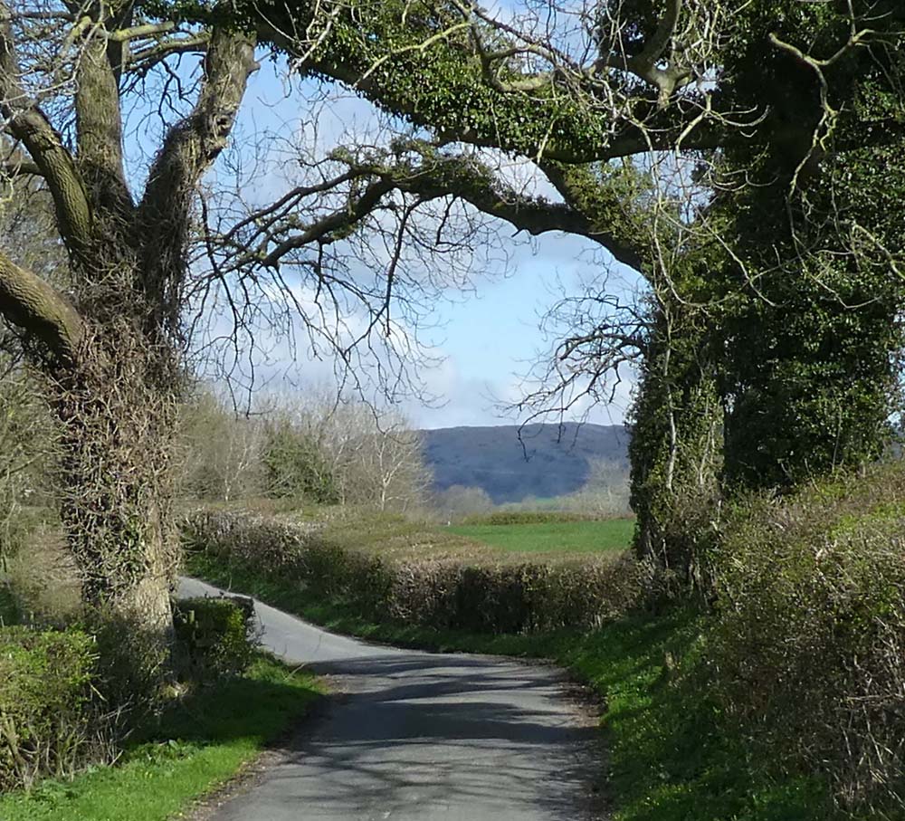
Hilderstone and Farleton Fell

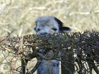
We were intrigued about the shrubs used to plant this new hedge. Perhaps it is a kind of laurel - see close-up below?


********************************************************************

Model update

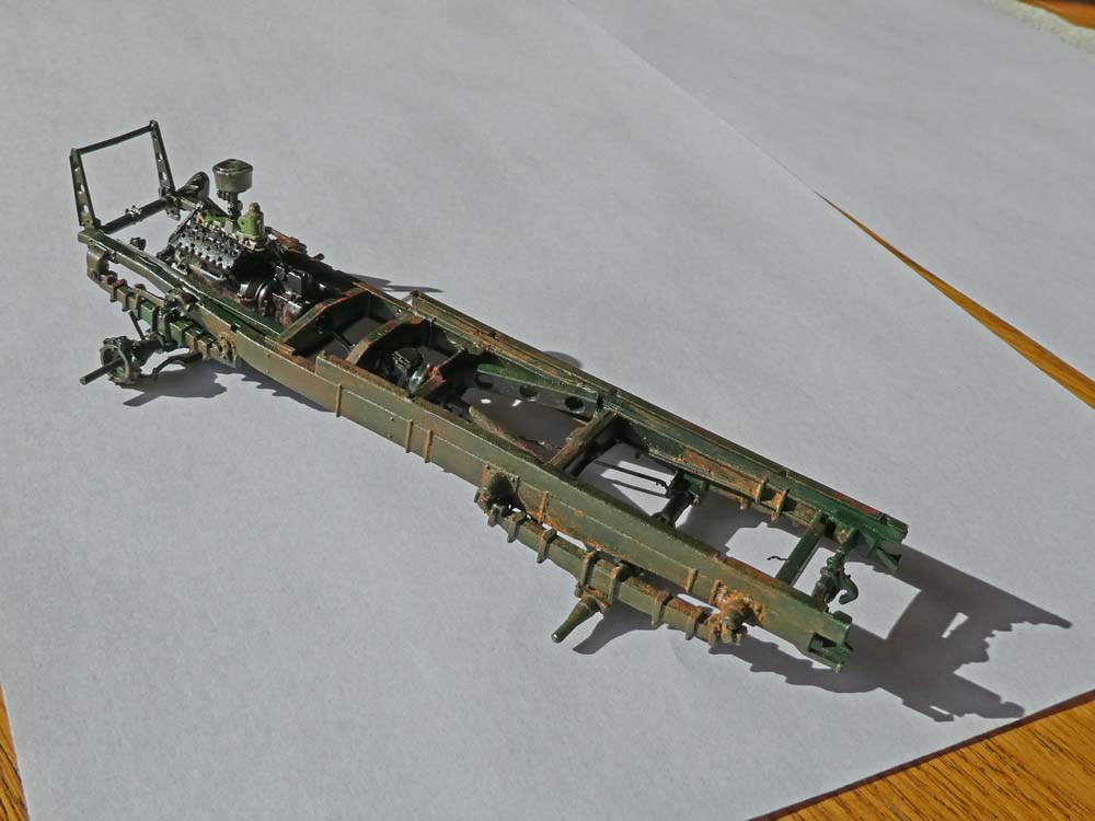
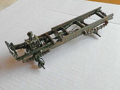
I have just finished the chassis for this:


Here the chassis is just primed and painted with the dark green body colour

Now some rust and weathering has been applied and then a coat of matt varnish. It is better seen if click to enlarge.

This kit is made in the Ukraine. There are about a dozen such manufacturers there mostly with a good reputation for precise moulding and quality. There is a movement in the modelling world to buy our next kits from one of these manufacturers. Even if they can't supply now it could give them a good order book if and when they can return.

*************************************************************************

Katie update

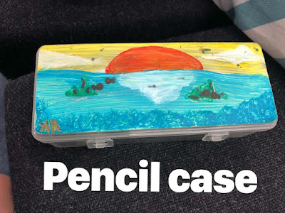
Granddaughter has now got her own phone and we have been communicating via her email address - It had to happen.

I asked if she had painted anything recently and she sent me this. It is her pencil case with a paintable surface stuck on. I asked what was the medium, snd she replied "paint", then as an afterthought "and a couple of pencils for detail."

I then noticed Katie had signed the picture "KR" but the K was wrong way round, so again I queried:

"It’s my art signature that I made up"


Saturday 26 March 2022

Swindale from Keld

Friday 25th March 2022

How welcome to be setting off north again after months of combing the non-industrial parts of Lancashire rewarding as that has been.

Narrow lanes lead from Shap village to the small village of Keld. Tarmac extends for another one and a half kilometres from where one can climb a little and then descend into Swindale on a faint path that is easy to loose all the way to the road and farm at Swindale Head. Keld has a 16th century chapel but I parked beyond that and did not visit. There is a space by the side of the stream for several cars just at the far end of the village.

This visit to Swindale should have been  a great pleasure - this dale being one of my favourite Lake District venues and much of the day was just that but also marred by some frustration. 

As I arrived at tarmac's end and Tailbert farm I found my newly acquired OS mapping was not showing  on my iPhone. I spent ages trying to bring back the mapping and the route I had plotted and at one stage hit a button saying "download maps." I think that process may have continued unabated until I arrived at Swindale Head. Fortunately I had been  able to switch to Memory Map which is still on my phone. At Swindale Head I now found the iPhone was on low battery. The OS mapping had worked perfectly on my previous trip a week ago, and my iPhone easily lasts for a day's walk with capacity to spare. I couldn't find out if the maps were still "downloading" so I just deleted the OS app. I plugged in a battery pack I carry and restored some charge. At this point I found that my camera was displaying a blue hue over the photos when in the "P" for Programme mode and again much frustration and time was wasted trying to correct what must be some accidentally selected setting. Eventually I reverted to "Intelligent Auto" where photos were as they should be so that looks like yet another tech problem to solve.  By the time I had climbed out of Swindale up the side of Gowther crag I found my iPhone was again dead. I  had a paper copy of the map but in this featureless landscape  navigation was challenging and I spent a lot of time finding and loosing tracks.  I had intended to return by the path above Wet Sleddale which would have brought me back to Keld avoiding the repeat trek back down the road, but the track I followed was a safer option without having GPS. Paths shown on the OS map in this wilderness are not always discernible on the ground.

I thought I had discovered a seamless system with the OS mapping but I now have my doubts and it looks as though it may need as lot of unravelling if I want to continue using it. On-line response to another queryI had has had me waiting several days for a reply and one that was not satisfactory. The plotting and using of routes is fussy and seems to force one into using attributes that I don't want. I just have better things to do with my life than trying to sort all this and will probably now revert to my clunky but reliable old Memory Map. That is a pity because I think there is the basis for a good system with the OS mapping and others who are more savvy with  tech may find it fine but I am just not that interested in spending time trying to sort it*.

Ready for off at Keld


From hereon blue hue on photos until mode switch later


Zoom to Kidsty Pike

End of tarmac. Path down into Swindale goes from just beyond the farm

Swindale. Pity about the blue but the general setting and ambience of this pick-of-the-bunch Lake District dale still comes through I think


Some years ago this elaborate provision of a fish ladder for Swindale Beck was undertaken  producing a grim scar on the landscape. To some extent that has now been ameliorated. See also photo from on high below the post office van photo.


Down to the fish ladder which has to some extent moulded into the landscape especially as all the surrounding growth has regenerated


* maybe I will when I have calmed down a bit.


Saturday 19 March 2022

East of Sedbergh - Whinny Gill

 Friday 19th March 2022 - Whinny Gill, east of Sedbergh

Only four degrees as I drove to Sedbergh but it became much warmer later on.

This route followed the same paths as my previous post here from a week ago to just beyond Hebblethwaite Hall but then headed further north to follow Whinny Gill eventually morphing into Nor Gill where paths on the OS map mysteriously end at indeterminate points.

At the scattered farm buildings a farmer's wife was busy outside one of the houses on my right and we chatted confirming that this is actually Hebblethwaite Hall, albeit somewhat modest to have the title of a hall.

I pressed on in bright sunshine and cloudless sky with ever improving views of the Howgills  to my left and eventually getting closer to the rim of Whinny Gill. I stood at the top looking down then switching gaze to the higher route above and debated whether to descend to explore the now much narrower gill. There is a sort of romantic notion about the thought of exploring a gill but from experience I know it is not all that entertaining unless you go with that as your prime intention being prepared to wade through the water, but when you are hopping from side to side alternating between slippery rocks and reed beds with unidentifiable gloop below and trying to keep your feet dry it can be tiresome. Whatever, I descended and followed the gill for quite a long way before climbing out onto the tops again. Photography was challenged trying to make sense of the brightly lit fellside and the darkness of the gill's depths.

Where the paths end on the map I traversed rough but relatively easy moorland to pick up the more northerly paths to return to the main road north of my starting point. A few hundred yards down the road a pubic footpath was indicated going through Cross Hall Farm. There was no sign from the road and as so often one feels wary walking through the middle of complex farmyards. The farmer's wife appeared and I politely asked if I was on the path and she curtly said I was. I walked on but was faced with several different gates as I was being followed by Mrs. Farmer whose husband had now appeared. They pointed vaguely in the direction of a couple of gates and then corrected me with some slight indication of irritation. I suggested  a couple of footpath signs would help but the farmer just shrugged. I descended through another gate into their caravan site and had to find a not obvious route round the back of caravans to find a hidden footbridge - the joys of country walking. 

More pleasant field walking had me back at the hall and back out by my outward route to the car.

This guy was watching me from the other side of the road just as I was leaving my parked car.


Howgills

Habberthwaite Hall

This and below, looking back at my route


More of the Howgills - a modest pano. shot with the camera. I used to take several single shots then merge them into a pano. with Photoshop Elements but this is so much easier and efficient

Whinny Gill

I descended into the gill just beyond the sheepfold


All that rock on the left was loose above - I didn't fancy scrambling over all that with the danger of possible rockfall from above


This just after I had climbed back out of the gill. I've Photoshopped so the waterfall is visible at the expense of overexposure in the sunlight.


Looking back at my route up the gill


Sunday 13 March 2022

From Heversham

Saturday 12th March 2022 - 4 mile circuit from Heversham 

There has been much disruption and bad weather recently and I have not walked much during the last three months and have put on weight and lost fitness, so intend to walk more locally on a regular basis. Such walks hardly qualify for a post here but yesterday I drove a little further afield, albeit only about five miles to Heversham. 

I have dithered for ages about my mapping. For years I have had Memory Mp running on Windows 10 which is partitioned on my iMac desktop using Parallels software (Memory Map for Mac has a bad reputation. and therefore avoided by me.) I hate Windows 10 and the whole operation of Memory Map has been clunky especially if I close windows and then re-boot.

I pessimistically anticipated a mammoth struggle installing an alternative. Ages ago I did a trial with Anquet but found it hopelessly user unfriendly. So, on Friday I  bought the Ordnance Survey Premium package for s modest annual £23 for the whole of GB on 1:25 and 1:50. That downloaded seamlessly and similarly onto my iPhone with the app. I still have Memory Map there as well if I want to use it. Today's little four miler was partly to test out the OS mapping and also to explore some paths close to home which, as far as I can remember I haven't walked before. The OS mapping proves to be excellent. I can download  my existing GPX route files, and plot routes altering line thickness, colour and transparency along with many other easy to use attributes with convenient interaction with the app on the iPhone. In my opinion this is a superior product in all departments, especially when we presumably have the continually updated versions of OS mapping.

I parked up close to Heversham church and followed previously walked paths through the churchyard and up the hill skirting the trig on Heversham Head to arrive at the road above Greenside. From then onwards I was on new territory. Both myself snd fellow bloggers have recently noticed yellow paint on the latches of the newly installed swing gates, but I now came across a gate with no suitable latch to daub but it had  the now customary, but inexplicable dash of yellow on its top bar. I didn't climb all the way to the trig, but for others, if they visit here the view is one of the top three in my local area.

Fellow blogger BC has just posted about walking in Yorkshire Dales limestone country, a region with which I have a close affinity, and although not Yorkshire Dales I was in similar terrain with bright green, sheep-cropped pasture dotted with outcrops of whitish limestone combined with the blue of the sky - 'tis all a tonic to the soul.

After a short stretch of country road I was climbing on sheep pasture to pass by Hincaster Hall, a sixteenth century Grade 2 listed farmhouse.  This atmospheric edifice nestles in a mysterious hollow surrounded by gloomy trees awaiting the re-plumage of Spring. I could imagine melodrama - perhaps a prisoner held in upper rooms, or tales of smuggling, or skirmishes between Roundheads and Cavaliers or whatever. Half a mile further on the old farmhouse of High Barns had a contrastingly more congenial setting which I was pleased to capture to my satisfaction in the second of two photos below.

A few hundred yards on a walkway on the A6 gave me the opportunity to photograph and view in more leisurely fashion my favourite local tree. I must have driven past it hundreds of times. 

As I turned off on the track to Mabbin Hall I noticed a plaque never seen before detailing the site of an historic milestone, snd once again there was something new to discover from walking along oft driven roads.

Higher up that sunken lane my way was barred by a huge fallen tree. At first I thought I could get through crawling under the fallen trunk, but having done so found that even larger trunks and foliage made progress impossible. I was able to climb out up the banking and fortunately the tree had demolished part of the barbed wire fencing allowing easy access into the field. I followed on with the lane on my right separated by an endless impenetrable hedge. There is always tension in these circumstances hoping for a gate back into the lane or facing the dread of imprisonment or exit into another field, and so on... Escape only occurred when I reached the end of the lane leading onto the minor road for my descent back to Heversham.

Quite a rewarding local outing.

Heversham church - my path went through and out the back

I know we have discussed this strange new practice and I've already forgotten what conclusions  we came to as to the purpose, but I still wonder who these people are that dream up such schemes. I wonder how much they get paid?

The sun shining on Whitbarrow, another of my favourite limestone venues

Limestone sheep-cropped pasture


Hincaster Hall - all on its own in the middle of nowhere. Food for the imagination

High Barns, and below - a happier location


My favourite tree. It is only about eighty yards off the A6 and I have driven past hundreds of times


I crawled under, only to find...

...this. I climbed out on the left and carried on up the field

Start/finish: Heversham. Anti-clockwise. Map and route plotting courtesy of OS