For newcomers

At the bottom of each post there is the word "comments". If you click on it you will see comments made by followers, and if you follow the instructions you may also comment and I always welcome that. I have found many people overlook this part of the blog which is often more interesting than the original post!

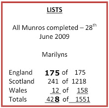
My blog nick-name is SIR HUGH. I'm not from the aristocracy - my middle name is Hugh which relates to the list of 282 hills in Scotland compiled by Sir Hugh Munro in 1891. I climbed my last one (Sgurr Mor) on 28th June 2009

****************************

Monday 31 October 2016

A weekend at Leyburn

Once again, following from last year Martin and Sue Banfield (Phreeruner/Postcard from Timperley) provided a party of sixteen (I think) with a weekend's bed and breakfast at the excellent Eastfield Lodge in Leyburn.

Most of the gathering were veterans of the TGO (The Great outdoors Challenge), an annual backpacking walk across Scotland organised by the TGO magazine - I am sure for those not familiar further details are there on the TGO website.

It would be interesting to count the number of TGO challenges totalled by those present - I reckon some have done more than ten? I wouldn't be surprised if Gayle has a spreadsheet that would provide that information and much more.

I was a bit concerned about giving into persuasion to join up for the next challenge, but I managed to resist - my aged frame is rebelling at crawling in and out of a one man tent and carrying anything more than about 8kg.

We assembled late afternoon on Friday and Martin had provided the most excellent fish pie including generous quantities of scallops, and also superb beef and veggie lasagnes, and we all had a merry evening of lively anecdotes and wide ranging conversation.

On Saturday we had a grand walk covering 13.5 miles according to various bits of tech carried by some who have tired of opening a 1:25 maps in a high wind with the prospect of transforming into a kite-surfer.

There were two highlights. At a campsite we tried to sidle past an unfortunate motorhome driver who was stuck in the mud and attempting to extricate with old sheets of plywood and the like under the wheels. He thought it was his lucky day when he saw a dozen or so able bodied macho walkers arriving, and of course we had to stop and help. Despite lots of conflicting advice, incompetent driving and much pushing we were unable to get the beast back onto the track. The site owner told us all the local tractor folk were away at some auction. We had to march on because carrot cake and tea were waiting at Eastfield Lodge and we had a dinner appointment at Thirteen restaurant that evening.

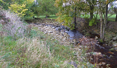
A bit further on we had to cross a stream - Martin lead the way, but crafty Gayle along with me and two others found a bridge a bit higher up, but poor Graham slipped and fell into the stream - well somebody has to do it.

The meal at Thirteen was excellent and acclaimed by all.

On Sunday a reduced party had another nine mile walk getting back to Eastfield Lodge in time to drive home in daylight - it was the weekend for clocks back for BST.

Many many thanks to Martin and Sue for this superb and brilliantly organised weekend.

CLICK PHOTOS TO ENLARGE 

Bolton Castle

Martin studies his tech. As far as I know we were not actually lost at this point

Will it go this way...

...or this way? Unfortunately, "no". We went on our way

The upper falls at Aysgarth

Strange things appeared on our way to the lower falls

Lower falls at Aysgarth

Martin, a  true leader demonstrating by example, leading the way to the river crossing. Unfortunately that was no help to Graham

On the Middleham gallops on Sunday. Leyburn/Middleham are centres for racehorse training establishments

Middleham Castle dating from 1190

Friday 28 October 2016

Bretherdale

Thursday walk with Pete -  27th October '16  

We are only walking about four miles these days as Pete is bothered with his arthritis, but today he was spritely and we almost cantered round this edge of the Lake District circuit. From the outset we had views across to the east and the two lanes of the M6 separated by several hundred yards, and we could see the endless traffic moving up and down like tiny multi-coloured matchboxes on rails.

I often wonder what opportunities I may have for photos of items other than the landscape, which although impressive in this part of the world can be taken for granted, but I know I do have some readers in different countries and hopefully I will be giving them a taste of our unique countryside. However, today did provide one or two more interesting subjects.

At the summit of our western leg we looked up to see the trig point on North Side which I visited with Pete back in January 2009 - to see the blog post  CLICK

From here we looked steeply down into Bretherdale which is a secret and pretty dale, much less known than its southern neighbour Borrowdale which I praised in a recent post.

Back at the the auction mart and its Café Ambio we enjoyed our pot of tea, and flapjack for me, and carrot cake for Pete. A group of four farmers were sat at a nearby table having jolly and apparently amusing loud conversation, but despite my familiarity with the local dialect I couldn't understand a word.
WORTH CLICKING TO ENLARGE
The distant separated lanes of the M6


My camera will do panoramas but here I took three shots and merged them with Photoshop. Click to enlarge.
Pete gives some indication of the prevailing wind and cold

I like the way the old farm buildings were nestled into the landscape

Zoom to Shap Wells Hotel near the M6

Yes, I know it's not a tractor, but I thought it may be a bit more challenging for Alan R.

Don't send your old bedstead to the dump, pack it off to Bretherdale for recycling

Typical of little used farm buildings that abound in this area

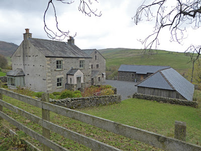
There is a cluster of houses at Bretherdale Head which hark back to "The Old Days."
Perhaps this is spoiled by the two more modern gas cartridge lamps.


Bretherdale Hall. On the market for £865,000 comprising two holiday cottage lets with an approximate  annual income of  £74,000 (so the estate agent's blurb says). It looked a bit gloomy we thought, but the internal photos look better.


Anti-clockwise. Start finish at road junction, south-east corner

Wednesday 26 October 2016

Playing and watching


As a youngster I remember "playing out' with others from the neighbourhood, often on the flat roof of a motor garage built into the hillside with drops of twenty feet or so on three sides, with access possible from the rear which was level with the sloping terrain. Here we would ride, un-helmeted on ramshackle secondhand bikes and play games of our own devising, often to the annoyance of adult residents. Later we went further, down into the woods, unaccompanied. Cuts and bruises were common but visits to the doctor were a last resort, I think you still had to pay- the NHS didn't arrive until 1948. Of course this was just after the war and resources were  limited.

Now we have "adventure" playgrounds in every village, designed' by experts with university degrees, with soft surfaces, and helmets almost obligatory, but for more special treats a series of more sophisticated venues have sprung up for children. These have arisen partly from the increasing financial difficulties of farmers, pressurising them into finding more lucrative ways of making a return from their land.

Last weekend we took granddaughter Katie (fifth birthday) to The Ice Cream Farm south-east of Chester. Here investment in the purpose built adventure play park must have cost more then a million pounds.

Much thought and invention has gone into creating a series of costly well constructed activities. One building with a floor area of quarter of a football field houses a bizarre collection of water handling machinery (German manufacture) with windy handles, pumps, sluices, troughs, channels, scoops and the like. Children bring a change of clothes and then go ape with water splashing, tumbling and gurgling everywhere. There are seats for adults to sit and read their books (or play with their mobile phones).

Another attraction features a mock-up of a wild west gold panning site with water running through wooden troughs where the children (and the adults) get a metal tray/sieve to dredge sand from the stream bed which is panned off to reveal randomly placed mini jewels which the kids are allowed to keep, up to a full small bag which is supplied; the collection of jewels Katie obtained provided the background for many of her endless imaginary games during the rest of the weekend.

There are three proper JCB excavators which the children can operate solo scooping up, swinging, and dumping piles of gravel. That is very popular and you can pre-book your slot to avoid wearisome queuing.

Another purpose built shop the size of a mini supermarket displays and sells over forty different flavours of ice cream.

There are many other activities. Children can easily be occupied for a whole day - have a look at the website: CLICK


The array of ice creams in the background is less than half of the total counter

Panning for jewels - Mum just as enthralled as Katie

We went to the farm on Friday staying on a nearby site with my caravan. On Saturday we circumnavigated the walls of Chester...

...and on Sunday we went to Beeston Castle (cold and windy, but good fun). Katie tries out her skills as a medieval archer

***********************************

I watch a lot of documentaries on TV and I know I have mentioned this before, but I am becoming almost frenzied at the obtrusive background music, but more and more often, foreground music that accompanies them. 

I recently switched one off that otherwise would have been an informative experience.

Last night saw the second of a series about the human face, which apart from the music had long periods where we learnt nothing at all with frequent repetition of what had been said before, and only occasional references to factual recognised research. I again switched to something else.

Another gripe concerns astronomical programmes - I never know whether I am looking at proper photos, perhaps from the Hubble, or a computer simulation.  

A few weeks ago I saw a BBC film made about a sheep farming family in the northern Pennines, Addicted to Sheep,  CLICK FOR BBC REVIEW    There was no commentator and no music. The family provided intermittently what I reckon were unscripted comments and conversation. The film makers had obviously spent many hours there over a long period showing the hardships of weather, animals succumbing, lambs being neutered, and many other graphic sights, but at the same time conveying the deep satisfaction of the family derived from this hard encompassing way of life and their pragmatic, but caring regard for their livestock. Even the village school sought to discuss with the children the ethics of rearing stock for food, and other aspects of hill farming life. That was worth the whole of the license fee (if I had to pay it) in one hit.

Las night I watched another excellent documentary on BBC4: A Very British Map: the Ordnance Survey Story. I had seen this before but it merited this second viewing giving insights into the so British development of the Ordnance Survey from the military, combined with all the stuffiness of the Establishment - wonderful. My only gripe here was the the commentator, Lesley Manville pronounced the word "ordnance" as "orda-nunce" throughout - there is no such word as ordanance, and "ordinance" has a different meaning altogether.

Tuesday 18 October 2016

Kinder Scout

Monday 17th October 2016 

My final summit of the 175 English Marilyns

A fitting end to this campaign (but not to climbing further Ms I hope).

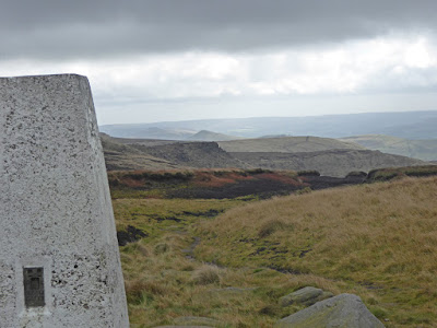
A fitting end because Kinder Scout has one of the frustrating characteristics of many of the summits on this invented list - it is almost indeterminate. The trig point is an obvious focal point which many would be satisfied to claim, but over half a kilometre to the north-west there is ground three metres higher and it must be visited.

After a non-stop power walk (by my standards) from Barber Booth car park via Jacob's Ladder, a now well engineered steep climb, I gained the trig point. The hard walking I am sorry to say was not laudable, it was promoted by a shameful macho demonstration to myself. I had stopped at one point to chat to a guy who was just descending from two nights backpacking over Crowden and Kinder Downfall, and shortly afterwards I saw there was somebody catching me up from behind. I was determined not to let him come past me, and being guilty of one of the deadly sins I was proud that he dropped further and further behind.

The trek to the high point was across rough, tussocky, rocky, boggy ground until I eventually found a small cairn, but this was not located exactly at the spot height of 636m, nor was the OS grid reference given on Hill Bagging's website, which also locates itself on a footpath marked on the map - that path is fifty yards or so to the north. I spent much time stumbling about over tussocks, without the aid of my poles to counteract my aged lack of balance, the poles were tucked under one arm as I held the compass and GPS map on the iPhone in my hands. For several minutes I had a sort of Rum Doodle episode, mistaking north-east for north-west, what a fool! There is no way that I could visually identify the highest point amongst thousands of grassy hummocks and tussocks, but eventually I had the GPS red circle over the exact spot on the map. I looked around and was sure there were others two or three inches higher, and I began to question the sanity of what I was doing.

The start of Jacob's Ladder - it gets steeper than that

More laid path after Jacob's Ladder. The trig point is a few hundred yards beyond the rocks on the skyline with still a bit more climbing to do

Looking down Edale not far from the trig


The small cairn fifty to a hundred yards from the true summit

Although the ground beyond looks higher, I assure you this is the highest point (as far as anyone not possessing theodolite, Abney levels and the like could tell)

Looking down Jacob's Ladder from the top

Yellow cross  is approximate position of the small cairn - I omitted to OS Grid Ref. it. The red flag is the OS grid Ref. given by Hill Bagging, and 636 is the supposed high point

Sunday 16 October 2016

Borrowdale (M6, not Keswick)

Thursday 13th October 

Favourite outdoor locations are the better for having been discovered by oneself, and better still, if by accident, rather than being told about them by another.

I can't remember my discovery of this Borrowdale, but I had driven past its source many times before I went to investigate, knowing nothing of it at the time. Since then I have walked up and down the valley several times and along the ridges high up above on both sides. There is an almost hidden entrance from the A685 south of Tebay which if you look carefully you can see from the M6. A Land Rover type track winds up to Low Borrowdale and High Borrowdale farms which I think are both unoccupied. From High Borrowdale the track becomes a footpath for a kilometre or so before another track leads out to the A6 Shap Road which was the way north before the advent of the M6.

The valley is well wooded and the twists and turns provide changing views - it is all delight. Wainwright said it is, "The most beautiful valley outside the Lake District." Well, Alfred you may have been pleased to hear if you were still here that with the recent extension of the Lake District National Park it it is now within the boundary, as far as I can tell from the very poor mapping available on the Internet depicting these changes.

Pete and I walked nearly as far as Low Borrowdale on Thursday in drizzly weather. We met a guy on a nostalgia visit, he having spent his childhood and early employment in the area working on the farms. He had noticed that the farm covering a large part of the south-eastern end had recently been sold at auction. Friends of the Lake District have been active in this valley and now with its inclusion in the national park it is to be hoped there will be no despoiling of this gem. Some years ago a planning application was turned down for a holiday accommodation complex at the north western end.

-----------------------

Although the weather was drizzly it is worth clicking to see these photos enlarged which give a taste of the autumn colours and varied scenery within less than two miles of walking up this valley.


The distant peak is, I think, High House Bank just on the other side of the A6, and below a zoom to same


Haven't bothered to show our route. We set off from eastern end and walked to just short of Low Borrowdale


Friday 14 October 2016

The Longest Walk

Gayle drew my attention in my last post to a minor alteration to the English Marilyn, Muncaster Fell. The highest point has been relocated to a different lump on the ridge.

My claim to that ascent arises from the longest walk I  ever did which included a traverse of Muncaster Fell, so I am counting it as "done", but it all brought back memories.

Here is a letter I sent to Dave Hodgson, a prominent member of the Fell Runners Association and a senior colleague of mine during my career with Yorkshire Bank.

The walk was from Shap to Ravenglass, gleaned from, The Big Walks, Ken Wilson and Richard Gilbert.

If you click to enlarge it should be readable, but below I summarise the route.


17th June 1991

Depart Shap - 5:20am
Long Sleddale
Old Corpse Road
Riggindale
High Street
Patterdale
Grisedale
Dunmail Raise
Steel Fell
HighRaise
Angle Tarn 
Eskdale to bottom of Hardknotts
Muncaster Fell
Ravenglass

42 miles - 17.5 hours.

As I walked into Ravenglass a guy was tending the garden of his guest house. He enquired as to where I had walked from - his reply, "Oh! My friend put that walk in the book. We often wondered if it could be done in one day!"

He turned out to be Roger Putnam and had been at Oxford with my friend Gimmer who comments here. I was informed that there were no trains home on Sunday, so Barney, my Springer, and I stayed the night with Roger.

Wednesday 12 October 2016

The last but one

Sunday 9th October '16

I had two remaining English Marilyns* to climb: Mickle Fell and Kinder Scout. Gimmer, is a long-standing friend from school and scouting days. He recently bought a house near Dufton and we had agreed that Mickle Fell would be a joint ascent.

Warcop military firing range incorporates MF which is surrounded with "DANGER AREA" markings on the OS map. As far as one can understand one is obliged to obtain a permit. Well, just you try!

It is possible to find an address, but no telephone number or email address. That leaves the only possibility of writing for a permit for a day in the future and awaiting its return hoping for fine weather. That wouldn't be so bad if it was a quick dash to the summit, but the shortest route is an eight mile round trip ascending on pathless bog, heather and peat hag - no push-over. We both researched possibilities exchanging emails considering various options. One telephone number was found leading to a female voice rattling off future non-firing times and dates apparently recorded in a noisy room with the speaker muffled with a knitted sock in her mouth. Gimmer and I had listened, Gimmer could glean nothing. The only intelligible morsel I could interpret was a recurring Sunday availability after 1:00pm; we decided to claim diminished responsibility and assume that was available without permit - it may well be so, but there seems to be no way of finding out. We searched accounts of other ascents on Hill Bagging, but could glean nothing more.

Gimmer (always one for pushing matters to the edge), now enthused with the added drama, plotted a route ascending to High Cup Nick, following Maize Beck, and striking up to Mickle Fell via four kilometres of wild moorland terrain. I measured this at sixteen miles. Hill Bagging showed no records of this route, and it looked more likely to be an area of unexploded ordnance. I was able to persuade Gimmer that this was not  good on the grounds of safety, terrain, and above all distance.

My option was to take the shortest route from the cattle grid at NY 831 198 on the B6276, but Gimmer, having had his master plan vetoed identified a longer route that I had considered and dismissed, mainly because it was longer; a twelve mile round trip starting from NY 872 211. This had the advantage of being on CROW access land to within three kilometres of the summit, so  we could time our crossing into military land after the 1:00pm deadline, and it had the advantage of a track nearly all the way to the summit. So I was overruled.

The weather held fine except for a cold wind and one brief period of drizzle. We visited the big cairn, and the supposed highest point, a minor cairn sixteen metres away, then walked to the far south-western end of the ridge, returning to the summit for pasties, flapjack and hot coffee.

Views  in all directions were impressive, including Ingleborough, and nearer, Cow Green Reservoir and the line of the Pennine Way.

The track had been monotonous, and seemed to go on forever both ascending and descending and I was glad to have company. We saw not a soul, and even though I have a greater capacity than most for being solo, I did think to myself during the last couple of miles that this would have been a long lonely trip on my own.
-------------------------
Since writing this I have found various other more informative accounts of Mickle Fell ascents, but whatever is said the military seem to make it purposefully difficult to conform with their rules which only leads to  people being tempted to disobey them. The same applies to farmers and footpaths, where the odd marker post across a field would save the farmer and the walker inconvenience.
-----------------------
* Marilyns - all hills in Great Britain with a minimum drop of 500ft all the way round the summit. 

England    175
Scotland  1218
Wales       158
Total       1551

I have climbed 427, and only have one left to do of the English 175
---------------------

Fish Lake on the ascent

The monotonous Land Rover track

Mickle Fell

The trig on Mickle Fell - the proper summit is another couple of kilometres along the ridge

Cow Green Reservoir. Cauldron Snout (waterfall) visible, appears to be in full flow.
The Pennine Way runs past there right across this photo

The main cairn, and the supposed highest point smaller cairn in the foreground.
Photo courtesy of Gimmer

This photo was taken circa 1968/9. My mother had heard of the construction of Cow Green Reservoir and wanted to see the area before it was flooded and I took her there, so this view would now all be reservoir. The construction infrastructure can just be seen in the distamce.