Tuesday 30th May 2023 - Kingsdale circuit
Emboldened by my relatively level country canal walk a few days ago I decided on something more strenuous.
I quote from my post from 14th July last year:
"I don't think I have driven up Kingsdale before and I was awed. Kingsdale is a major go-to environ for potholders which one can imagine from this broad dale with ranges of exposed craggy limestone lining the steep valley sides, it is like something from another planet"
Searching my OS map on the computer I found that the above had already prompted me to draw a route. Closer inspection marked mysteriously at the halfway point "Apron Full of Stone" using capital letters indicating this as an assigned name - mmm?
My previous visit had fixed in my mind a wild and unfrequented dale and that was what I expected. When I arrived at a previously noted mini lay-by on this narrow road from Ingleton I could only just squeeze in between two other cars.
After a short walk up the road I branched right on a track to climb to the point where a path continued north to skirt Kingsdale below its eastern ridge. The climb was taken very very slowly with minute steps and frequent rests. As I topped out though a boundary gate I thought the effort and my related breathlessness had brought on delusion in the form of a mirage - plonked in the middle of this stony track up which I would have hesitated to drive my old Land Rover was an ice cream van!
I couldn't pass by without taking advantage and spent a pleasant twenty minutes with some satisfaction, sat on a conveniently sized lump of limestone with a cornet and flake looking back across to my car on the other side of the dale.
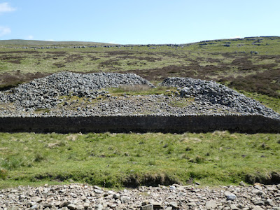
A continuing short but steep (defined by me because of my affliction) section continued until level and pleasant walking took me to Braida Garth Farm. My OS map showed the public path skirting the top side of the farm which I followed through a complex of gates to arrive in the backyard of the farmhouse where I was greeted by the farmer. He told me the path now ran though the bottom side of the farm, but he was not concerned "you're not the only one" he said. We had some pleasant chat and off I went descending for a short stretch on the road. Kingsdale Beck, which I had crossed by bridge in full flow at the start of my earlier steep ascent was now a ribbon of dry boulders where any connection with water seemed unlikely. Further up the road I could see Apron Full of Stones. I can hardly say I was excited but off I trod to have a closer look at this figment of the archaeologist's imagination:
From:
"This romantically named site is a large ring cairn of gritstone and sandstone boulders perched on the eastern edge of Kingsdale Beck. It was excavated in 1972 and a cremation burial was found with no grave goods. Two further possible grave pits proved to be empty. The structure of the cairn is simple and of a single period with a boulder kerb.
The stones forming the body of the cairn are graded in size with the larger stones towards the base of the structure. The use of gritstone and sandstone is unusual since the site stands on limestone. Construction of the monument seems to represent clearance of glacial stone deposits scattered over a considerable area, perhaps as part of farming activity. A small collection of flints suggested an early Bronze Age date. The low-lying location has led at least one archaeologist to suggest that it is not a cairn at all, but a small henge. The revetment wall below the cairn was built by the National Park Authority to prevent further stream erosion."
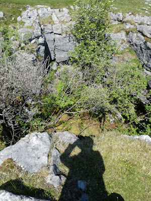
I arrived at a point where I was close enough to satisfy my mild curiosity but continuation was blocked by the boulder strewn dry Kingsdale Beck. Rather than risk wrecking my ankle or worse I took a photo and trudged back to the road to start my ascent to the high level path back along the western side of the dale.
I passed by Rowten Pot and took a photo. It seems that this could be one of the gateways to a huge caving/potholing Kingsdale complex.
From Wikipedia:
Rowten Pot is one of several entrances into the 27-kilometre (17 mi) long cave system that drains Kingsdale in North Yorkshire, England.[2] Its entrance is a shaft some 27 metres (89 ft) long, 10 metres (33 ft) wide, and at the southern end 72 metres (236 ft) deep.[3]
Description[edit]
A stream enters from just below the surface at the northern end. The cave is largely vertical, but at the bottom the stream flows through a short section of passage into the underground West Kingsdale river. This connects downstream with the Kingsdale Master Cave through three short sumps.[1] Upstream, longer sumps may be followed up the valley for over 1 kilometre (3,300 ft), passing below the final pitch of Aquamole Pot.[4]
The cave is usually descended using single rope techniques, and is popular with cavers, being spacious and offering a variety of aerial routes.[5] The three short sumps which connect to the Kingsdale Master Cave can be free-dived.[6]
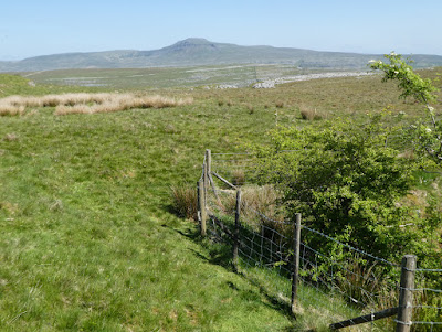
Further on I then passed Kail Pot which this time had a surrounding fence. Although looking impressive my research indicates that it is of little significance to the potholing fraternity.
From just past Kail Pot OS indicates a dead straight line path back to the road a little down from my car. That path rambled all over with twists and turns and with awkward limestone boulders underfoot. Eventually I followed a path not indicated which joined up with another which led directly back to the my car avoiding the anti-climax of a tarmac finish.
This had been a splendid outing in the best surroundings the Yorkshire Dales can offer. The 6.8 miles with 1035 feet of ascent with my breathlessness had been a challenge taking just over six hours at an average speed of about one mile per hour. But I deliberately took it slowly so that I could enjoy and I did stop for about twenty minutes for the ice cream and also another twenty minutes along the return high level path for my sandwich and coffee.
Memory Map with its Route Properties suggests two and a half hours!?
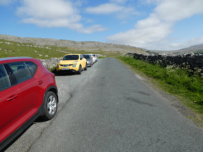 |
| My car, the white one |
 |
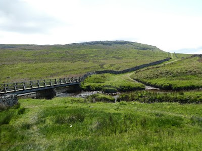
| General view up Kingsdale. My route crossed the bridge just above the wall bottom right and then climbed |
 |
| Crossing Kingsdale Beck in full flow to start my climb |
 |
| The climb to the ice cream van |
 |
| Looking back from the ice cream van |
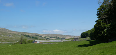 |
| Approaching Braida Farm |
 |
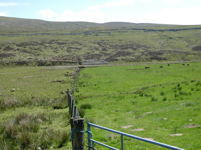
| Kingsdale Beck now devoid of water |
 |
| Apron Full of Stones - at the end of and just to the right of the fence |
 |
| And as close as I got. Kingadle Beck dry intervening |
 |
| Rowten Pot |
 |
| Kail Pot |
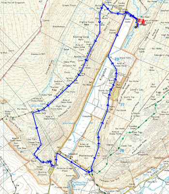 |
| Start/finish at U shaped feature on route at bottom of map |
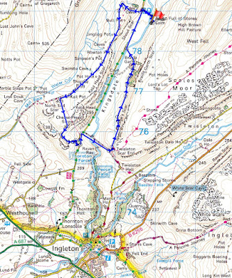 |
| Route in context |


