For newcomers

At the bottom of each post there is the word "comments". If you click on it you will see comments made by followers, and if you follow the instructions you may also comment and I always welcome that. I have found many people overlook this part of the blog which is often more interesting than the original post!

My blog nick-name is SIR HUGH. I'm not from the aristocracy - my middle name is Hugh which relates to the list of 282 hills in Scotland compiled by Sir Hugh Munro in 1891. I climbed my last one (Sgurr Mor) on 28th June 2009

****************************

Showing posts sorted by relevance for query Clougha Pike. Sort by date Show all posts

Tuesday, 27 April 2021

Clougha and a bit of culture.

 Monday 26th April 2021 - Clougha Pike - Grit Fell

The objective today: Andy Goldsworthy's installation near (supposedly) Clougha Pike. Andy is a British sculptor who has created many drystone wall works of art scattered around the globe and other varied artwork. Have a look at Wikipedia if you want to learn more of his metaphysical rationales for his works and his biography.

With Lockdown at bay and spring on the march I wore shorts for the first time this year.

Four years ago I ascended Clougha Pike with full knowledge of a dire forecast for a foul day with persistent rain and limited visibility. That could only have been indulgent masochism. I had already walked a couple of miles before seeing these cyclists at the Jubilee Tower from where I launched off into peat bog and swamp.  Click here if you want to know more.


Today was complete contrast with blue sky and in company with BC. We were on old tracks including an old cobbled lane where we found the "relic of all relics" for my photo file of abandoned and decaying items in the countryside. At a farm we chatted and learnt of the arduous efforts made in the early days of industrial revolution  to divert water for wheel powered mills. We crossed the path of the aqueduct that runs by gravity only from Haweswater to supply Manchester. The line is dotted with the unique waterboard iron gates, often stood alone in the middle of fields.

Rather than cross pathless moorland from Clougha summit to Andy's installation we went by Grit Fell and then onto a proper road scarring across the moorland for the grouse shooters. Grouse were evident frequently and unusually tame, probably because all their predators have been exterminated.

Andy's triple thingy was impressive, and even more so when viewed from inside where the drystone structure is  skilfully corbelled so that one seemed to be inside an egg. Andy Goldsworthy's features are certainly worth a visit. I have been to others and they are not always easy to access.

As we marched on the long descending grouse road BC was reminded of a climbing quarry which he had helped to pioneer many years ago. We only located this after having passed by and a chance look back after being distracted by crossing an aqueduct for the aforementioned pipeline from Haweswater. This was a substantial multi-arch affair demonstrating the amount of effort expended just to cross a tiny stream in a deep ravine, and that along with many other similar engineering endeavours over the 70 miles or so distance.  Construction took place between 1933 and 1955. 

We retraced to the quarry to find a couple of climbers in situ and BC was able to have a good old reminisce.

Another fifteen minutes on a good path had us back to our parking at Rigg Lane.


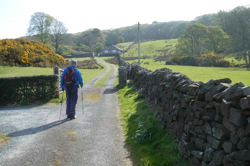
Onto tracks after half a mile walking down the road from the car parking


Old cobbled lane - atmospheric Industrial Revolution stuff

What a gem of a relic. Note also the old barn behind


With the help of the Chrysler badge on the bonnet I was able to identify the model back at home

Avenger, early/mid seventies. It was a good rally car in its day but not much good otherwise.


Good going on the way to Clougha


Why do they use this stuff.? I suspect it is some kind of subconscious protest

Clougha summit

I've become as bit carried away recently putting rondels on my model aircraft - it must be catching


A lonely pine. Pining for the The Two Blondes to come and decorate at Christmas?

Conspiracy theorists may say they are Stone Age beam-me-up-machines?

The Haweswater pipeline aqueduct. The quarry is behind my left shoulder


Tuesday, 1 September 2020

Littledale with BC

Monday 31st. August 2020 - Littledale, Lancs. 7. 5 miles 

There is a large lay-by on the single track road near Baines Crag. This was a bank holiday so we met at 9:30. There was one other car and another rolled up before we set off. Surprisingly there were only twelve in total when we returned six hours later.

I have had several outings in Littledale before. The terrain is similar to our recent walk in the Hindburn valley with heavily wooded, steep sided valleys and cropped turf and old tracks above,  giving extensive views. Looking down at the wooded valleys with their offshoots gives an air of mystery and secretiveness and there is a real feeling of exploration and possible tempting alternatives for other days.

We passed the abandoned church in Littledale, deconsecrated, stripped out and used as a barn for the nearby Littledale Hall estate.

From the Internet I gleaned that Littledale Hall was built in 1849 for Revd. John Dodson. He had been vicar of Cockerham but seceded from the Established Church because of the Gorham Judgement and retired with his family to Littledale.

Further research informed me that the Gorham Judgement arose from a bishop refusing to appoint a vicar in 1850 who argued that baptism was not "sacramentally effective" and that to "accept Jesus" required an adult decision. That apparently clashed with The Thirty Nine Articles of the Anglican High Church.

I've always thought that dunking babies, thereby having them traumatised and screaming, was not a kind thing to do, but then I would never have been a vicar having to make a decision on that matter of principle, but I reckon one should have the choice whether to "accept Jesus" or not rather than having it forced upon one at birth. The church hierarchy seem to thrive on creating these kinds of arguments and dissensions.

Littledale Hall is now a residential rehab centre for people with drug problems. There is a website giving details but strangely there is nothing about the principals who run this establishment - no names or company details at all. I presume this is a private enterprise that receives candidates mainly sent by and paid for by local authorities?

Beyond the hall Ordnance Survey said we were still on the public footpath but we were battling through waist high bracken until we discovered a substantial farm track a little higher up.

We walked as far as we could to get a view of the upper section of Littledale and were able to see where we had crossed higher up when we were walking the Lancashire Witches Walk in 2016. We then backtracked to pass through the buildings of Littledale Hall and eventually climbed up onto the edge of the Clougha Pike moorland. For me the track through the heather just coming into bloom was the highlight of this walk. I had not been on that part before and the views across to Black Coombe, Caw and the Old Man of Coniston and the rest of the Lakes hills was unusual and dramatic bcause we had enough height to be able to see these hills with the whole expanse of Morecambe Bay stretching out below them. Magic.

We had speculated about being able to match the appeal of our recent walk in the Hindburn valley and we reckoned that they both deserved equal merit.


Baines Crag and my parked car. A bit of Morcambe Bay in the background

Zoom to submarine construction buildings at Barrow 23 miles away

"C " number plate - 1965

At least it's still got some tread left on the tyres

Wooded valleys. Clougha Pike moorland - heather just coming into bloom


In Crossgill

We sat on the wall until this procession had passed by. They were in no hurry and neither were we
Littledale abandoned church

Littledale Hall

BC battling through the bracken. He turns back questioningly.
We found a proper farm track about twenty yards up the hill, but OS said we were on the public footpath here


We walked just beyond the far red line to get a view of upper Littledale then backtracked to pick up the return route - red line going right

Onto the moorland track

Looking back at our route. Littledale Hall the other side of the cleft top centre


Baines Crag - BC had of course climbed there but rough boulder terrain at the foot of the crags was off-putting 


N.b. - The underlining on the captions is happening randomly in New Blogger and whatever I  do I can't remove it. Googling tells me others are having the same problem.


Monday, 20 February 2017

Clougha Pike - SD 544 594

Sunday 19th February '17

I have a vague way of mentally categorising walks which is too airy-fairy to detail now, but yesterday I had a gung-ho attitude to the dismal forecast and wanted one that would be medium  distance, medium challenging, and with no emphasis on views which I knew would be restricted. So what about a bit of masochistic moorland yomping?

Some easy footpaths and then two kilometres of road brought me to Queen Victoria’s Jubilee Tower* from where I launched off onto the squelchy moorland, in the half light, and cloudy drizzle, supposedly following a path along a fence line.

All of this walk had visibility between a hundred and two hundred metres accompanied by on-and-off rain, and a long middle period of quite heavy stuff. I used the word yomping which I understand to mean walking over rough, footpathless terrain, probably carrying a heavy pack. The path (in name only) didn’t follow the fence line as indicated on the map and for much of the way it was so far off, that worryingly, I couldn’t see the fence through the gloom and kept using the compass and the GPS, and so I squelched on to reach a corner of fence and wall to turn north-west for Clougha Pike. The weather was pretty hostile now and most unwelcoming at the summit where I jibbed at taking photos, my priority being self preservation. Again the map indicated a path following a wall line but this strayed away and then petered out; a better navigator would have picked up the track to the east. The path by the wall was non existent. I was descending perilously on the worst deep heather, tussock grass ever. Every single step had to be tested for thigh depth holes. Going was literally, painfully slow. It became so steep, which wasn’t apparent on the map, that I had to take a long detour. Well, I was getting what I came for, and as so often, managed to turn a benign walk into a minor epic - always good fun to overcome such challenges?

The remaining trek along the road coincided with the walk I did with Pete last Thursday and I arrived back at the car with my top half totally dry thanks to my Paramo jacket, but the Paramo Cascada trousers were not so good. I think they let in water through the long side zips.

Carefully measured and timed:  8.12 miles and 5.33hrs = 1.51 mph reflecting the difficulty of much of the terrain.


I am still using Impressive Art setting
CLICK TO ENLARGE

The snowdrops were much more apparent than the green saturation indicates


Jubilee Tower where I peeled off left onto the moor

On map as "Shooters Cairn"
I lost interest in taking photos after this - the cynical may ponder that I turned back from here. Fancy doing Everest and forgetting to take a photo on the summit

Anti-clockwise. Start and finish at blue waymark, bottom of blue triangle - that was my walk with Pete last Thursday

Tuesday, 15 January 2013

Tech comes to Bowland


Abbeystead, starting point for this walk, was the scene of a dreadful explosion in an underground building at the waterworks in 1984 killing 16 of a visiting party of 44.

Although I lived only a few miles away in Preston, and then in Arnside, I have always had an irrational feeling I would somehow be intruding if I went there - the same applies to Lockerbie. However, now browsing the map after the passing of time, I noticed The Wyre Way, a long distance footpath which circumnavigates a bowl of land to the east nestling up to the foot of the Bowland Hills, and I decided to explore on a trip with Tom on Saturday.

The walk is all situated within the Abbeystead Estate which includes Abbeystead House described as a “shooting lodge” when built for the Duke of Sefton in 1886. The estate is now owned by the Duke of Westminster.
Some shooting lodge!
Another notable feature, for nerds only: a few kilometres north-east of our walk, is grid reference SD 6418 5654 close to Whitendale Hanging Stones, and appropriately remote. Somebody with a double degree in goodness-knows-what has calculated this to be the centre of the UK... including the islands!  (Click here), but be warned; this not as simple as you might think.

I have walked over all the summits of these hills in the past, but this valley route gave excellent views from a new perspective, with varied walking, on squelchy fields, Land Rover tracks and Tarmac roads. It would be an idyllic route on a summer’s evening.

-----------------------------------------------------------------------------

                      iPhone and iPad mimi - (FOR TECHIES ONLY).

My iPad mini and iPhone are now loaded with Memory Map OS GB 1:50,000 Complete. 

My only requirements from a gps are to pinpoint myself on the map, and to refer to it as required when navigation is in doubt, so in the interests of battery life I only switch on when needed rather than having it continually recording the route and its attendant statistics.

IPad mini 

In-car use. I navigated (Tom was driving).

GPS signal boots up quickly and remained constant throughout the journey in the car.
Although a conventional sat nav is great when driving alone, navigating with the 1:50,000 OS map as a passenger is a dream: easy to see with instant enlargement or reduction to see greater or magnified areas at the touch of a fingertip, and moving position all the time clear to see.

Backpacking? On this walk it stayed in my rucksack. It's a bit heavy, weighing in at 458g including protective case and charging plug - that is half the weight of my tent!

The camera gives good results, but holding it still is not easy. I still prefer to use a proper camera, and in the past have occasionally remembered to take photos with the iPhone to post on the blog, which can’t be done from the camera in the field (as far as I know). You could decide to use the iPad only and not take a camera thereby saving weight.

Picture viewing is excellent. In the Apple shop I had a demo looking at the same photos on an iPad with Retina Display versus the iPad mini where that facility is not available - I could hardly tell the difference.

You would have the benefit of a backup for your mapping in the event of mobile phone failure. Battery life on the iPad is better than the iPhone. The iPad mapping is much better for forward planning with the ability to see a greater area.

I am not sure how you would carry the iPad on a backpacking trip so that you would have quick and easy access, and after this trip I found the iPhone totally adequate for my needs whilst walking. All in all I think the iPad would be luxury to help with strategic route planning, and valued, as a personal choice for all its other attributes not specifically relevant to walking and navigation.

iPhone

The iPhone is brilliant in the field. The screen is easy to see, even in bright light, and scrolling is perfection compared with the MM 3500, and I reckon the latter will be redundant from now on. The GPS signal picks up quickly and continues even when in a pocket. 

-----------------------------------------------------------------------------------------------------


Centre of UK just visible -small  red spot to north east of the route


The vertical red line is part of the boundary of OS Sheet 102 I have marked on my Memory Map
Clougha Pike and Wards Stone behind foreground hill on right

There are numerous similar markers for the Wyre Way, all with different symbols - we wondered about the significance of the hat on this one - any ideas?

Descending to Tarnbrook - Wards Stone 0n horizon

Tarnbrook Fell - we walked about a hundred metres up this track before we both, simultaneously realised we were off route.

Tarnbrook - an earily isolated hamlet - it seemed like a film set for Tom Jones or The Herries Chronicle

Tarnbrook again

Wolfhole Crag, I think 

Another elaborate Wyre Way marker

Clougha Pike and Wards Stone looking back at the valley bottom we had traversed