
Wednesday 13th July 2022 - Deepdale (Dentdale)
6.5 miles. Ascent 1291ft.
The start could be approached from the north over Barbon and through Dent, or from the south via Ingleton and Kingsdale. I chose the latter. I don't think I have driven up Kingsdale before and I was awed. Kingsdale is a major go-to environ for potholders which one can imagine from this broad dale with ranges of exposed craggy limestone lining the steep valley sides, it is like something from another planet. I should have taken photos but there is only a single track road with drop-off tarmac edges that would prevent pulling off onto the grass and there are only a few passing places, so my awe was mixed with tension and apprehension that I would meet a vehicle coming the other way. Fortunately I was lucky and after opening and closing two gates I arrived at White Shaw Moss and was pleased to find decent parking at the end of the track where I would finish my circular walk.
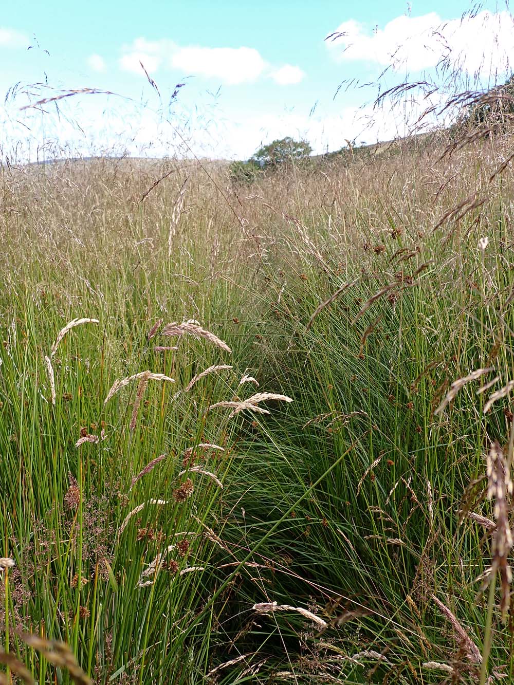
The views far down into Deepdale and Dentdale were stunning illuminated with patches of early morning sun - it was only 8:30am. In the far distance a pointy hill was seen and although I don't find it easy identifying such I am pretty sure that was Kidsty Pike at the end of the High Street range in the Lakes twenty seven miles away in a straight line.There was a rudimentary path steeply descending into Deepdale and then more level walking through sheep fields on green turf and limestone ambience, and views of the best of Yorkshire Dales* hill country in all directions. Walking down Deepdale to almost where it joins Dentdale was Yorkshire Dales walking at its best. I then had to regain a thousand feet or so of height to climb the bridleway to high on the other side of Deepdale after which the track levelled out to contour, more or less, back to my starting point. That bridleway was not easy going bering paved with uneven stone, some loose and some embedded, and there were frequent waterlogged stretches of puddle forcing one to dodge from side to side using the grass verges for short spells, then balancing on and off the grass patches in the centre of the track all preventing any rhythm of walking. Compensation came from the views back down to the two dales with Whernside dominating across and then Pen-y-Ghent poking out above the skyline, and further to the south immense extents of wild country as far as one could see.
That was one of the best walks I have done for some time.
******************************************************
* I use the term Yorkshire Dales loosely being aware that there are other counties involved in the overall area of what I think of as "the limestone country."
************************************************************
If you have similar feelings for the Yorkshire Dales as I do it is worth clicking photos to enlarge for a slideshow
 |
| My car at the end of the bridleway |
 |
| The road descends steeply to Dentdale. I peeled off right on a footpath about a hundred yards further down |
 |
| The distant pointy hill could be Kidsty Pike? |


 |
Governor's Lathe. A very isolated working farm. Internet didn't find anything about this unusual name |
 |
| Gin clear water |
 |
| Typical limestone country walking |
 |
| Much of the path down Deepdale was marked with yellow splashes of paint. The colour was much brighter and deeper than the photo shows. This one even informed us that his was a footpath! That kind of marking would be more expected on our better known long distance paths and seemed a bit out of place in this remote dale. |
 |
| Mire Garth - now a holiday let |

 |
| Halfway up the bridleway on the other side of Deepdale looking back up the dale I had descended into from top right |
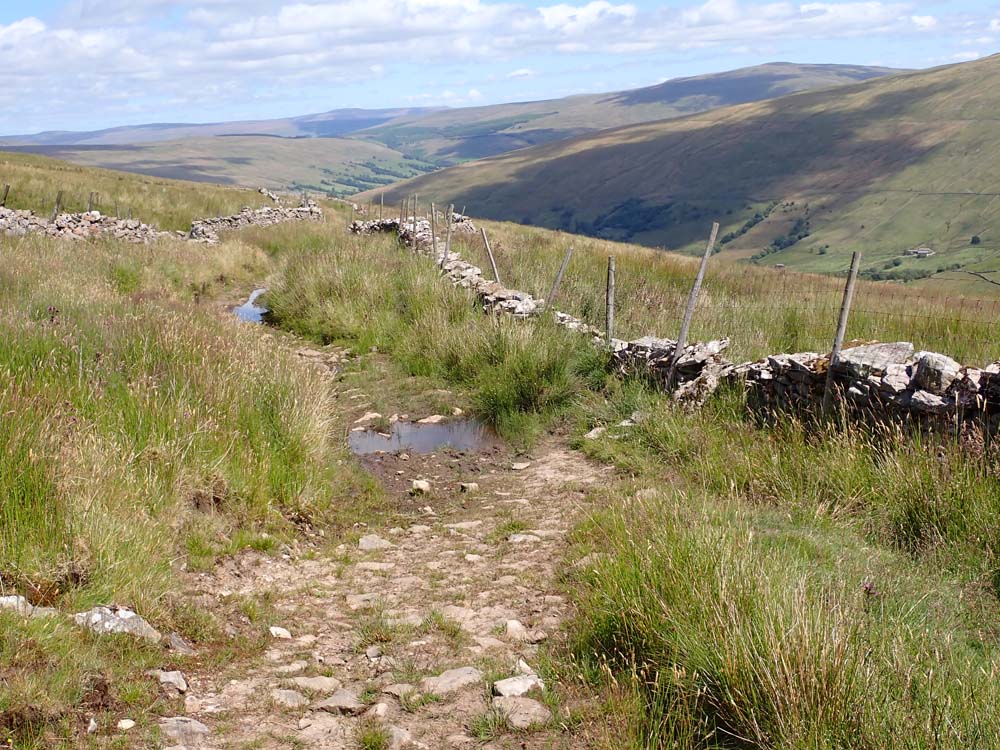 |
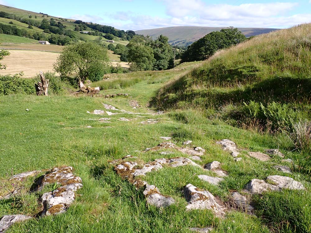
| A good indication of the hard going on the bridleway after the climb as it levelled out and contoured back to my car. Note the huge expanse of wilderness in the distance |
 |
| Start/finish, White Shaw Moss, bottom right. anti-clockwise |


A quiet part of the world.
ReplyDeleteThat road up Kingsdale is narrow, I bet you drove home via Dentdale and Sedbergh.
BC - Good guess.
ReplyDeleteA lovely walk Conrad and your new camera captures it well.I felt I was there with you!
ReplyDeleteAfoot - As i'm sure you have gathered it is my favourite region for several different reasons. I am pleased with the Olympus TG6 except that I do miss the longer zoom. The big plus is protection from ingress through the zoom lens and peace of mind in the worst of weather knowing it will not come to harm.
ReplyDeleteYes, I know the region is your favourite and, having visited the Yorkshire Dales just the once, I appreciate why. I had a look online at your new camera and the specs are impressive.My Sony has only 3x optical zoom which is poor, but it’s a 20MP camera so a zoom can be faked without noticeably losing image quality. I don’t do that very often though. I’ve been using the OS mapping on my Mac and it’s a vast improvement on using the current Mac version of MM. The OS mobile app I find hopeless so use MM which means I’ve had to take an annual subscription for OS mapping for the Mac and one for the latest MM maps for the phone.
ReplyDeleteafoot - I continue to use my Windows version of Memory Map on the partitioned PC on my Mac via Parallels. I also use MM with its app on my iPhone and I am happy with all that except...
ReplyDelete...that is now more or less the only use for the partitioned PC - most of my old files from my PC days are hardly ever referred to and in any case can be stored and opened on the Mac if I want. but it seems cumbersome to have all that baggage just fro the sake of one mapping application. I suppose nothing is perfect. I would probably embrace the promised new Mac version of MM as and when it arrives.
Sorry conrad - I went a bit ‘off topic’ with the mapping stuff! The latest version of MM won’t work with my Mac OS version and I don’t really want to upgrade with all the potential hassle and glitches, so I’m stuck with two different mapping systems for the moment.
ReplyDeleteAfoot - any topic has always been welcome here - the more the better especially as there seems to be a dropping off in this blpgging pursuit. I seem to get less and less comments and page views.
ReplyDeleteI've just caught up. That's a lovely story about your friendship with Pete, and I do admire your computer literacy. I've just spent a few hours on my old Windows XP machine updating topwalks.com, for what it's worth.
ReplyDeleteEnjoy your walks.
Phreerunner - my PC version is now running on Windows 10 - I find it almost incomprehensible. I vaguely remember XP being more user friendly but suspect it is no longer supported by Microsoft?
ReplyDeleteCorrect, it's not supported, and very slow, but my old Dreamweaver software won't work with Windows 10...
ReplyDeleteThere's another intriguing looking little valley in that area I've often noticed when studying the map: lying like a kidney bowl in the hills on the other side of Garsdale from the station - reached by a path via Clough gill and its eponymous Force, or by a narrow track from the dale. I wonder if you've been there and done that - or if it is not worth the mileage: one of the many Grisedales. Worth a Mass ?
ReplyDeletegimmer - I drove part-way up the road of that valley on 12th March 2005- here is a ink to the account.
ReplyDeletehttps://www.dropbox.com/s/w82y2b1iyg0axzy/KnoutberryHawforTom2.jpg?dl=0
I have plotted a six miler to take in most of the valley and now await a weather window and blank in the diary. I think you may have to copy and paste the link. Please let me know if ypu can't open it.