For newcomers

At the bottom of each post there is the word "comments". If you click on it you will see comments made by followers, and if you follow the instructions you may also comment and I always welcome that. I have found many people overlook this part of the blog which is often more interesting than the original post!

My blog nick-name is SIR HUGH. I'm not from the aristocracy - my middle name is Hugh which relates to the list of 282 hills in Scotland compiled by Sir Hugh Munro in 1891. I climbed my last one (Sgurr Mor) on 28th June 2009

****************************

Wednesday, 31 August 2022

Trigs 99 - visit 2

Tuesday 30th August 2022

1. Carr Hill (The Cranks)                          SE 275 925    76m

2. Viewly Hill (Barf Hill)                          SE 400 860    67m

3. Eldmire Hill                                          SE  429 752    41m

4. Marton-le,Moor (Skelton Windmill)     SE 373 695    58m

5. Bland Close                                           SE 298 685      99m

6. Whitwell (Thifegate Lane)                     SE 244 910    146m

The new i phone 11 came into its own today after returning the first offering due to a faulty on/off switch and then having a problem transferring the data from the old iPhone 6, including my Memory Maps OS 1:50 and 1:25 . That was achieved with the help of the excellent Apple Support system where one speaks to a real person quickly and  nothing seems to be too much trouble.

Gayle asked whether the new acquisition had been a blur moment, Blur moments are spontaneous purchases made almost without one knowing it has happened, only to dawn when one reviews one's credit card statement later. The new iPhone purchase was in the opposite category. You battle on with some item that irritatingly performs just up to the point where you can't justify the cost of renewal.You will it to do the decent thing and fall on its sword. That of course doesn't happen. Eventually you kid yourself that one of those dubious justifications gives you permission and then you make the long debated move.

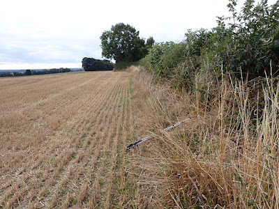
Carf Hill trig involved a short walk up a deeply enclosed lane but with a serendipitously placed rusty iron gate climbed to enter the trig's field. Crackly stubble crunched underfoot. Trigs hidden in hedges seem to be a recurring feature on this map. That is odd because the whole point of a trig is to be able to see and measure two others distant, Hedges pre-date trigs so I wonder.

The sat-nav in my Kia performed heroically during the whole day. I was soon at Thornton-le-Street where I parked at the end of what I thought was a private road leading to Thornton-le-Street Stud marked on the map. As it turned out I could have driven on this  tarmac road all the way and saved myself a couple of kilometres walking but it was pleasant going through quintessential English parkland. First view of the stud gave the impression of an opulent country house but on getting closer it seemed to have been converted into rather shabby looking flats. At one point I passed massive badger excavations that would have daunted one our erstwhile canal navvies.

Minor roads from the A 168 passed through a huge industrial estate where I missed the hidden continuation of my public road and some trekking back and forth ensued. A quick walk up another stubble field made me realise my unplanned fortune that this trip was happening after the crop had been cut. Yet another one hidden in a hedge (with nettles.)

Marton-le-Moor had me parking on a minor road and walking a hundred yards to a junction with very a busy road belying its  B6265 status. I had to walk another hundred yards or so on the grass verge with non-stop vehicles whizzing past at seventy mph to find yet another hedge incarcerated trig. I suppose it would have been quieter when they were erected between the 1930s and 60s. but I couldn't see how they may have observed others from this spot even then.

Bland Close - see map:


There are two possible approaches:

1 From the north driving through Ripon housing to what I thought would be a private track (yellow) to Bland Close with unknown surface or right of access.
2. From the south on a cul-de-sac minor public road continuing as a bridleway (blue) leading in about 1 km to Bland Close.

I chose the latter. The bridleway proved undrivable. I reversed back into a farmer's field at the end of the tarmac. The farmer was loading hay bales and we chatted. He confirmed that the yellow track from Ripon was drivable so that would mean eliminating a potential two miles walking. The farmer was very forceful in telling me my best plan was to drive back the seven miles to the northern Ripon option but that didn't appeal to me. It only took about ten minutes to walk to Bland Close by the bridleway from the farmer's field. This business of meeting people who try to insist that you follow their alternative route to your plan is not uncommon and one has to learn to treat such advice with caution. 

The farmer at Bland Close pleasantly gave me permission to visit via yet another stubble field. He said he would be grateful if I could lift the trig another metre to raise it from its 99 metres above sea level to 100 metres.

A quick drive had me to Thiefgate Lane and the final trig (in a hedge across a stubble field would you believe?)

Sat nav gave me the "quick" option back over the A66 or the "short"  back through Uredale, Wensleydale and Garsdale to Sedbergh. There was only seven minutes difference. I had a magnificent drive all the way on endlessly clear roads - 'twas all like re-enacting Stirling Moss's Mille Miglia.

A Grand day out.

Carr Hil trig and...

...looking back after having climbed the gate from the lane

Parkland on the way to Viewly Hill

Thornton-le-Street Stud. Turned out to be shabby flats

Massive badger works

Thornton-le-Street Stud trig

On the way to Eldmire Hill

Eldmire Hill trig

Marton-le-Moor trig. "For those in peril on the B6265"


Bland close trig and...

... the view therefrom

Thifegate Lane trig


Saturday, 27 August 2022

Trigs 99 - Visit 1

Trigs OS Sheet 99 - Friday 26th August 2022

Hunters Hill        60 m     SE 324 995

Fingay Hill           9m      SE 401 992

Arncliffe Wood   299m    SE 459 997

Bullamoor           110m    SE 392 942

Masty Bank         116m    SE 428 901

Two hours driving on clear roads took me to the track leading to Hunter's Hill Farm. The trig is on a field a few hundred yards beyond the farm. 

I was greeted by two friendly farm dogs as I approached Mr Farmer sat on his tractor in the farmyard. He has had similar visits from trig point baggers and was happy to sit up there and chat for a while. I was told I would find a Union Jack flying at the trig and that his brother's ashes were scattered there. I said I would show appropriate respect, but strangely he made some indication that would not be obligatory. As we chatted he had an incoming phone call and had a to and fro about the cost of his diesel oil which seems to be increasing daily.

As I carried on to my objective I was followed by one of the collie farm dogs who seemed to welcome a walk, or perhaps he sensed that I may get lost and was happy to show me the way. The trig had the proud flag flying and had been well maintained, newly painted white. Views on this glorious sunny day were extensive and sharp.

I entered Brompton into my car sat-nav and only realised after about twenty minutes that I was heading in the wrong direction - you see I can even get lost without getting out of the car. There must be more than one Brompton in the area. 

I have only just discovered trigpointing UK where all our trig points are recorded with logs of bagger's visits so I had learned that friendly permission had been given at Low Moor Farm. As I arrived I was lucky to catch the farmer as he was just setting off in his car,  I was told the trig had bee moved from the centre of the field to the hedgerow. A short trek and a couple of gates had me up there and after checking in with the pillar I used the GPS to locate the original position easily, especially as the remains were still evident.

Some harrowing grass-in-the-middle narrow lanes brought me to an exit onto the frighteningly busy A19 for a one hundred yard stretch to then branch off and climb again through steep, narrow U-bend lanes to squeeze into limited parking at the  National Trust access point labelled Scarth Nick. Here I followed the Cleveland Way on a substantial track often well paved with those old mill sandstone slabs.

A low drystone wall with an eighteen inch gap to a barbed wire fence protected the trig standing  a dozen yards beyond. I was not prepared to risk torn clothing or injuries. If I can get within close sight of a trig that will do for me. The point of this exercise is to have an objective which will take me to new ground and possible discoveries and encounters. Actually touching a trig pillar is of little consequence but having said that I will make every attempt within reason. 

I had targeted to visit the first four listed here but I reckoned I would have time to slot in one more. I drove to Bulamoor which I knew was in the bottom south-west corner of an enclosed reservoir complex with security fencing. There was a small lay-by opposite the high locked gates but Google Earth had shown me there was access to the adjoining field allowing me to walk round the perimeter of the security fencing to that far corner where I was able to get a photo at about thirty yards distant. The trig was standing proudly atop the reservoir infrastructure.

A short drive and I was at a bridleway end  hopefully giving to access to the final trig field.  By luck that proved to be the case - there was a hole and passage through the hedging and a low barbed wire fence which I could straddle. I crossed the field  to the far hedge. My 1:25 map showing field boundaries was not working and I was not sure of which side of the hedge I would find the trig. There was no sign. I was able to walk out to the road and back up the other side of the hedge but despite searching carefully the trig was mot there. I did find a pile of stones and earth at the point where GPS on my 1:50 map was showing me to be  on the spot. Subsequent reference to Trigpointing uk confirmed my conclusion.

The long drive home included about half and hour lost with grid-lock on the early part of the A 66 from Scotch Corner. That was a 220 mile round trip but most enjoyable and well worthwhile I thought. 

Lane leading to Hunter's Hill Farm 


Mr. Farmer on his tractor


"In loving memory of George William Hugill - 1926 to 2019
George lived and farmed in this area all his life. "


Low Moor Farm and my car at the start for Fingay Hill

The trig in its moved-to location and...

...where it came from about fifty yards away nearer the middle of the field

On the Cleveland Way. The path was more substantial further on

Looking back down the Cleveland Way. You can just see the pimple of Roseberry Topping to the left of the tree on the near horizon. Heather in bloom: wonderful, does my soul good


Arncliffe Wood trig guarded by wall and wire. That was near enough for me

As near as I could get to Bullamore

The location of Masty Bank. GPS put it at a point just behind this mast enclosure - see next photo 

This was within  couple of metres of the GPS indication but I'm not sure if it had anything to do with the absent trig


Broad red is part of boundary of Sheet 99. Yellow is my approximate car driving


Tuesday, 16 August 2022

Trig points 99 (Intro)

Tuesday 16th August 2022

A new project:

Visiting all 22 trig points on Sheet 99: Ordnance Survey 1:50 Landranger 99 (Northallerton and Ripon.)

For any readers from abroad not familiar with UK mapping see footnote below.

I have previously visited all trigs on OS Sheets: 91 96 97 98 and 103. The next sheet that is the least drive from home, is 99.The furthest east trigs will involve a two hour drive, but those  are mostly easily accessible and I can probably mop up three or four in one visit. As I move back west the terrain looks more interesting and I may take more time by incorporating each trig within a decent walk if that can be engineered from surrounding paths and tracks. There are only 22 on this sheet compared with 76 for example on Sheet 103 so this should be a more modest project.

Identifying the trigs is tedious. I enlarge the map on my computer screen so the kilometre squares are about 10cm across and then traverse west to east and back east to west examining each square and placing a mark.

Here is a typical trig as shown within the context of a kilometre square:

The green triangle is my marker. Each trig shows its height above sea level in metres. In the field I use the larger scale 1:25 map that shows field boundaries and more access information.

The green triangles are from my original survey. The reds were a tracking system to make sure I had them all on the spreadsheet which serves as my master tick list - see below.

At the moment there are no ascents but as they occur I put a number 1 in the column indicated and the number remaining is automatically calculated at the bottom. It's all a bit nerdy eh?

The attraction is to give me a focus and a project to keep my aged frame and my mind as agile as possible in my declining years, whilst providing a possible adventure as one heads into unfamiliar territory with a purpose, hopefully making interesting discoveries and finding possible problem solving challenges when one encounters trigs located on private or difficult to access land. I can also choose to make quick forays for easy ones close to roads or please myself by incorporating them in longer walks. There are around 6,500 trig points covering the UK so there is no way I am going to visit them all, so no pressure. Has anybody visited them all? CLICK (recommended.)

Here are two good ones from the Yorkshire Dales (OS Sheet 98 - Wensleydale and Upper Wharfedale)


The Three Peaks from Rye Loaf Hill

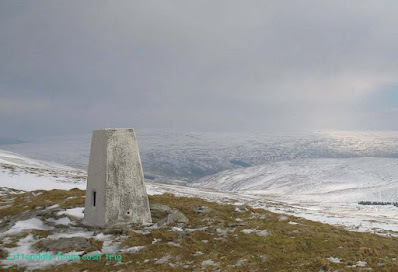
Littondale from Cosh trig

******************************
Trig point = triangulation point.

To make a map: draw an accurate measured baseline (say 10 miles) - not easy. Stick a trig point at each end. Identify a high point several miles away and stick another trig point on it. Then measure the  two sets of angles horizontal and perpendicular from each end trig to the new one. Draw the connecting lines and calculate the lengths of the other two sides of your triangle and then continue from that triangle to its neighbours using their sides as each new baseline. In the UK the trig points are usually standard concrete pillars about four feet high with a mounting plate for the measuring instruments embedded in the top. and their location is marked on each map. For more entertaining information visit THIS.  (recommended)

OS divide their mapping into convenient local sheets

************************************************************
Katie's art update

I am told she used mixed acrylic and poster paint - mmm?


Thursday, 4 August 2022

Crosby Ravensworth, Coalpit Hill

 Wednesday 3rd August 2022

 Crosby Ravensworth, Coalpit Hill circular - 7 miles - ascent 766ft.

I had not planned to walk to day.  At 6:00am, my normal arising time for a day walk, I turned over, but at 6:30  glorious sunshine prevailed from my window. I couldn't decline the opportunity of wasting a good weather day.  Breakfast was hustled through and off I went. Driving in this less populated northern region early in the morning is a pleasure, I had the roads to myself and landed at Crosby Ravensworth to start walking at 8:35. I parked in a rough lay-by opposite a row of cottages in the village and within a minute a resident was approaching from one of the cottages. I anticipated some objection to my parking but she very politely explained that she had contractors coming to surface her frontage, that is driveway, not part of her person, with heavy machinery, but she just asked me to back up a few yards so they would have no access problem. and she then wished me well for a good walk -  all quite pleasant.

A short stretch through the village lead to a tarmac track branching off south-west. The tarmac gave way to a grassy track which climbed non-stop at a gentle gradient for about three and a half kilometres to reach the cairn and trig on Coalpit Hill.

Along the way a line of grouse butts appeared. By now I was walking through heather moorland, but still on the good grassy track, and heather was blooming, a little early I reckon. The first of these bird murdering locations was substantial, enclosed by four walls and its floor laid with gravel to prevent squelching about in mud, (a virtual palace?)A couple of hundred yards further on the next butt was just a single barricade with no facilities (social housing?). All this set me wondering about the allocation of butts to those paying lots  for the pleasure of killing animals. To be graced with the "palace" does one have to pay more or does it go to a particular buddy of Lord Killagrouse? In which case being allocated the "social housing"would amount to almost social downgrading, perhaps for those not being quite "in" with the social milieu of the Laird, probably having  arrived in a Kia Sportage rather than a Wange Wover (Autobiography model).  How the other half live eh?

Views from Coalpit Hill across to the M6 corridor were extensive. Even at three or so kilometres  from the motorway its noise was audible for most of the walk. A short stretch from the summit across tussocky ground connected me back to another track and then eventually to the cul-de-sac end of a very minor tarmac road and pleasant walking back ito Crosby R.

As I arrived back at the car I half expected, with my record of unsolicited cups of tea and the like*, to be offered such by my pleasant neighbour from this morning, but the newly laid frontage was complete, looking pristine, but my hopes were mot realised. 

That was a good walk on easy going and my time was much faster than recent walks over more demanding terrain. All sheer pleasure, snd recommended for anybody looking for a quick seven miler.

* See Bowland Climber's last blog post: CLICK


A short walk out of the village leading to pleasant wilderness

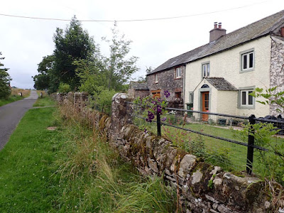
My departure from the village  branching right is just beyond this cottage - 1759


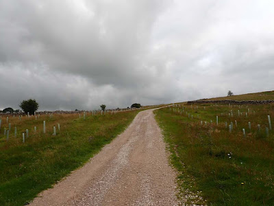
Tarmac track gave way to gravel which gave way to...

...pleasant green track


Coalpit Hill is the pimple a bit in from the right on the horizon

The Palace and...

...Social Housing

Cairn on Coalpit Hill

Coalpit Hill trig looking across to the M6 corridor


Back into the village past the Butcher's Arms.

Start finish, Crosby Ravensworth, top right, clockwise.