For newcomers

At the bottom of each post there is the word "comments". If you click on it you will see comments made by followers, and if you follow the instructions you may also comment and I always welcome that. I have found many people overlook this part of the blog which is often more interesting than the original post!

My blog nick-name is SIR HUGH. I'm not from the aristocracy - my middle name is Hugh which relates to the list of 282 hills in Scotland compiled by Sir Hugh Munro in 1891. I climbed my last one (Sgurr Mor) on 28th June 2009

****************************

Monday, 18 March 2019

Knott and Maulds Meaburn Moor

Sunday 17th March 2019
Knott (Gt. Asby)               NY 647 092 - 412m
Meals Meaburn Moor     NY 639 152 - 292m

Over the years I have dallied with Ordnance Survey triangulation points. For readers from abroad these are concrete pillars used by our mapping quango to mount surveying equipment enabling mapping of the whole of the UK - there are 6,500 of them, so for me this is a good list because the number means I have no likelihood of completing them all and can just cherry pick and avoid the stress of compulsive list ticking.

OS maps are divided into numbered sheets. In the past I have visited all the trigs on Sheet 97 (Kendal and Morecambe) and Sheet 98 (Wensleydale and Upper Wharfedale) - there are usually forty or fifty on each map sheet.

Some years ago I had made a start on Sheet 91 (Appleby-in-Westmorland) and visited 16 of the 48. I have for the moment resumed this campaign and visited two more yesterday bringing my total to 18.

Trigs have to be in a prominent position to enable a view of two more trigs to measure the angles of elevation and horizontal plane for completion of each triangle. The majority are therefore situated on high points but there are also many on  low lying terrain, often only a short distance from a road, so it can be feasible to visit several trigs in one outing.

If you want to know more THIS SITE is worth s visit.

This resumption was conceived on a whim as I breakfasted and looked out at a tempting weather window. I had other things to do but I reckoned I could be there and back in time for at least some of my chores.

This was all glorious limestone hill country as good as it gets and it was invigorating to get back amongst some hills after much recent rural country walking. Knott was only a short climb and I decided to  put off my chores and drive the few miles north of Orton to bag the second one which was only a short walk from the road. That gave me a little bonus.  Ordnance Survey, having finished using trig points offered members of the public the opportunity to "adopt a trig" - that has since been discontinued, and I have only seen one or two of these, but Maulds Meaburn was one such. The adopter was one William Dodds - "On the occasion of his retirement - May 1994." Despite time Internet searching I could glean nothing about William.  If anybody knows more I would be interested to hear.

After allowing my  Panasonic TZ100 to ingest mud I made an insurance claim and then bought a new TZ80 which only has the smaller sensor but with the advantages of a 30 x zoom and a proper viewfinder. Today was my first chance to give this a try so I took many photos.


WORTH CLICKING FIRST PHOTO TO SEE SLIDESHOW FULL SCREEN


Just off from the road - we have had much rain recently. Knott is the obvious hill - the trig is quite a long way back from a cairn that can be seen from this location


Lime kiln. There are many in these limestone dales

Typical limestone escarpment
This and below - zooms into the northern end of The Howgills


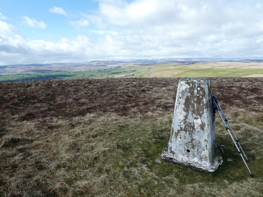
Knott summit and trig

Just a few yards from  Knott trig - perfection


================================================


On the way to Maulds Meaburn trig, only a couple of hundred yards from the road


East from Maulds Meaburn trig - northern pennines in the distance

"This trig pillar was adopted by William Dodds on the occasion of his retirement - May 1994"


Friday, 15 March 2019

Dry stone walls and canals

Thursday walk with Pete - 14th March 2019 - Stainton Bridge and Lancaster Canal

We had three blogger's gifts in only three miles today.

Although I have seen the Dry Stone Walling Association training school before I don't think I have photos, so on this bright sunny day I was able to get some decent shots.

We have walked on the canal bank before and over the Stainton Beck aqueduct, but today from the road we came across a notice forbidding access because of repair and restoration work. The aqueduct was damaged by a "seven foot wall of water" by Storm Desmond in 2015 - see a short well written account of all this from the Westmorland Gazette - CLICK HERE

Further on we were able to see the ongoing work and get a zoom shot, but there are much better close up photos on the link shown above.

Just after the aqueduct this section of the Lancaster Canal terminates at Stainton Bridge as a navigable waterway, but note: going back four kilometres the other way the canal is blocked again by the M6 motorway. From Stainton Bridge the Lancaster Canal Trust is involved with restoration, hopefully to the original terminus in Kendal. There is all sorts of information on their website:
https://www.lctrust.co.uk/the-trust

I have gleaned the following to include here.

Canal & River Trust has recently announced that due to the problems encountered by the contractors work on the aqueduct is not expected to be 
completed until October.  Lancaster Canal Trust is disappointed but understand the difficulties of the work and conditions.

and: - read only if you are really interested in the details of restoration.


Meet at STAINTON at 9.30 each day
Dates: For the second time this year, starting this Saturday, 2nd March, a Waterways Recovery Group from the Northwest will be joining us, this time for a week.
Lengths 5 and the newly laid length 6 of the rubber liner has now been joined and sealed and is ready to bepulled out, another layer of geotexile laid over it and finished with blocks. The pumps have been kept running over the previous days so it should be fairly dry.
The contractors Wilson’s have cleared out the accumulated piles of material from just before B172 and finished‘profiling’ the banks the same as with the rest of the FF. They have taken away some 7 lorry loads of material but the very wet mud from the bed, referred to by the technical name sloppy stuff, which couldnt be moved by lorry has been pulled up underneath Br 172.
An early task will be to move this material from under the bridge and onto the car park from where it will be picked up by a local contractor and carted away. A 5 ton digger and a dumper have been hired to do this work and to re-instate the ramp down from the car park to the canal bed so that a telehandler can move the final load of blocks, which will be delivered later in the week, down onto the 6th length.
If all goes according to plan (and why shouldnt it!) it should be possible to clear the final length as far as the access ramp of significant stones and minor profile deficiencies and lay out the last of the liners.
Sealing the lining under Br 173 and along the wash walls with puddling clay is a further task as is back filling the profiled lengths once the liner is up to the correct height along the banks.
page1image20112
Volunteers of all skill levels are welcome. We will provide whatever protective clothing is required for the job in
page1image21440
hand (hard hats, hi-vis jackets and work gloves) if you don't have your own. We advise that you bring warm
page1image22808
clothes, waterproofs, sturdy boots or wellies and a packed lunch with drinks
page1image23856
PLEASE let me know if you can attend - this is important in case details change, a quick email to
page1image25224
chair@lctrust.co.uk is all that’s needed.
page1image25992


Click photo to enlarge


Blackthorn in blossom

Field End Bridge - lots of water coming down


Stainton aqueduct under repair and restoration - see better photos from Westmorland Gazette link above.

The start of restoration west from Stainton Bridge. We walked just a little further than you can see

Looking back down our route from Stainton Bridge and the current terminus of navigation


Sellet Hall bridge - as far as we went, and current limit of restoration

Our route there and back

It would be a massive job to restore navigation here, and also the canal is blocked again by the M6 a bit further south at Tewitfield. If all that was done the Lancaster canal could connect to the national canal network via a short pilot trip from the Ribble Link at Preston to join the canal network at Tarleton. What a boost for Kendal that would be!


Sunday, 10 March 2019

"This time next year we could all be..."


If you would like to be a millionaire it’s simple. Just solve one of the current seven most difficult to solve mathematical problems and collect the £1m. prize from the Clay Foundation in the US.

Just call me Archimedes. Like the great man I have all my best ideas soaking in a hot bath and today so it nearly was, except I didn’t come up with a relevant indisputable result, but at least I formed the notion for this post. I was wrestling with the logistics involving train times, buses, cars, and walking distances for the next two sections of our straight line walking route from Blackpool to the east coast with BC. We are now nearly halfway through and facing a transition from private to public transport.

One of the Seven Last Great Problems is the classic Travelling Salesman calculation trying to work out the shortest route between a number of towns he must visit known as the P versus NP problem. If there are only four towns there are only six options - easy to see which is best by simple maths. If you scale up to ten towns the exponential number now becomes  3,628,800 (ten factorial). 

Here is an extract from The Millennium Problems by Keith Devlin. Keith has made a brave attempt to describe the problems for the layman producing a book I found absorbing. That is saying a lot for me as one who failed O Level maths.

CLICK TO ENLARGE
Keith goes on to explain the colossal increase in available routes by just adding one or two more cities - when you get to 25 you will have: 15,511,210,043,330,985,984,000,000 options to evaluate. Eventually the problem goes beyond present day computing ability. Even for ten cities Keith says if you took a minute to work out the mileage for all 3,628,800 possibilities it would take you just over twenty years! There is much more on this problem in the book, but you may be heartened by the following from Keith:  "P versus NP puzzle is the most likely to be solved by an unknown amateur. Not only is it relatively easy to understand what the problem says, it is possible  that all it will take  to solve it is one good new idea."

Ok, I was only concerned with three destinations for this section of our route, and not particularly with shortest distances, but I enjoyed the catalyst to go back to a book that gave me pleasure a couple of years ago.

======================

My title comes from Only Fools and Horses, and again I found myself pursuing further knowledge by identifying the source which I was not aware of, although my son W was familiar with it.  From Vaudeville in the US  the full line is:

"Only fools and horses work for a living"

Friday, 8 March 2019

Paradise Lane again

Thursday walk with Pete - 7th March 2019 - Paradise Lane circular

We walked most of this route on 22nd June last year. For such an insignificant venue it promoted a disproportionate amount of discussion:  nineteen interesting and varied comments. I don't often refer readers back to previous posts but reckon this one is worth another glance:

Paradise Lane - June 2018

At my age I am ambitious to mop as many new sights and unvisited curiosities as possible. Although previous outings have been rewarding I feel I am wasting valuable time by revisiting. I remember being criticised somewhere for this stance and wonder if I am in some minority, or if I am suffering from some kind of blind spot?

There were discoveries last time that I will not repeat. Pete is laid-back about covering old ground again saying it is more about getting together, having some exercise and a natter, and a pot of tea at Café Ambio afterwards. I wholeheartedly agree, but when I walk alone, which I strongly favour, that is not the case.  By saying that I don't mean that I am demeaning walking with friends - it is just a different kind of enjoyment. Pete also points out that if you walk a route in reverse you benefit from the new views, often quite surprisingly.

Some old tractors were largely hidden on a track amongst ramshackle wooden sheds. I photographed three having no  recollection from the last visit, and then found I had photographed one of them last time.

A massive tree had fallen across the road recently requiring what I suspect must have been monumental effort to clear. The newly exposed cross cutting of the trunk had a warm glowing colour unusual in nature and the tree rings were exposed in fine detail. It was sad to see that such a giant had fallen, but for some perhaps atavistic reason I found the sight fascinating and interesting.

After Paradise Lane we crossed to use the footpath alongside this busy road. On one's own territory significant sights are taken for granted. I have driven and walked past Billerudkorsnas paper mill hundreds of times over the years. They claim to be a world leading manufacturer of specialised papers for medical, foodstuffs and many other applications. There has been a paper mill there from 1788 at one time converted to a flour mill then back again to paper. The old corn mill is worth a visit (for free), but the modern paper production plant has now been taken over by Swedish owners. We walked alongside what I presume is a water filtration process with channels of gushing water, today a sort of pale turquoise colour. The works are situated on the River Bela snd I guess that is their water source.

We continued along Hangbridge Lane to emerge on the B6384 at Hang Bridge, a fine 1890s double arch spanning our second meeting of the River Bela, now in a more countrified setting. I note Ordnance Survey use one word for the lane and two for the bridge. A short stretch on this busier road took us back to the car.


This and below - the two that got away last time.
I seem to be finding tractors for Alan's identification that are more and more obscured by rubbish and the like, and only at a zoomable distance - I must have had the shakes here for these blurry images


Water filtration at the paper mill alongside the A6 walked and driven past many times before without bothering to comment.

River Bela from Hang Bridge

Hang Bridge (courtesy of the Westmorland Gazette)


Monday, 4 March 2019

Tractor update

Monday 4th March 2019

In my post on 22nd February - Derby Arms/Meathop - (Click for link) I omitted to show the machinery being operated by the tractor - two commenters were curious enough to know more so I've been back and here is the result.