At the bottom of each post there is the word "comments". If you click on it you will see comments made by followers, and if you follow the instructions you may also comment and I always welcome that. I have found many people overlook this part of the blog which is often more interesting than the original post!
My blog nick-name is SIR HUGH. I'm not from the aristocracy - my middle name is Hugh which relates to the list of 282 hills in Scotland compiled by Sir Hugh Munro in 1891. I climbed my last one (Sgurr Mor) on 28th June 2009
****************************
Wednesday, 26 May 2021
Bampton Grange, Haweswater again
Tuesday 25th May 2021 - Bampton Grange -Bampton Common - Haweswater
After my debacle (debuckle?) a couple of days ago I had a strong feeling of unfinished business. When I plotted the original route I was pretty certain it was going to be a classic quality walk. Although it was a fine walk in its own right my pride had been dented by my unplanned wanderings and I wanted to do something to retain a better memory of what I had hoped this would be.
I saw that I could continue from Buckle Bridge down to Haweswater and return to Bampton Grange, and apart from a bit of cul-de-sac tarmac out of Bampton the rest of the walk would be on footpaths.
The chance of a late finish was obviated by an earlier walking start at 9:30 am.
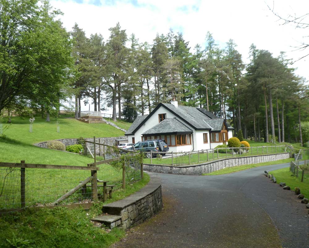
Sparse rain started within a few yards and opposite Bampton Grange church I donned a waterproof. I also needed gloves - crazy for mid-May. I have a light pair of gloves with touch screen finger tips which work pretty well.
I was looking for some variation from my previous visit and noticed a little tarn marked Littlewater on the map but the track from the road displayed a Private, no public right of way, farm only notice. I pressed on. Ahead as I crossed the sheep pastures and climbed the almost welcoming soundly constructed stiles with their massive flat slate through stones for steps, an enticing little hill with a pointed rocky summit was constantly in view. As I left cultivation and entered the access land I diverted to take in the little summit (spot height 342m.) That proved to give me a bonus with a view to the aforementioned Littlewater - pity, it did look an attractive venue nestling in its surroundings.
My previous route took me down to my nemesis bridge, but here I turned south-east and descended to the shores of Haweswater. This path drops about 300ft. in a third of a mile providing exciting glimpses of waterfalls and rushing water deep in the wooded ravine below: see video which shows the terrain I have descended to the bridge and then the start of the rushing beck before it drops more steeply. - see video :
The return along the shore of Haweswater to Burnbanks was on a good track and provided nostalgia from my Coast to Coast trek in the other direction back in 1990. I seem to remember the path being more basic and closer to the shoreline, but perhaps that was further up the water in the other direction?
Burnbanks provided a welcome bench cut from a tree trunk for my snacks and flask of coffee. Burnbank is now a pretty kind of model village with architect designed bungalows arising from the housing that was provided for the workers, now demolished, during the 1930s when the massive six year Haweswater construction programme was underway. The water flows for about seventy-five miles by gravity alone to supply Manchester with its drinking water.
A sneaky little path runs from there through bluebell woods to Naddle bridge. Classic country walking follows on paths taking me back to Bampton Grange after an enjoyable walk with a mix including an iconic Lakeland village, sheep cropped turf, Lakeland fells, waterfalls, and attractive country walking. A classic little nine-miler in my opinion, and something thankfully resurrected from my previous mini-epic.
PLEASE CLICK PHOTOS TO ENLARGE
Bampton Grange church - here , only fifty yards from the car I donned my waterproof - no removed until after "The Bridge."
Littlewater. the track to it from the Bampton road was private, but from spot height 342m I got this view
Haweswater and the standing stones (again)
Turning left at the bridge - the beck on its way to Haweswater
Looking up towards Mardale Head...
... and the other way towards the dam
A look at one of the waterfalls - much is hidden by the trees
The first house on entering Burnbanks
My lunch spot. The path to Naddle Bridge goes off the road at right hand edge
This was a zoom from about thirty yards down into the river - this impressive bunch was on an isolated clump of grass with water flowing past on all sides - it was intense in colour and shouting out to be seen
Today's route in pink showing slight diversion from my previous routes and then the return by the lake
This photo included retrospectively for Gimmer - see comments below
We were both on the 'Buckle Bridge to Haweswater' path on the same morning - how funny it would have been if I'd got a later start and bumped into you! Mick was also mistimed to have encountered you crossing the road as he drove back out from Mardale Head.
Gimmer - Mick and Gayle who have commented above have entered for the Lakeland 50, in July this year. It is a 50 mile endurance run/walk across the Lakes, being half of its associated Lakeland 100 sponsored by Montane
M and G have been training and reconnoitring the route which happens to pass over Buckle Bridge and as they say above, by coincidence they were there only within a couple of hours of my visit. I think Gayle passed the bridge again a couple of days later and without really trying spotted the errant buckle below the boards and took the photo which I have NOW included in this post above. They have since visited me here on their return journey home and Gayle confirmed that although the photo seems to indicate retrieval would not be difficult that was not the case, so it will be left to puzzle some budding archaeologist in a few hundred years time, being plastic it will unfortunately survive, and I in my declining years will have some kind of mixed feelings in remembering it from time to time.
This now deserves to be declared an Emergency - requiring an airborne team, complete with joiner and spare timbers in the back - cannot have pollution unto eternity on and in such an unspoilt (well, until that 'event') track and beck. But 'The Name' will endure - soon, it will become a piece of ancient Cumbrian lore - it will have meant the bridge where determination was required to progress - that, or where the local king, seeking always to go a little further, found way his barred, not by snow (disappointingly) but by a pictish brigand's shield, fell into the angry flood and was swept away. I trust the OS has been alerted.
This blog features mainly my walking exploits interspersed with other random topics
ALL REASONABLE COMMENTS WELCOME. NOT SURE HOW TO MAKE A COMMENT? EMAIL ME AT: conrob@me.com.
Cautionary quotes for those who intend to walk with others and other flag wavings:
"Will you walk a little faster?" said a whiting to a snail
"There's a porpoise close behind us, and he's treading on my tail."
"...the man who goes alone can start today, but he who travels with another must wait till that other is ready, and it may be a long time before they get off."Henry David Thoreau
--------------------------------
Aspirations
Lives of great men will remind us
We can make our lives sublime
And,departing, leave behind us
Footprints on the sands of time.
Footprints, that perhaps another,
Sailing o’er life’s solemn main,
A forlorn and shipwrecked brother,
Seeing, shall take heart again.
Longfellow
----------------------
"Adventure is just bad planning"
Roald Amundsen
--------------------------------
...he suddenly flung down his brush on the floor, said ”Bother!” and “O blow!” and also “Hang spring-cleaning!” and bolted out of the house without even waiting to put on his coat. Something up above was calling him imperiously...
Wind in the Willows
I saw a jolly hunter With a jolly gun Walking in the country In the jolly sun.
In the jolly meadow Sat a jolly hare. Saw the jolly hunter. Took jolly care.
Jolly hunter jolly head Over heels gone. Jolly old safety catch Not jolly on.
Bang went the jolly gun. Hunter jolly dead. Jolly hare got clean away. Jolly good, I said.
Charles Causey - (24 August 1917 – 4 November 2003) was a Cornish poet, schoolmaster and writer. His work is noted for its simplicity and directness and for its associations with folklore, especially when linked to his native Cornwall.
LISTS
My UK long distance walks
My French long distance walks
BOOKS
EIGHT BOOKS are available; Each one has a day to day journal and many colour photos.
Conrad Walks Land’s End to John o’Groats (77 days - 106 pages)
Hardback £30.00
PDF download £10.00
--------------
Conrad Walks The Broads to The Lakes (28 days - 92 pages)
Hardback £21.97
PDF download £7.28
---------------
Conrad Walks The GR10 Pyrenean traverse, Atlantic to Mediterranean - (52 days - 107 pages)
Hardback £23.71
PDF download £7
---------------
Conrad Walks The GR5 - Lake Geneva to Mediterranean - (35 days - 113 pages)
Hardback £28.00
PDF download £4.00
---------------
Conrad Walks The French Gorges - (35 days through Provence, the Ardeche, and the Cevennes - 99 pages)
Hardback £27
PDF download £4
--------------
Conrad Walks Wales - (58 days round the whole Welsh border - 237 pages)
Hardback £36.29
PDF download £5.00
---------------
Conrad Walks Coast, River and Canals - (SE Coast, Severn Way, and various canals - 157 pages)


We were both on the 'Buckle Bridge to Haweswater' path on the same morning - how funny it would have been if I'd got a later start and bumped into you! Mick was also mistimed to have encountered you crossing the road as he drove back out from Mardale Head.
ReplyDeleteGyle - That is so strange. I remember we had another near miss on Ben Lui. Great minds...
ReplyDeleteOn a purely practical point I couldn't get that video to play with a click - said it was private. Maybe me not functioning.
ReplyDeleteBC - My fault. Forgot to make it public. It should work now.
ReplyDeleteYes I got it now. Very evocative.
ReplyDelete
ReplyDeleteHenri IV would have approved of this essay - the pause by the church must have brought benediction
But - what the whole world is wondering is whether you retrieved said buckle !
Gimmer - Mick and Gayle who have commented above have entered for the Lakeland 50, in July this year. It is a 50 mile endurance run/walk across the Lakes, being half of its associated Lakeland 100 sponsored by Montane
ReplyDeleteM and G have been training and reconnoitring the route which happens to pass over Buckle Bridge and as they say above, by coincidence they were there only within a couple of hours of my visit. I think Gayle passed the bridge again a couple of days later and without really trying spotted the errant buckle below the boards and took the photo which I have NOW included in this post above. They have since visited me here on their return journey home and Gayle confirmed that although the photo seems to indicate retrieval would not be difficult that was not the case, so it will be left to puzzle some budding archaeologist in a few hundred years time, being plastic it will unfortunately survive, and I in my declining years will have some kind of mixed feelings in remembering it from time to time.
This now deserves to be declared an Emergency - requiring an airborne team, complete with joiner and spare timbers in the back - cannot have pollution unto eternity on and in such an unspoilt (well, until that 'event') track and beck.
ReplyDeleteBut 'The Name' will endure - soon, it will become a piece of ancient Cumbrian lore - it will have meant the bridge where determination was required to progress - that, or where the local king, seeking always to go a little further, found way his barred, not by snow (disappointingly) but by a pictish brigand's shield, fell into the angry flood and was swept away.
I trust the OS has been alerted.
Gimmer - We can't possibly proceed as you suggest without having an Enquiry first (see my next post.)
ReplyDelete