Friday 19th March 2022 - Whinny Gill, east of Sedbergh
Only four degrees as I drove to Sedbergh but it became much warmer later on.
This route followed the same paths as my previous post here from a week ago to just beyond Hebblethwaite Hall but then headed further north to follow Whinny Gill eventually morphing into Nor Gill where paths on the OS map mysteriously end at indeterminate points.
At the scattered farm buildings a farmer's wife was busy outside one of the houses on my right and we chatted confirming that this is actually Hebblethwaite Hall, albeit somewhat modest to have the title of a hall.
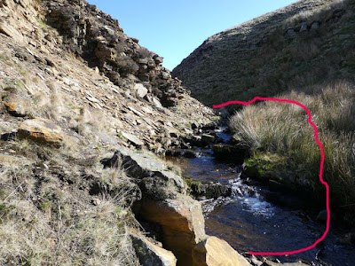
I pressed on in bright sunshine and cloudless sky with ever improving views of the Howgills to my left and eventually getting closer to the rim of Whinny Gill. I stood at the top looking down then switching gaze to the higher route above and debated whether to descend to explore the now much narrower gill. There is a sort of romantic notion about the thought of exploring a gill but from experience I know it is not all that entertaining unless you go with that as your prime intention being prepared to wade through the water, but when you are hopping from side to side alternating between slippery rocks and reed beds with unidentifiable gloop below and trying to keep your feet dry it can be tiresome. Whatever, I descended and followed the gill for quite a long way before climbing out onto the tops again. Photography was challenged trying to make sense of the brightly lit fellside and the darkness of the gill's depths.
Where the paths end on the map I traversed rough but relatively easy moorland to pick up the more northerly paths to return to the main road north of my starting point. A few hundred yards down the road a pubic footpath was indicated going through Cross Hall Farm. There was no sign from the road and as so often one feels wary walking through the middle of complex farmyards. The farmer's wife appeared and I politely asked if I was on the path and she curtly said I was. I walked on but was faced with several different gates as I was being followed by Mrs. Farmer whose husband had now appeared. They pointed vaguely in the direction of a couple of gates and then corrected me with some slight indication of irritation. I suggested a couple of footpath signs would help but the farmer just shrugged. I descended through another gate into their caravan site and had to find a not obvious route round the back of caravans to find a hidden footbridge - the joys of country walking.
More pleasant field walking had me back at the hall and back out by my outward route to the car.
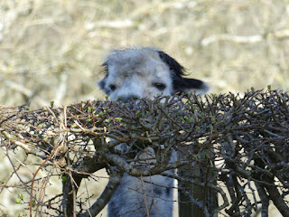 |
| This guy was watching me from the other side of the road just as I was leaving my parked car. |
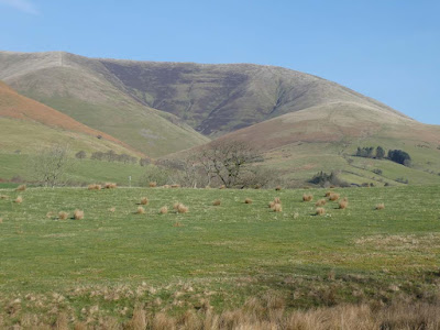 |
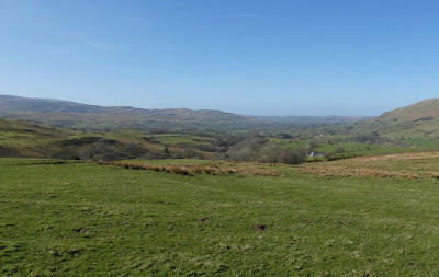
| Howgills |
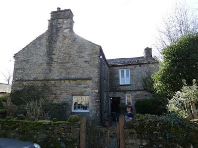 |
| Habberthwaite Hall |
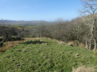 |
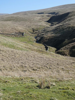
| This and below, looking back at my route |
 |
| More of the Howgills - a modest pano. shot with the camera. I used to take several single shots then merge them into a pano. with Photoshop Elements but this is so much easier and efficient |
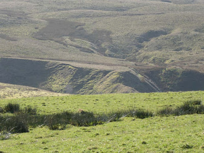 |
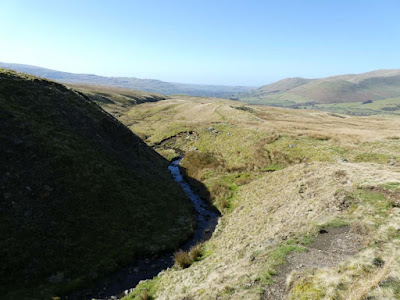
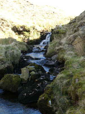
| Whinny Gill |
 |
| I descended into the gill just beyond the sheepfold |
 |
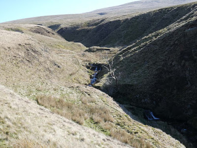
| All that rock on the left was loose above - I didn't fancy scrambling over all that with the danger of possible rockfall from above |
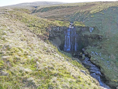 |
| This just after I had climbed back out of the gill. I've Photoshopped so the waterfall is visible at the expense of overexposure in the sunlight. |
 |
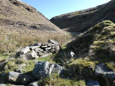
| Looking back at my route up the gill |


Another good find in that forgotten part of the north. You must be scouring the maps.
ReplyDeleteFarmers are a law into themselves.
that 'hall' sounds like a model for a Walpole novel
ReplyDeleteBC - It becomes more difficult to find new ground, even more so because I have not left previous routes plotted on the map and can't remember if I have been before. I have another one planned for the next opportunity taking in part of our memorable Outlying Fells route through Swindale.
ReplyDelete------------------
gimmer - I agree. Twas you who put me on to Rogue Herries a long time ago.
Shouldn't "gill" be spelt "ghyll". Even if not, it's got more style. Another Yorkshire oddity: with a perversity for which the county is famous Tykes set out to call half-pints gills, softening the the g in the process. As far as I know - and I'm not going to subject myself to the tedium of Googling this potential lacuna - gill was already established as one-third of a pint. The pathetic defence: "Ee, but we're different oop here."
ReplyDeleteOn the other hand I may be woefully out-of-date. Movies about Yorkshire - I just saw another at the Bordersides - have ditched all this well-chewed history. The jokes, such as they are, rely on Urdu refererences
RR - that is how it is spelt on the OS map for this and the other gill in my previous post. I must admit my hackles raised when I saw it but felt I should conform. The OS do take a lot of trouble to get correct local information, so I have read. There are spellings of this word with the Y in close proximity on this same map. I asm pretty sure this is in Cumbria, not Yorkshire but perhaps your antipathy extends to The North in general?
ReplyDelete