For newcomers

At the bottom of each post there is the word "comments". If you click on it you will see comments made by followers, and if you follow the instructions you may also comment and I always welcome that. I have found many people overlook this part of the blog which is often more interesting than the original post!

My blog nick-name is SIR HUGH. I'm not from the aristocracy - my middle name is Hugh which relates to the list of 282 hills in Scotland compiled by Sir Hugh Munro in 1891. I climbed my last one (Sgurr Mor) on 28th June 2009

****************************

Saturday, 19 March 2022

East of Sedbergh - Whinny Gill

 Friday 19th March 2022 - Whinny Gill, east of Sedbergh

Only four degrees as I drove to Sedbergh but it became much warmer later on.

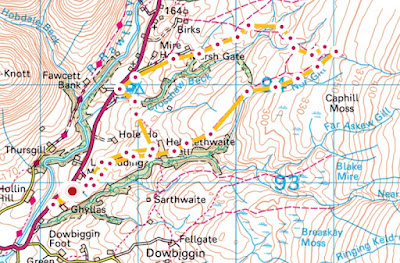
This route followed the same paths as my previous post here from a week ago to just beyond Hebblethwaite Hall but then headed further north to follow Whinny Gill eventually morphing into Nor Gill where paths on the OS map mysteriously end at indeterminate points.

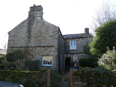
At the scattered farm buildings a farmer's wife was busy outside one of the houses on my right and we chatted confirming that this is actually Hebblethwaite Hall, albeit somewhat modest to have the title of a hall.

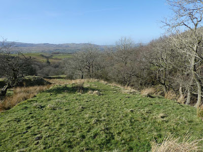
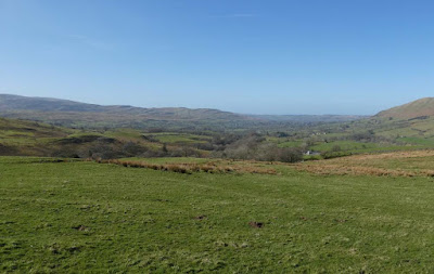
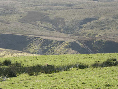
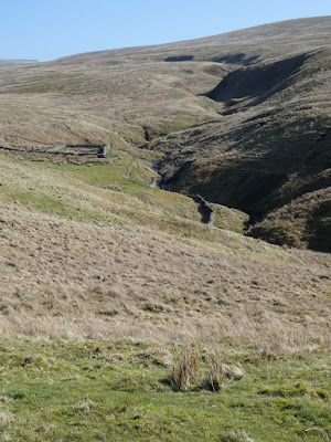
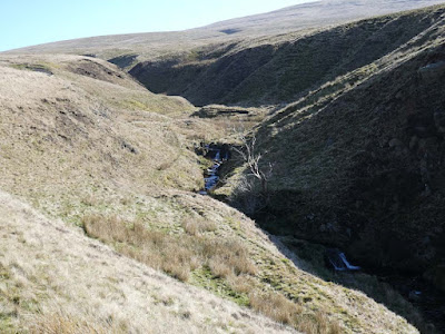
I pressed on in bright sunshine and cloudless sky with ever improving views of the Howgills  to my left and eventually getting closer to the rim of Whinny Gill. I stood at the top looking down then switching gaze to the higher route above and debated whether to descend to explore the now much narrower gill. There is a sort of romantic notion about the thought of exploring a gill but from experience I know it is not all that entertaining unless you go with that as your prime intention being prepared to wade through the water, but when you are hopping from side to side alternating between slippery rocks and reed beds with unidentifiable gloop below and trying to keep your feet dry it can be tiresome. Whatever, I descended and followed the gill for quite a long way before climbing out onto the tops again. Photography was challenged trying to make sense of the brightly lit fellside and the darkness of the gill's depths.

Where the paths end on the map I traversed rough but relatively easy moorland to pick up the more northerly paths to return to the main road north of my starting point. A few hundred yards down the road a pubic footpath was indicated going through Cross Hall Farm. There was no sign from the road and as so often one feels wary walking through the middle of complex farmyards. The farmer's wife appeared and I politely asked if I was on the path and she curtly said I was. I walked on but was faced with several different gates as I was being followed by Mrs. Farmer whose husband had now appeared. They pointed vaguely in the direction of a couple of gates and then corrected me with some slight indication of irritation. I suggested  a couple of footpath signs would help but the farmer just shrugged. I descended through another gate into their caravan site and had to find a not obvious route round the back of caravans to find a hidden footbridge - the joys of country walking. 

More pleasant field walking had me back at the hall and back out by my outward route to the car.

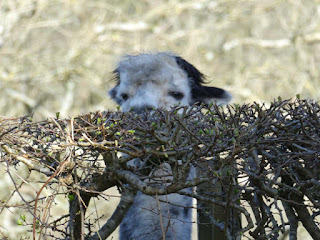
This guy was watching me from the other side of the road just as I was leaving my parked car.


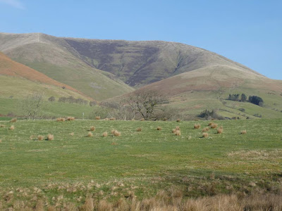
Howgills

Habberthwaite Hall

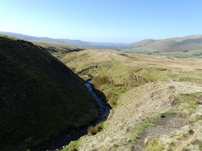
This and below, looking back at my route


More of the Howgills - a modest pano. shot with the camera. I used to take several single shots then merge them into a pano. with Photoshop Elements but this is so much easier and efficient

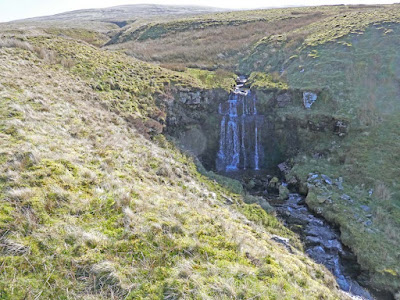
Whinny Gill

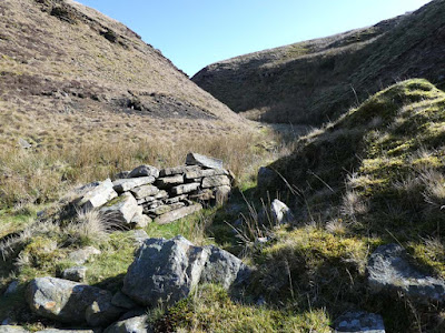
I descended into the gill just beyond the sheepfold


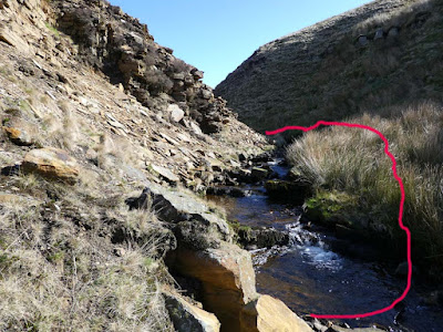
All that rock on the left was loose above - I didn't fancy scrambling over all that with the danger of possible rockfall from above


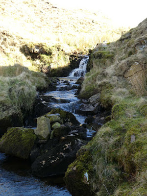
This just after I had climbed back out of the gill. I've Photoshopped so the waterfall is visible at the expense of overexposure in the sunlight.


Looking back at my route up the gill


Sunday, 13 March 2022

From Heversham

Saturday 12th March 2022 - 4 mile circuit from Heversham 

There has been much disruption and bad weather recently and I have not walked much during the last three months and have put on weight and lost fitness, so intend to walk more locally on a regular basis. Such walks hardly qualify for a post here but yesterday I drove a little further afield, albeit only about five miles to Heversham. 

I have dithered for ages about my mapping. For years I have had Memory Mp running on Windows 10 which is partitioned on my iMac desktop using Parallels software (Memory Map for Mac has a bad reputation. and therefore avoided by me.) I hate Windows 10 and the whole operation of Memory Map has been clunky especially if I close windows and then re-boot.

I pessimistically anticipated a mammoth struggle installing an alternative. Ages ago I did a trial with Anquet but found it hopelessly user unfriendly. So, on Friday I  bought the Ordnance Survey Premium package for s modest annual £23 for the whole of GB on 1:25 and 1:50. That downloaded seamlessly and similarly onto my iPhone with the app. I still have Memory Map there as well if I want to use it. Today's little four miler was partly to test out the OS mapping and also to explore some paths close to home which, as far as I can remember I haven't walked before. The OS mapping proves to be excellent. I can download  my existing GPX route files, and plot routes altering line thickness, colour and transparency along with many other easy to use attributes with convenient interaction with the app on the iPhone. In my opinion this is a superior product in all departments, especially when we presumably have the continually updated versions of OS mapping.

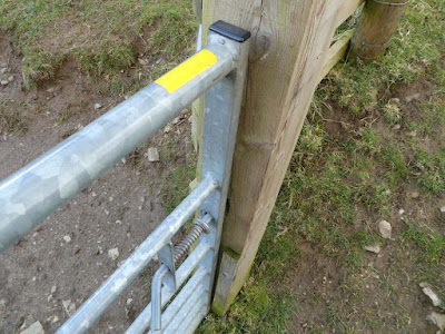
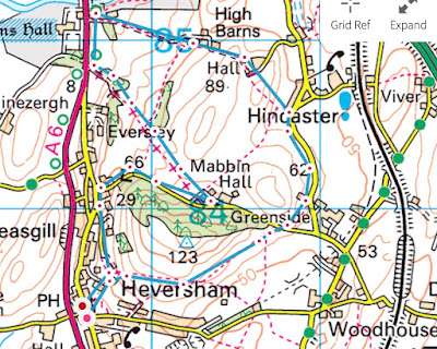
I parked up close to Heversham church and followed previously walked paths through the churchyard and up the hill skirting the trig on Heversham Head to arrive at the road above Greenside. From then onwards I was on new territory. Both myself snd fellow bloggers have recently noticed yellow paint on the latches of the newly installed swing gates, but I now came across a gate with no suitable latch to daub but it had  the now customary, but inexplicable dash of yellow on its top bar. I didn't climb all the way to the trig, but for others, if they visit here the view is one of the top three in my local area.

Fellow blogger BC has just posted about walking in Yorkshire Dales limestone country, a region with which I have a close affinity, and although not Yorkshire Dales I was in similar terrain with bright green, sheep-cropped pasture dotted with outcrops of whitish limestone combined with the blue of the sky - 'tis all a tonic to the soul.

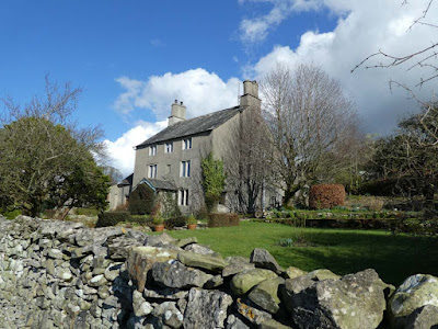
After a short stretch of country road I was climbing on sheep pasture to pass by Hincaster Hall, a sixteenth century Grade 2 listed farmhouse.  This atmospheric edifice nestles in a mysterious hollow surrounded by gloomy trees awaiting the re-plumage of Spring. I could imagine melodrama - perhaps a prisoner held in upper rooms, or tales of smuggling, or skirmishes between Roundheads and Cavaliers or whatever. Half a mile further on the old farmhouse of High Barns had a contrastingly more congenial setting which I was pleased to capture to my satisfaction in the second of two photos below.

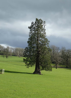
A few hundred yards on a walkway on the A6 gave me the opportunity to photograph and view in more leisurely fashion my favourite local tree. I must have driven past it hundreds of times. 

As I turned off on the track to Mabbin Hall I noticed a plaque never seen before detailing the site of an historic milestone, snd once again there was something new to discover from walking along oft driven roads.

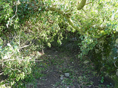
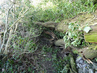
Higher up that sunken lane my way was barred by a huge fallen tree. At first I thought I could get through crawling under the fallen trunk, but having done so found that even larger trunks and foliage made progress impossible. I was able to climb out up the banking and fortunately the tree had demolished part of the barbed wire fencing allowing easy access into the field. I followed on with the lane on my right separated by an endless impenetrable hedge. There is always tension in these circumstances hoping for a gate back into the lane or facing the dread of imprisonment or exit into another field, and so on... Escape only occurred when I reached the end of the lane leading onto the minor road for my descent back to Heversham.

Quite a rewarding local outing.
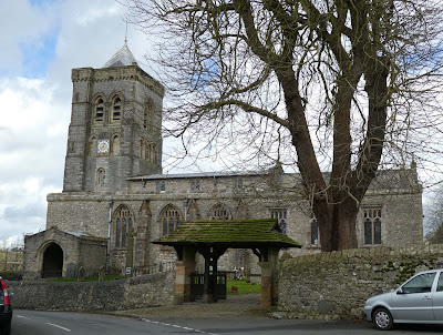
Heversham church - my path went through and out the back

I know we have discussed this strange new practice and I've already forgotten what conclusions  we came to as to the purpose, but I still wonder who these people are that dream up such schemes. I wonder how much they get paid?

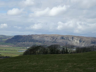
The sun shining on Whitbarrow, another of my favourite limestone venues

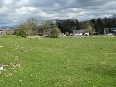
Limestone sheep-cropped pasture


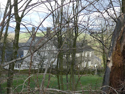
Hincaster Hall - all on its own in the middle of nowhere. Food for the imagination

High Barns, and below - a happier location


My favourite tree. It is only about eighty yards off the A6 and I have driven past hundreds of times


I crawled under, only to find...

...this. I climbed out on the left and carried on up the field

Start/finish: Heversham. Anti-clockwise. Map and route plotting courtesy of OS


Monday, 7 March 2022

A secret gorge

 Sunday 6th March 2022  - Hebblewaite Hall Gill  (east of Sedbergh)

(n.b. Ordnance Survey has spelling for the gill as above and for the the Hall as Hebblethwaite)

At last I head north again after spending months combing the non-industrial parts of Lancashire on my OS Sheet 103 Blackburn and Burnley trig point campaign.

I stopped to buy lunchtime munchies at the Spa petrol station in Milnthorpe.

Down to The Madman diesel has gone from £1.51 per litre to £1.72! I suspect that it may continue to rise. A pity we can't reincarnate John Wilkes Booth and send him off east on a more appropriate mission. Back on the road my attitude to driving sobered and I progressed at a steady 60mph in the nearside lane. With the modest amount of mileage I do I suppose I can handle that increase, but on top of the overall energy increases along with almost everything else I can see some stricter economy will be needed. Goodness knows how the less well-off will cope.

However, what joy to be heading into the dales on a blue-sky-sunny-morning. I had researched a good lay-by for parking at Straight Bridge and a short plod up the road had me off onto a track heading for Hebblethwaite Hall. A sign informed me of a local campaign to encourage red squirrels. As I approached the hall, which I never saw, the footpath skirting round farm buildings hiding the residence, I saw a grey run across,  but no sign of reds. One sees many attempts at reintroductions and/or conservation of areas for a particular rarity of flora or fauna but it is an uphill task dictating to nature.

When I identified this circular walk I knew that the map showed no footpath crossing from one side of Hebblewaite Gill at the far end. I continued on a pleasant track through woods with dappled sunlight and the impressive gorge of Hebblewaite Gill far blow tumbling in lively fashion over mini waterfalls. The track descended to the gill as the enclosing walls became narrower and steeper. What was now only a path turned sharply to the left and I was confronted by the gill tumbling out of an even steeper gorge and, wow! a dramatic fifty foot limestone wall on the left. Possibility for progress following the gill  look doubtful. I was able to climb on steep grass up the side of the big wall. I found myself uncomfortably close to the edge as I skirted over the top. I continued to follow the gorge on higher ground. Eventually the steep sides eased off to some extent and I was able to descend and cross the stream to start my return journey on the other side.

Whilst the return was still enjoyable much of it crossed squelchy fields and more muddy patches and that feeling of untamed terrain on the outward journey was lost.

It was great to be back in those northern dales, especially with the bonus of a notable discovery. I can see another possibility here following part of the outward route then heading north, but it would involve passing through what was for me the notorious Birks farm where I had one of the most unpleasant landowner encounters ever, but being forewarned I reckon I would be able to avoid confrontation.


WORTH CLICKING PHOTOS TO ENLARGE

Red squirrels ahead - what chance?


This may be Hebblethwaite Hall. This building is located within a hundred yards or so of SD 690 932 but is not shown on the OS map. The wording "Hebblethwaite Hall" is shown, but does not relate to the farm complex shown further east on the map. This impressive house is obviously old enough to have qualified for inclusion on the mapping so it is all a bit of a mystery.

This is the farm complex I refer to in my account above, but I don't believe it is the site of the hall. I saw no sign of a hall as I skirted the farm buildings.

Track now descending lower into the gill


Round the corner and WOW!
I climbed up the side on steep grass then over the top where I found myself uncomfortably close to the edge

Looking back down into the gorge. I walked further on until steepness eased then descended and crossed


Sunlight on the Howgills


I followed Clough River back to where it joins the river Rawthey and my car


Presumably a marker stone for the Yorkshire West Riding boundary?

Start/finish at Straight Bridge left centre


Saturday, 5 March 2022

Arnside Knott after Storm Franklin (21/2/22)

 Friday 4th March 2022

Just a quick trip over Armside Knott to view  the results of Storm Franklin from a few days ago. At the entrance to Redhills Wood opposite the cemetery there was a fair amount of devastation but not much elsewhere until I followed the link path  to High Knott Road on my return where there was more evidence of storm damage again, so it seems the northern slopes of the Knott bore the brunt.

Arnside Cemetery and the chapel used for parish council meetings, and...

...just across the road, entrance to Red Hills Wood and the Knott. It twas around here where most of the storm damage was seen


Across the bay to the Lake District hills. Arnside railway viaduct crossing at right end of photo

I took this and some others to demonstrate path development. This one leads up to the trig point on the Knott and was almost non-existent when I first came to Arnside 22 years ago. Then it was just a faint trace through the grass.

I've either forgotten about or never noticed this plaque on the trig. We have three walking groups in Arnside: The Ramblers, The Scramblers, and the Amblers. I am not enthusiastic about regular participation in walking groups and in any case, when I first came to Arnside accompanied by my springer, Barney I was told dogs were mot permitted, so I never bothered.


Another path (and below) that didn't exist when I first came here